Difference between revisions of "Maps of Pensacola"
Jump to navigation
Jump to search
| Line 6: | Line 6: | ||
Image:1767Plan.jpg|[[1767]] | Image:1767Plan.jpg|[[1767]] | ||
Image:1778PurcellPlan.jpg|[[1778]] | Image:1778PurcellPlan.jpg|[[1778]] | ||
| + | Image:Map1780.jpg|[[1780]] | ||
Image:BritishMap1781.jpg|[[1781]] | Image:BritishMap1781.jpg|[[1781]] | ||
Image:SpanishMap1782.jpg|[[1782]] | Image:SpanishMap1782.jpg|[[1782]] | ||
Image:1850Map.jpg|[[1850]] | Image:1850Map.jpg|[[1850]] | ||
| + | Image:1860Map.jpg|[[1860]] | ||
Image:1861CoastSurvey.jpg|[[1861]] | Image:1861CoastSurvey.jpg|[[1861]] | ||
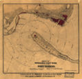
Image:JacobWeissCivilWarMap.jpg|1860s ([[Civil War]]) | Image:JacobWeissCivilWarMap.jpg|1860s ([[Civil War]]) | ||
Image:WilliamsCivilWarMap.jpg|1860s ([[Civil War]]) | Image:WilliamsCivilWarMap.jpg|1860s ([[Civil War]]) | ||
Image:WellgeMap.jpg|[[Wellge map]] of [[1885]] | Image:WellgeMap.jpg|[[Wellge map]] of [[1885]] | ||
| + | Image:1890Map.gif|[[1890]] | ||
Image:WatsonMaps1949Repro.jpg|[[1903]] & [[1906]] [[Watson maps]] (1949 reproduction) | Image:WatsonMaps1949Repro.jpg|[[1903]] & [[1906]] [[Watson maps]] (1949 reproduction) | ||
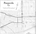
Image:Pensacola fl 1919.jpg|[[1919]] | Image:Pensacola fl 1919.jpg|[[1919]] | ||


