File list
Jump to navigation
Jump to search
This special page shows all uploaded files.
| Date | Name | Thumbnail | Size | Description | Versions |
|---|---|---|---|---|---|
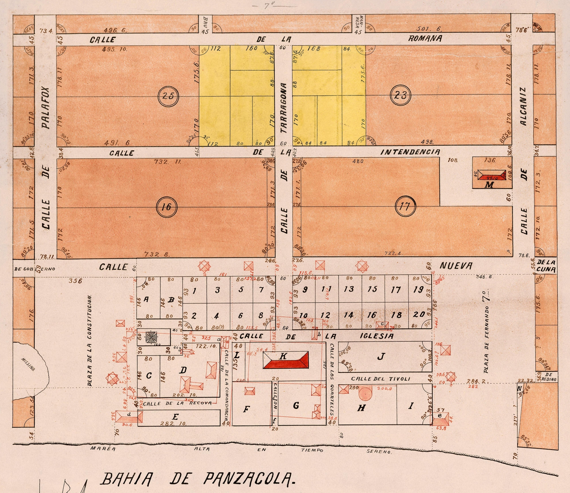
| 19:36, 10 November 2008 | Plan1812.jpg (file) |  |
13.21 MB | Plano, Panzacola, 1812 by Vicente Sebastián Pintado From the University of Florida Map and Imagery Library, [http://www.uflib.ufl.edu/ufdc/?b=UF90000105&v=00001] {{PD-old}} | 1 |
| 01:43, 22 April 2007 | WellgeMapHR.jpg (file) |  |
7.1 MB | 1 | |
| 22:51, 24 April 2009 | OverNASPensacola.jpg (file) |  |
6.1 MB | 1 | |
| 22:05, 10 November 2008 | Plan1812-halfres.jpg (file) |  |
5.77 MB | Half-resolution version of Image:Plan1812.jpg {{PD-old}} | 1 |
| 16:55, 6 April 2009 | Ellyson1940.jpg (file) |  |
5.17 MB | Ellyson Field in 1940. From aerial imagery at UF Libraries. {{PD-USGov}} | 1 |
| 18:43, 25 February 2008 | GroverRobinsonIV.JPG (file) |  |
5 MB | Likely PD | 1 |
| 17:04, 3 May 2009 | Pickens.png (file) |  |
4.59 MB | From [http://lcweb2.loc.gov/cgi-bin/query/D?ils:222:./temp/~pp_Kad8::@@@mdb=fsaall,brum,detr,swann,look,gottscho,pan,horyd,genthe,var,cai,cd,hh,yan,lomax,ils,prok,brhc,nclc,matpc,iucpub,tgmi,lamb,hec,krb Library of Congress]]. Reproduction number LC-USZC2 | 1 |
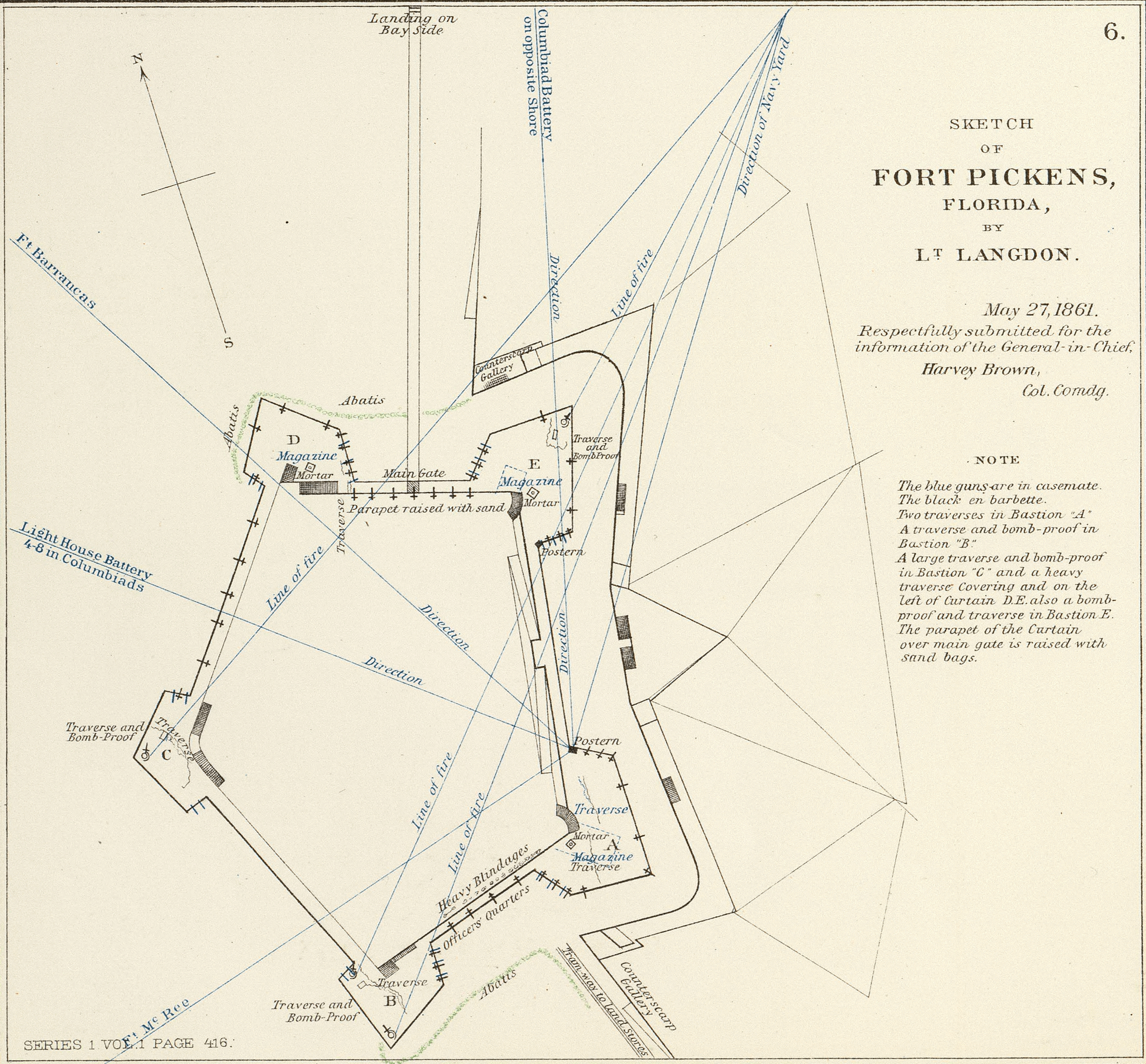
| 18:24, 6 February 2009 | Fort Pickens map 1861.png (file) |  |
3.45 MB | From Wikimedia Commons [http://commons.wikimedia.org/wiki/File:Fort_Pickens_map_1861.png] Date: 1861 Source: Sketch by Lt. Langdon {{PD-old}} | 1 |
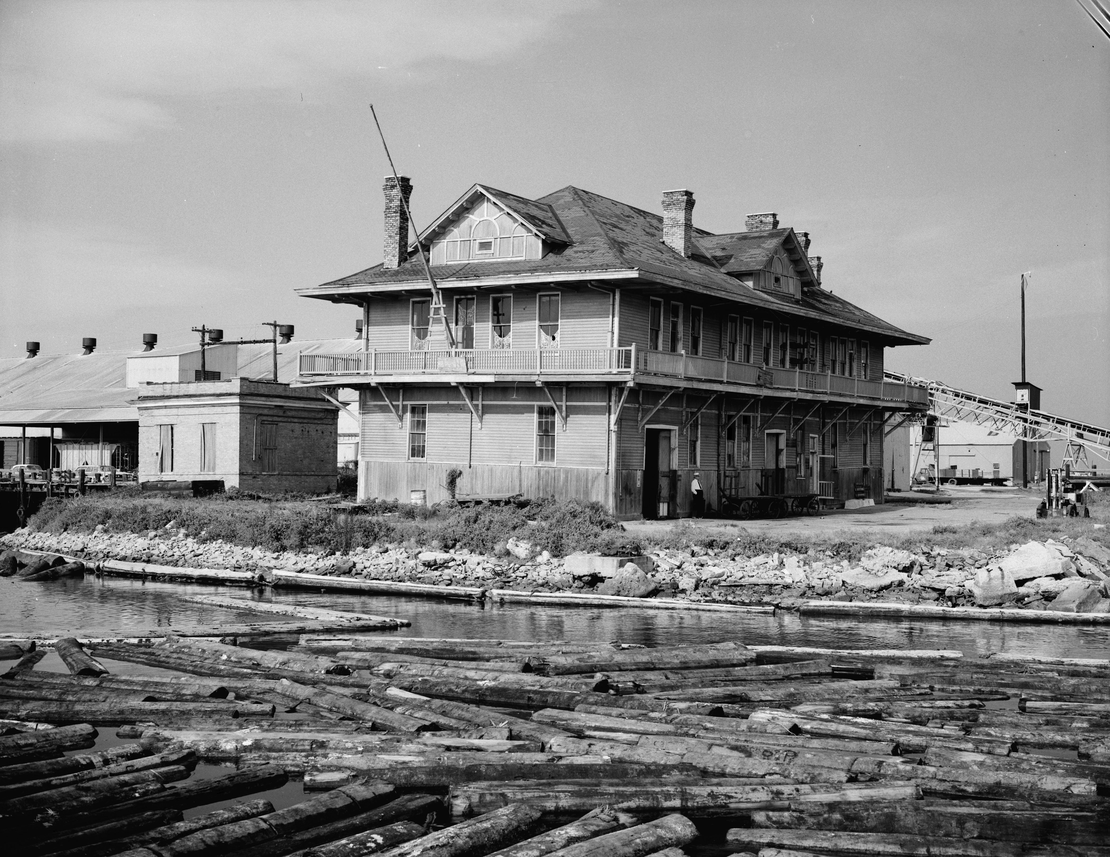
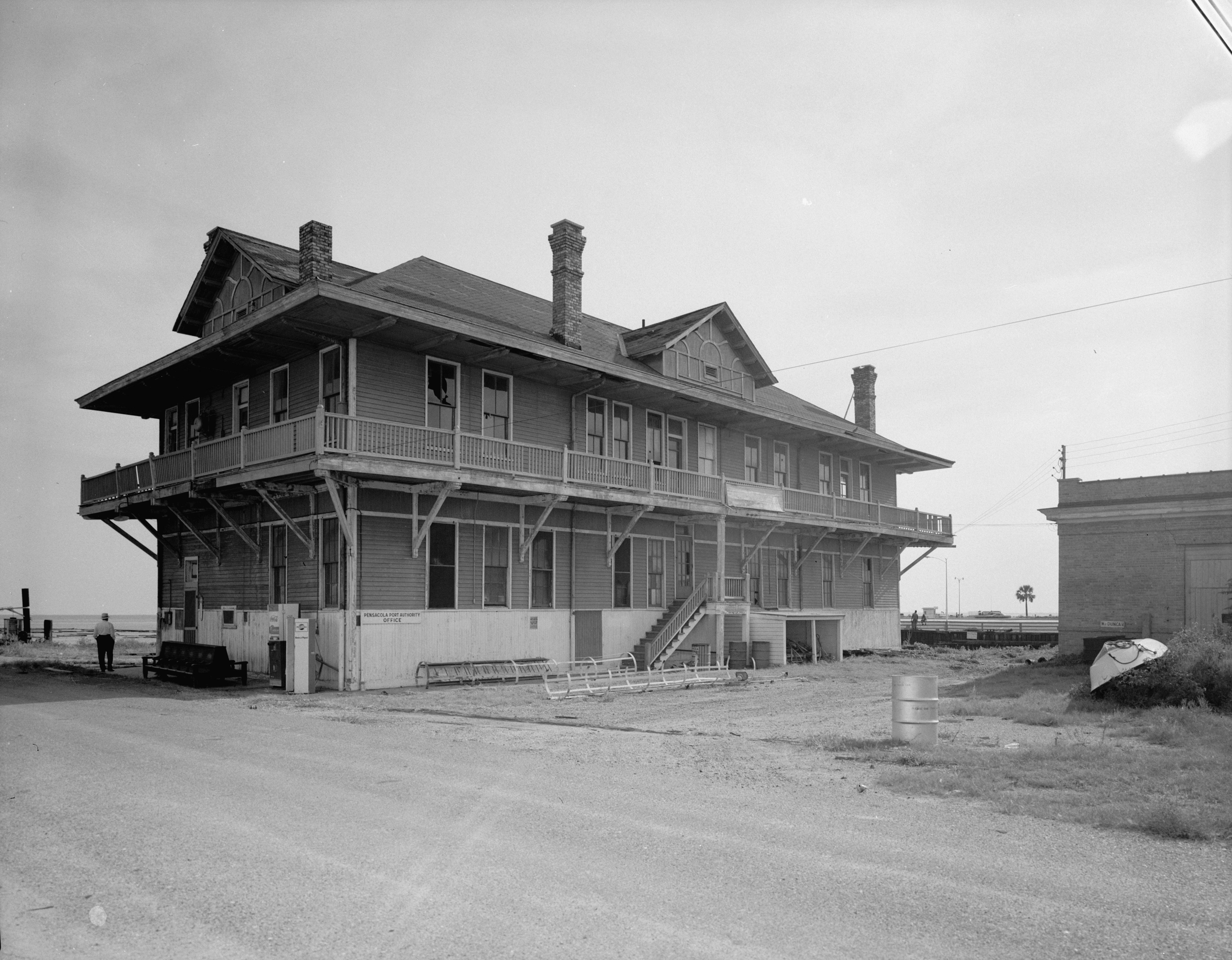
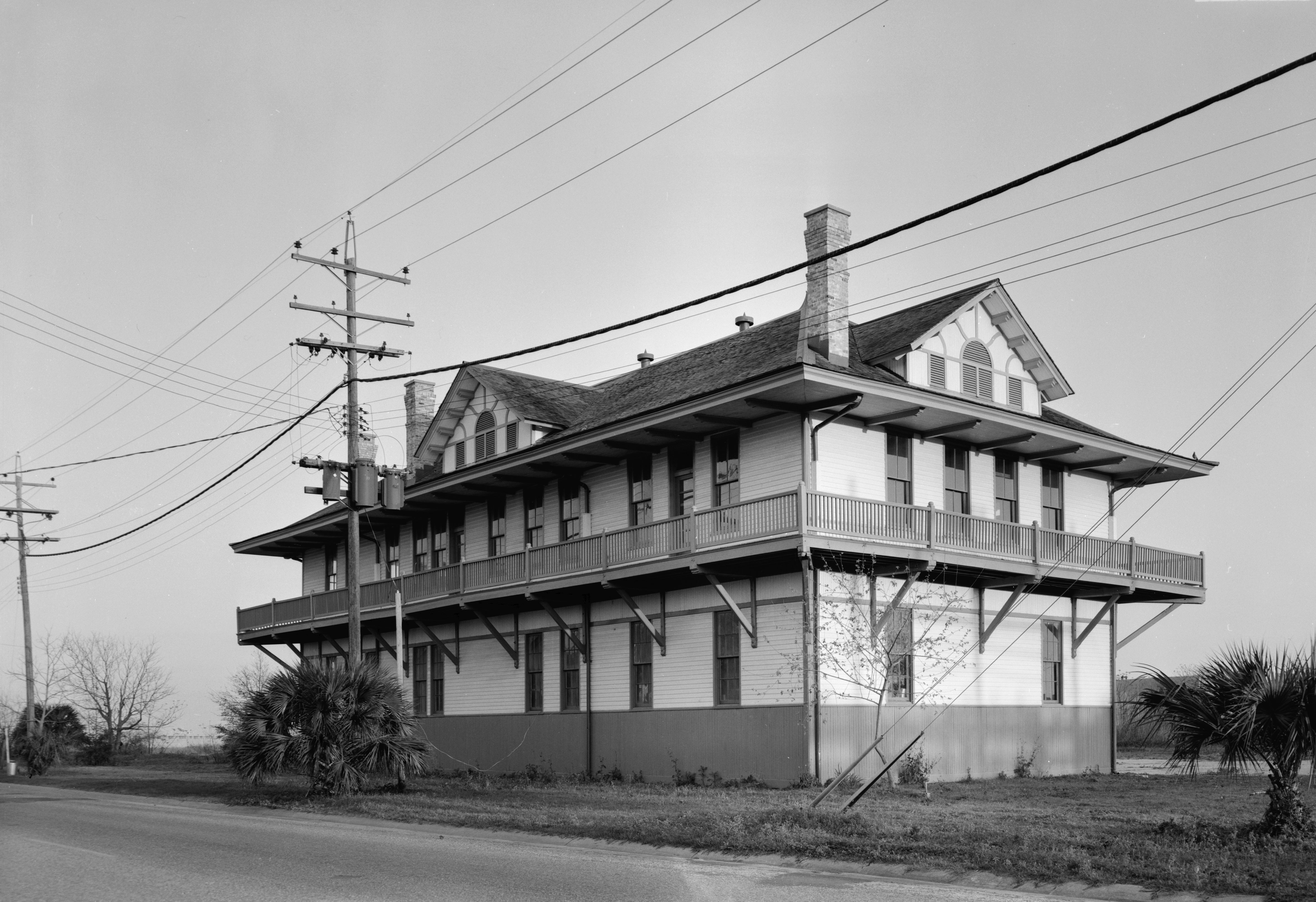
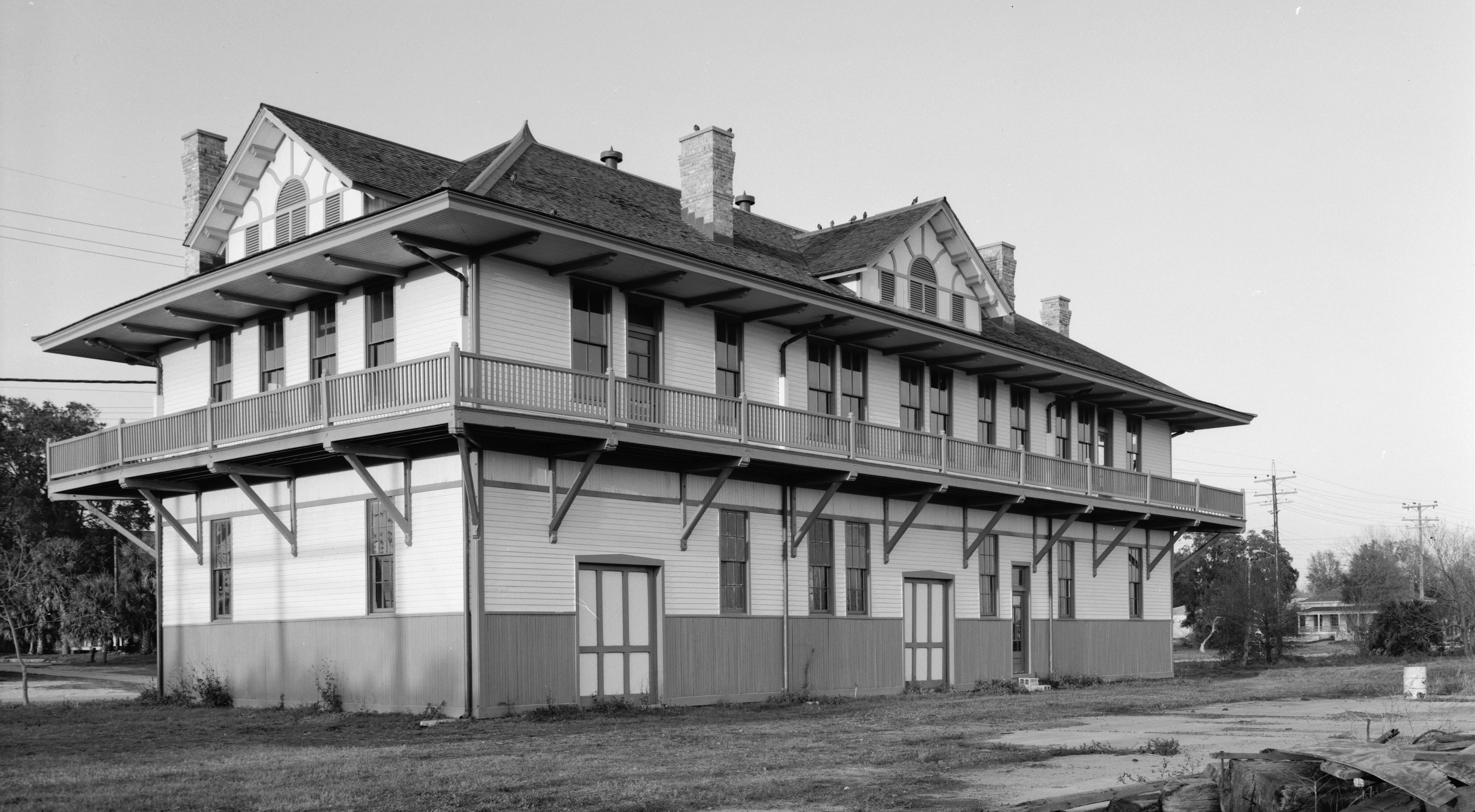
| 18:07, 8 February 2009 | LNMarine-HABS-SW.jpg (file) |  |
3.31 MB | Taken by Ray Malinowski in 1968 for the Wikipedia:Historic American Buildings Survey. Held in the Library of Congress, [http://memory.loc.gov/cgi-bin/ampage?collId=pphhphoto&fileName=fl/fl0000/fl0035/photos/browse.db&action=browse&recNum=0&title2=Lou | 1 |
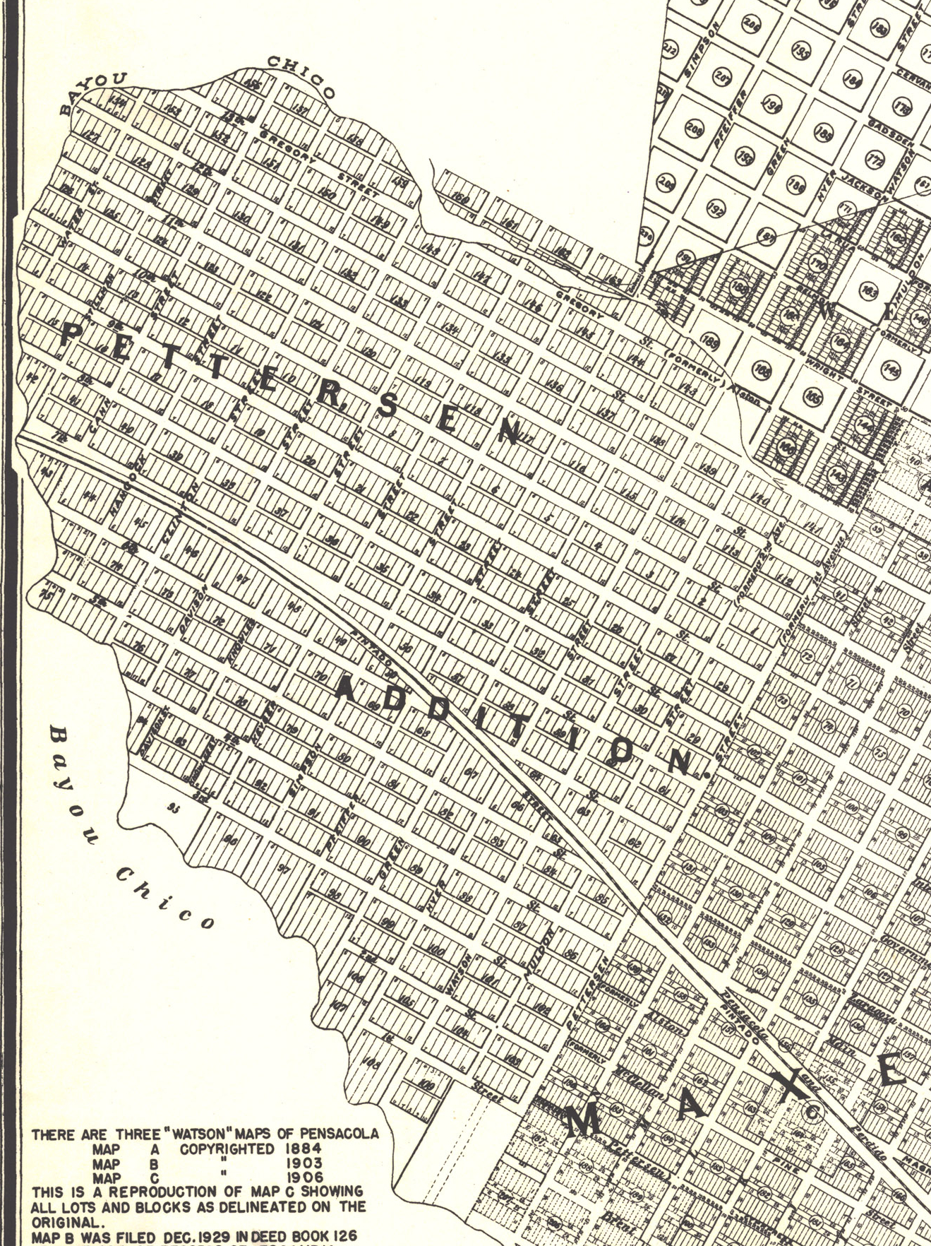
| 17:28, 4 September 2009 | PettersonAddition-Watson.jpg (file) |  |
3.24 MB | Cropped from Image:WatsonMaps1949Repro.jpg. | 1 |
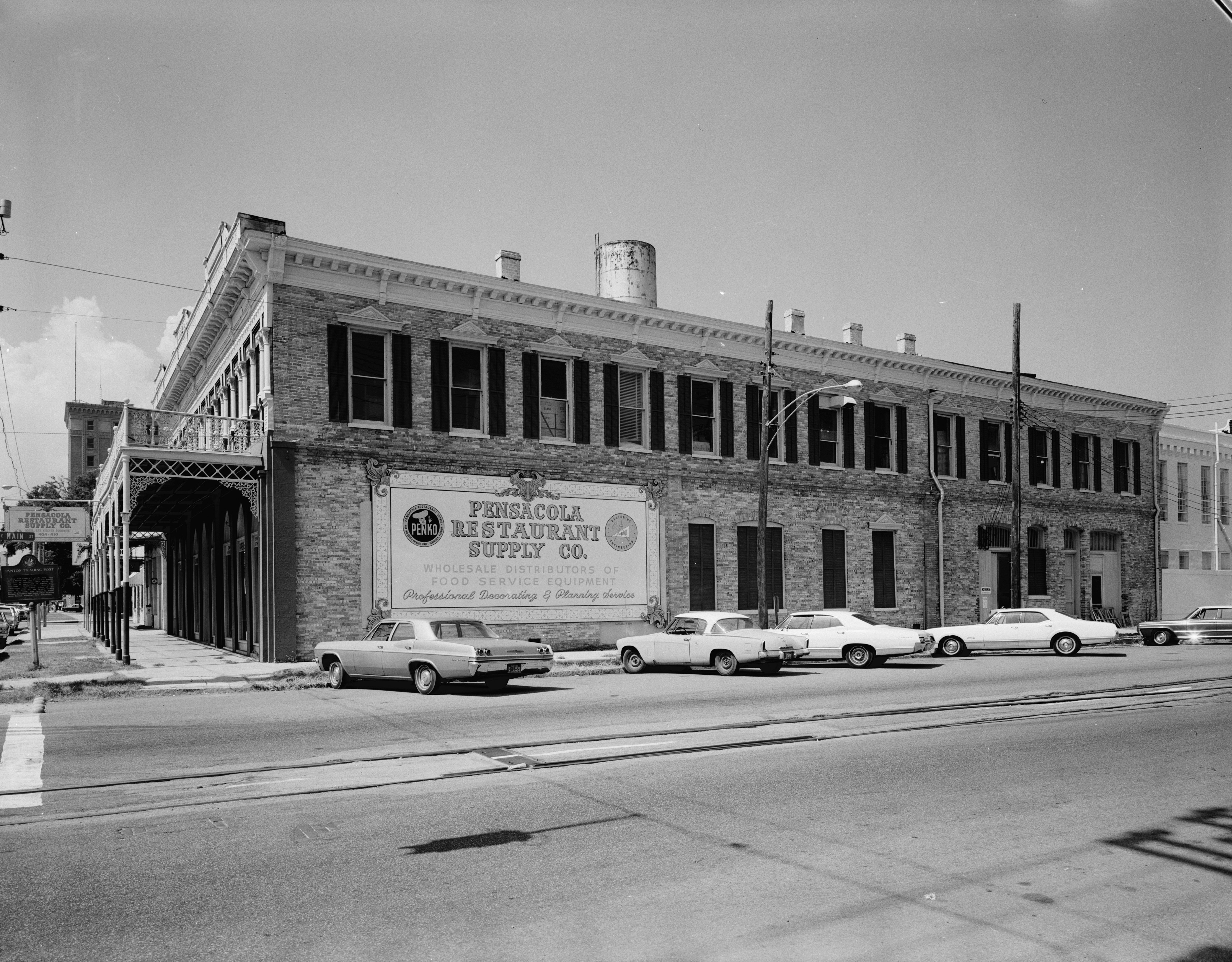
| 17:39, 8 February 2009 | BearBlock-HABS-South.jpg (file) |  |
3.06 MB | Taken by Ray Malinowski in 1968 for the Wikipedia:Historic American Buildings Survey. Held in the Library of Congress, [http://memory.loc.gov/cgi-bin/query/S?pp/hh:@field(TITLE+@od1(Bear+Block,+404+South+Palafox+Street,+Pensacola,+Escambia+County,+FL | 1 |
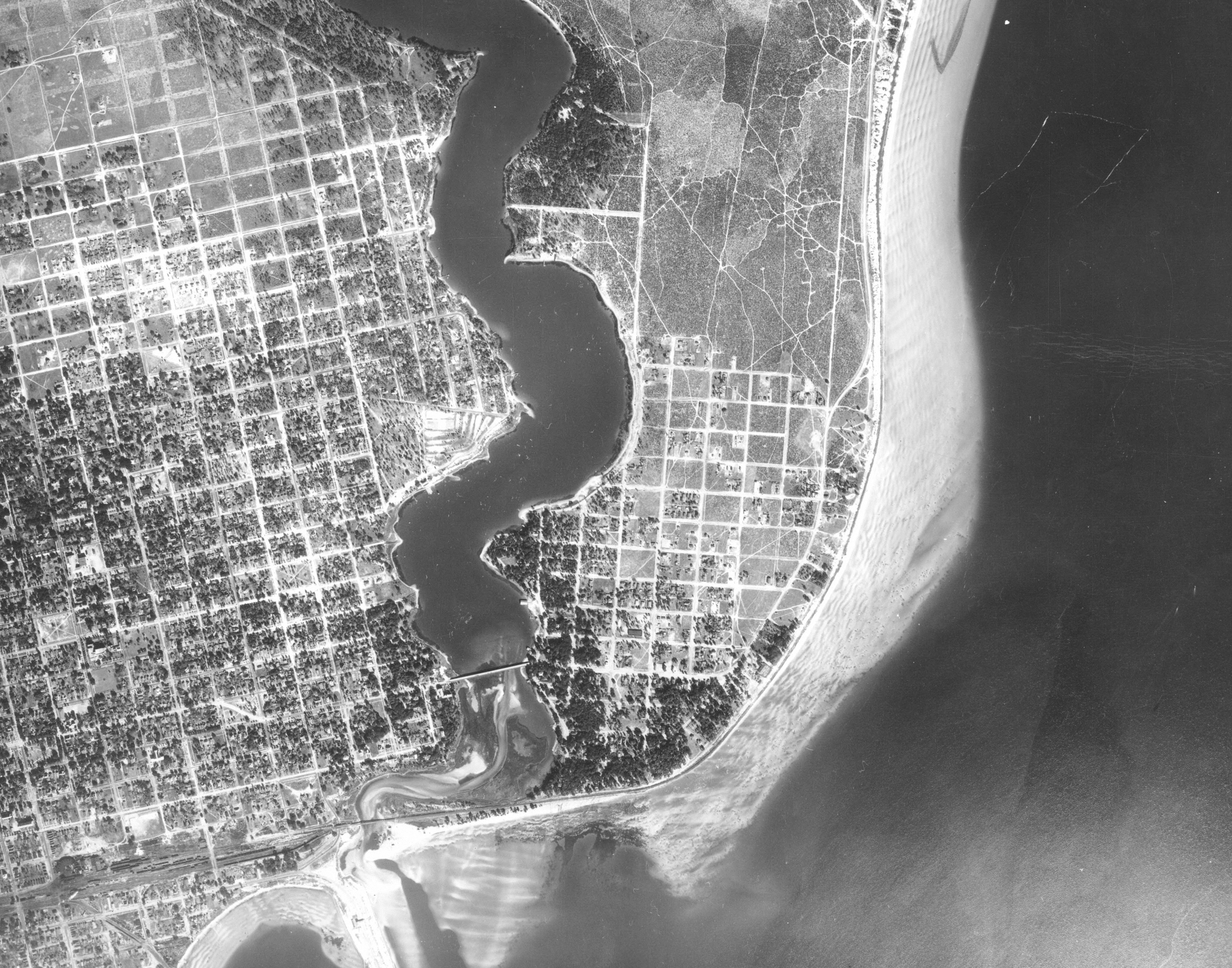
| 22:39, 5 April 2009 | EPH1941.jpg (file) |  |
3.05 MB | East Hill, Bayou Texar, and East Pensacola Heights in 1940. Aerial imagery from UF Libraries {{PD-USGov}} | 1 |
| 17:36, 8 February 2009 | BearBlock-HABS-Front.jpg (file) |  |
2.96 MB | Taken by Ray Malinowski in 1968 for the Wikipedia:Historic American Buildings Survey. Held in the Library of Congress, [http://memory.loc.gov/cgi-bin/query/S?pp/hh:@field(TITLE+@od1(Bear+Block,+404+South+Palafox+Street,+Pensacola,+Escambia+County,+FL | 1 |
| 17:34, 11 June 2009 | Pickens-ivan.jpg (file) |  |
2.87 MB | Fort Pickens after Hurricane Ivan {{PD-USGov}} | 1 |
| 18:25, 25 February 2008 | GeneValentino.JPG (file) |  |
2.85 MB | Likely PD | 1 |
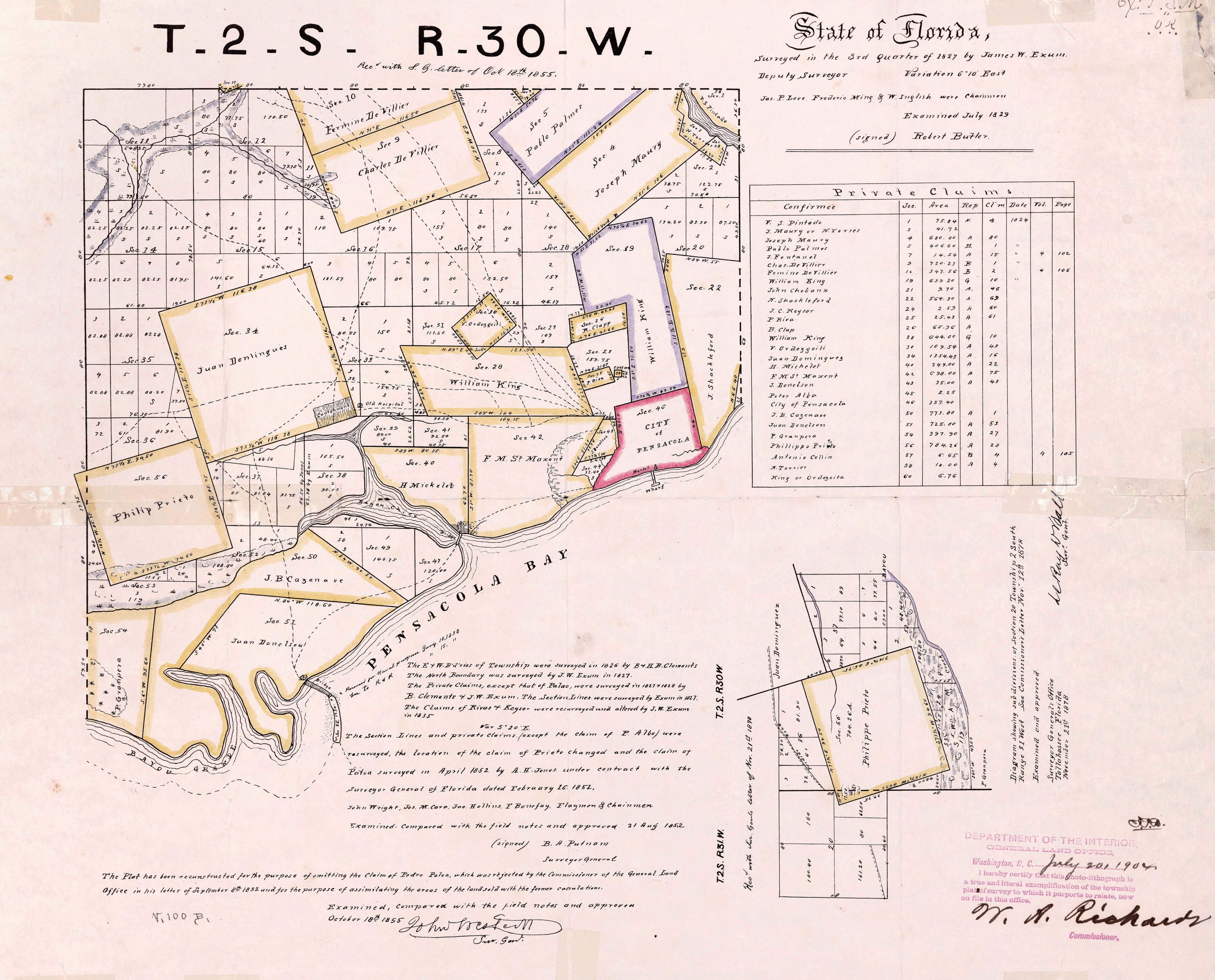
| 16:03, 12 June 2009 | ClaimsMap.jpg (file) |  |
2.84 MB | Map of Pensacola-area land claims surveyed and compiled in late 1820s From George A. Smathers Libraries, University of Florida. ID# UF90000133 {{PD-old}} | 1 |
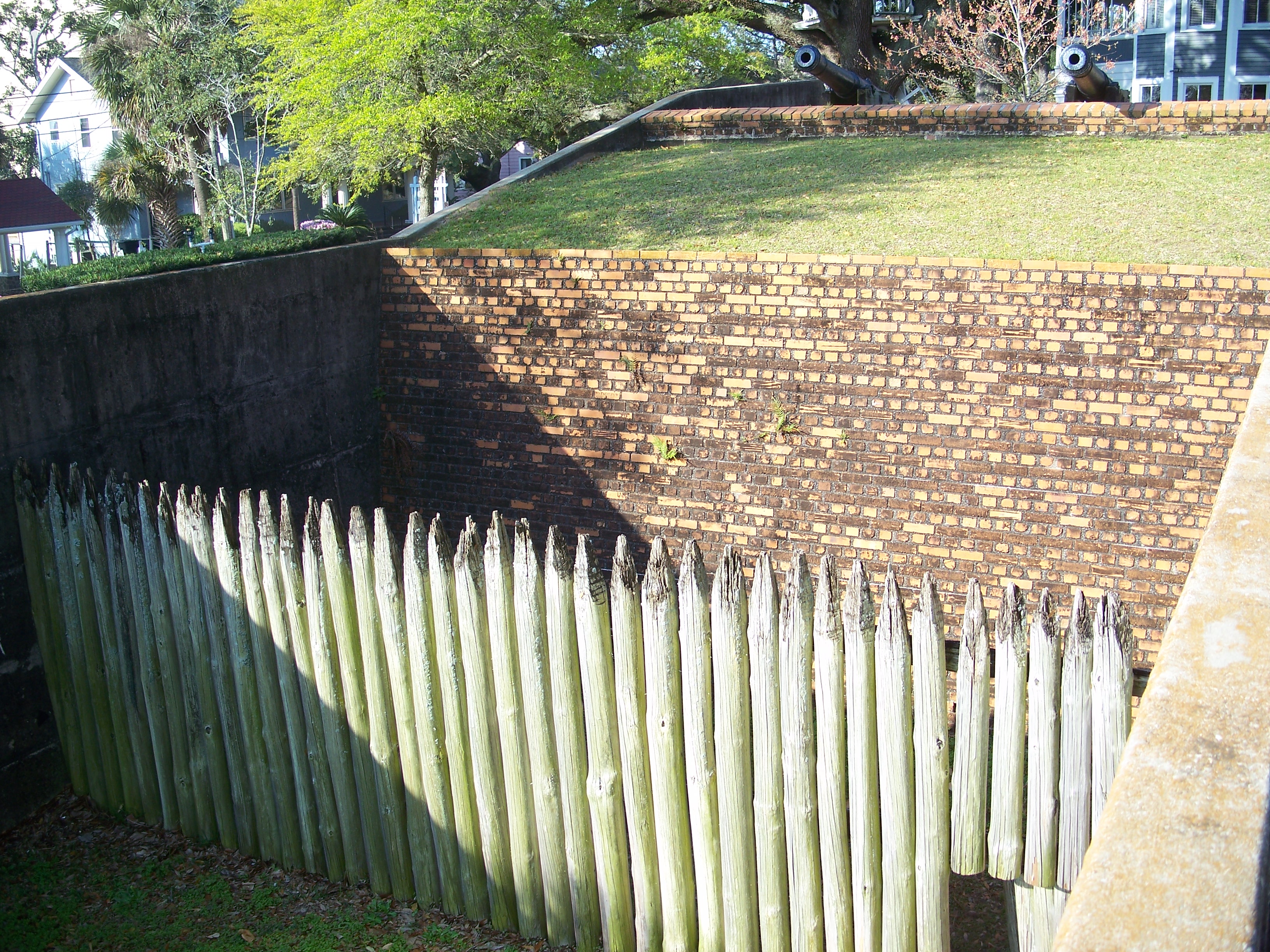
| 17:12, 22 February 2009 | Fort George.jpg (file) |  |
2.84 MB | From Wikimedia Commons [http://commons.wikimedia.org/wiki/File:Pensacola_Fort_George01.jpg]. {{GFDL}} | 1 |
| 19:43, 10 November 2008 | Plan1812-top-halfres.jpg (file) |  |
2.77 MB | Cropped selection from Image:Plan1812.jpg {{PD-old}} | 1 |
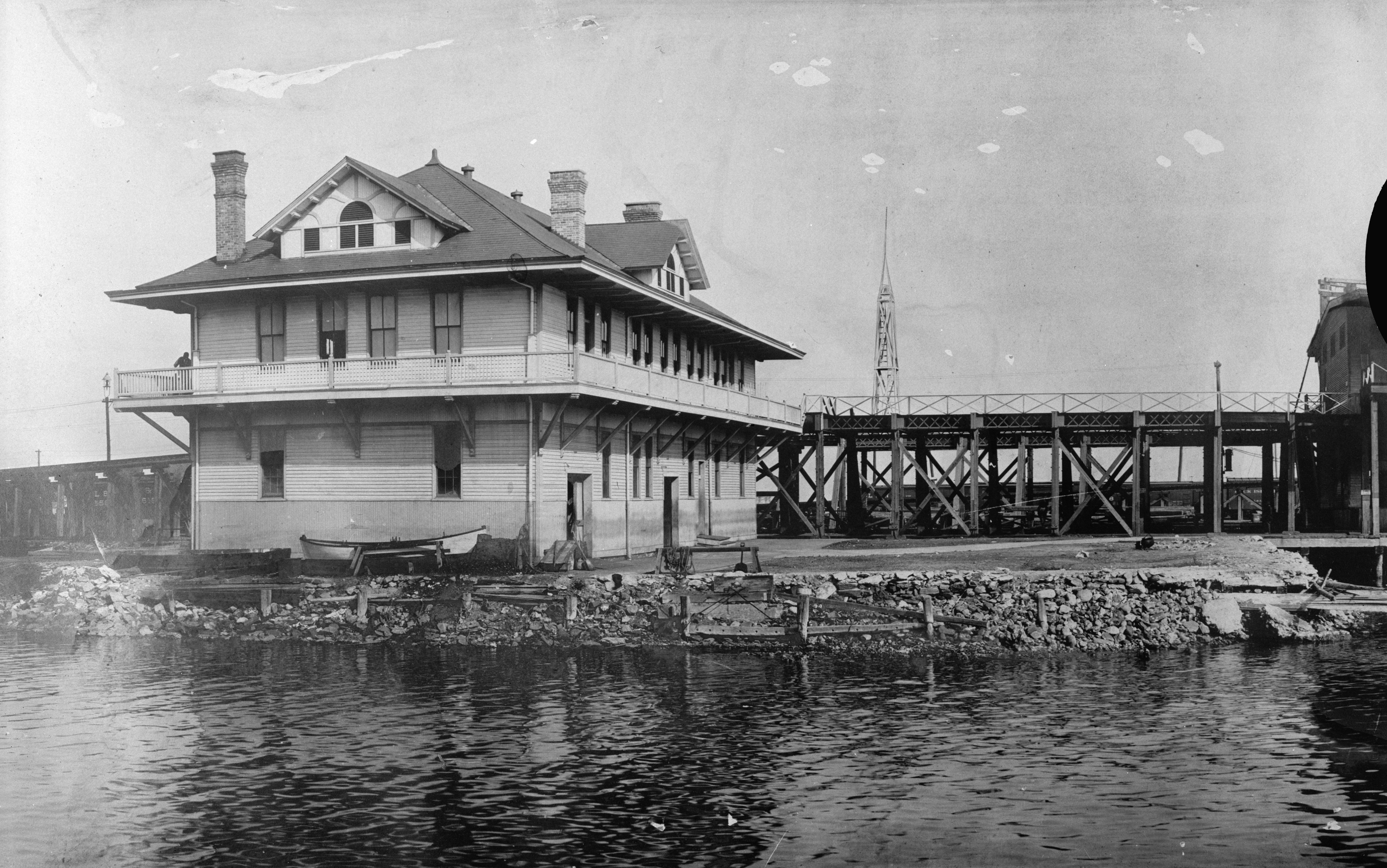
| 18:05, 8 February 2009 | LNMarine-HABS-SE.jpg (file) |  |
2.62 MB | Taken by Ray Malinowski in 1968 for the Wikipedia:Historic American Buildings Survey. Held in the Library of Congress, [http://memory.loc.gov/cgi-bin/ampage?collId=pphhphoto&fileName=fl/fl0000/fl0035/photos/browse.db&action=browse&recNum=0&title2=Lou | 1 |
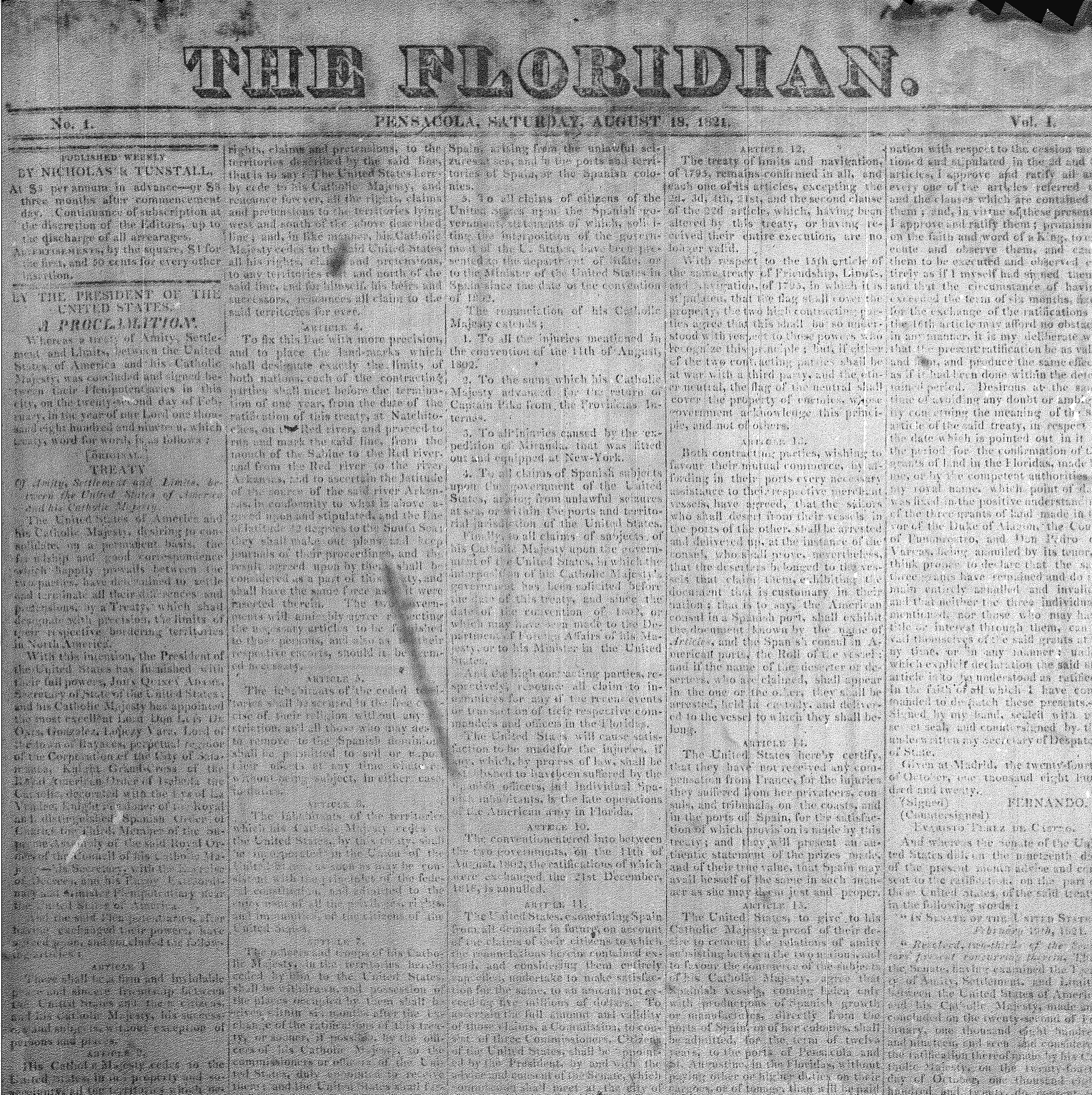
| 18:20, 12 March 2008 | Floridian-firstissue.png (file) |  |
2.53 MB | {{PD-old}} Courtesy UWF microfilm collections. | 1 |
| 17:21, 22 February 2009 | GalvezBust.jpg (file) |  |
2.45 MB | From Wikimedia Commons [http://commons.wikimedia.org/wiki/File:Pensacola_Fort_George_mnmt01.jpg] {{GFDL}} | 1 |
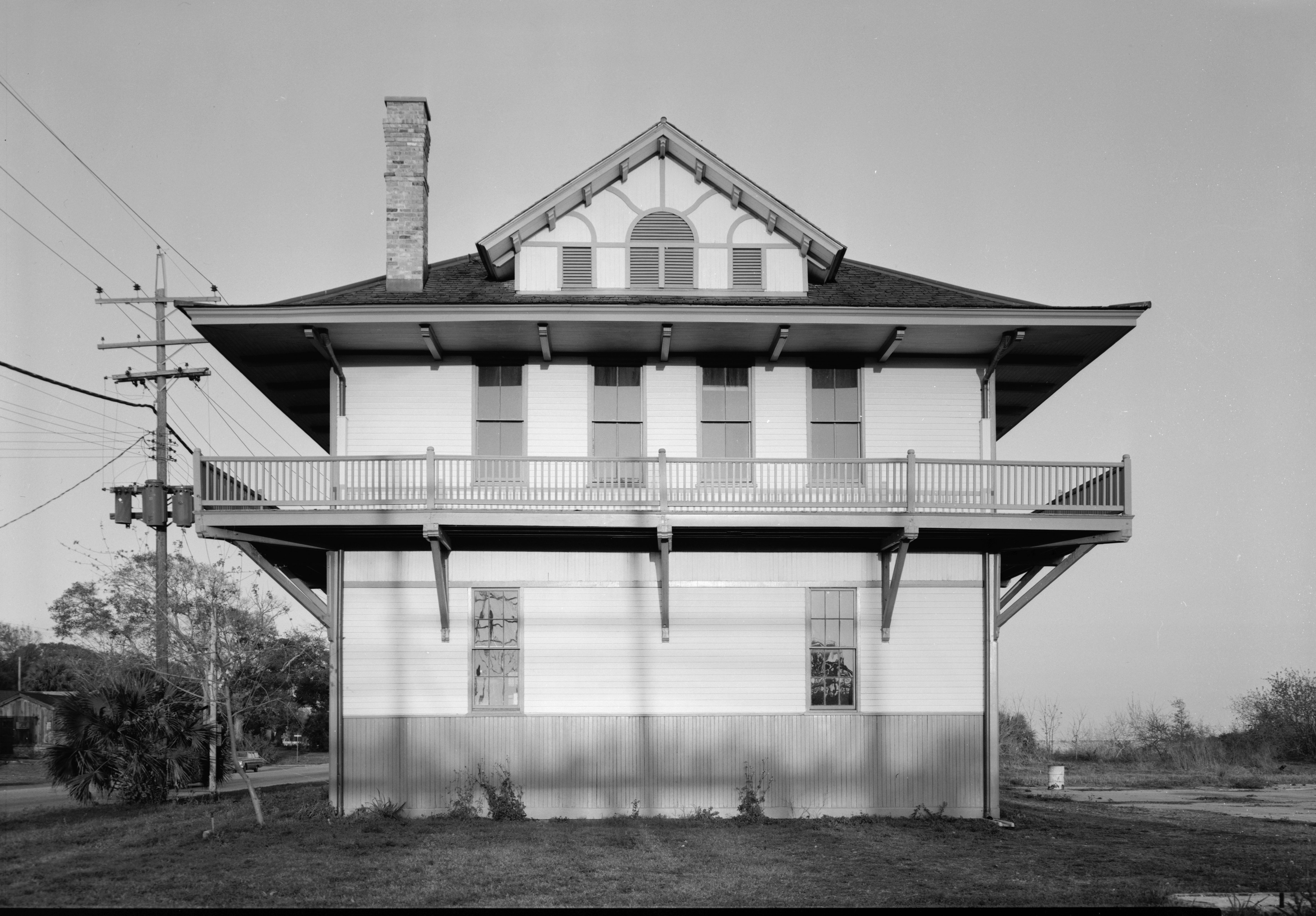
| 18:03, 8 February 2009 | LNMarine-HABS-NE.jpg (file) |  |
2.37 MB | Taken by Ray Malinowski in 1968 for the Wikipedia:Historic American Buildings Survey. Held in the Library of Congress, [http://memory.loc.gov/cgi-bin/query/S?pp/hh:@field(TITLE+@od1(Bear+Block,+404+South+Palafox+Street,+Pensacola,+Escambia+County,+FL | 1 |
| 18:10, 8 February 2009 | LNMarine-HABS-SW2.jpg (file) |  |
2.36 MB | Taken by Ray Malinowski in 1968 for the Wikipedia:Historic American Buildings Survey. Held in the Library of Congress, [http://memory.loc.gov/cgi-bin/ampage?collId=pphhphoto&fileName=fl/fl0000/fl0035/photos/browse.db&action=browse&recNum=0&title2=Lou | 1 |
| 23:08, 27 March 2009 | LiveOakFront.PNG (file) |  |
2.23 MB | October 6, 1847 issue of ''The Live Oak'' {{PD-old}} | 1 |
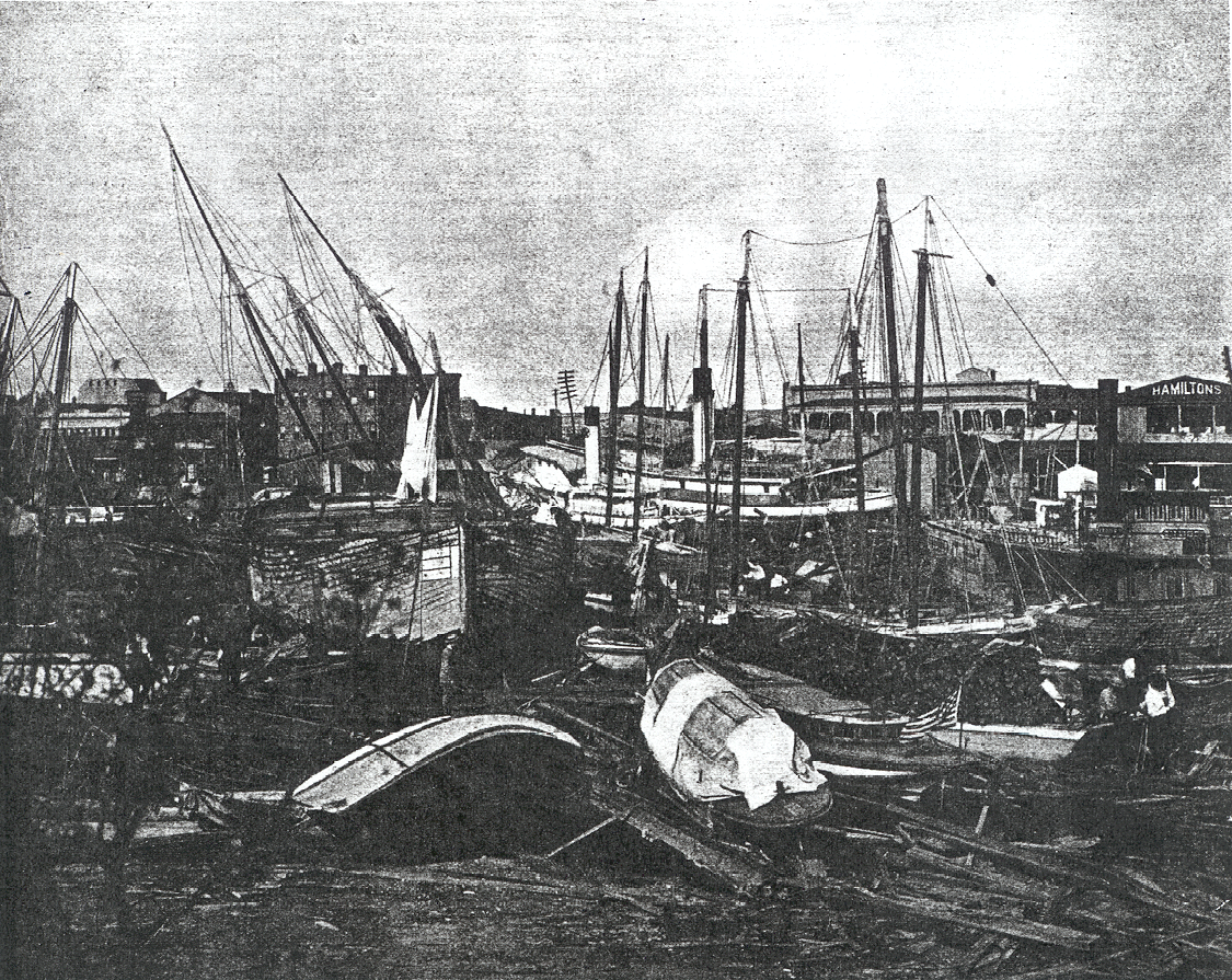
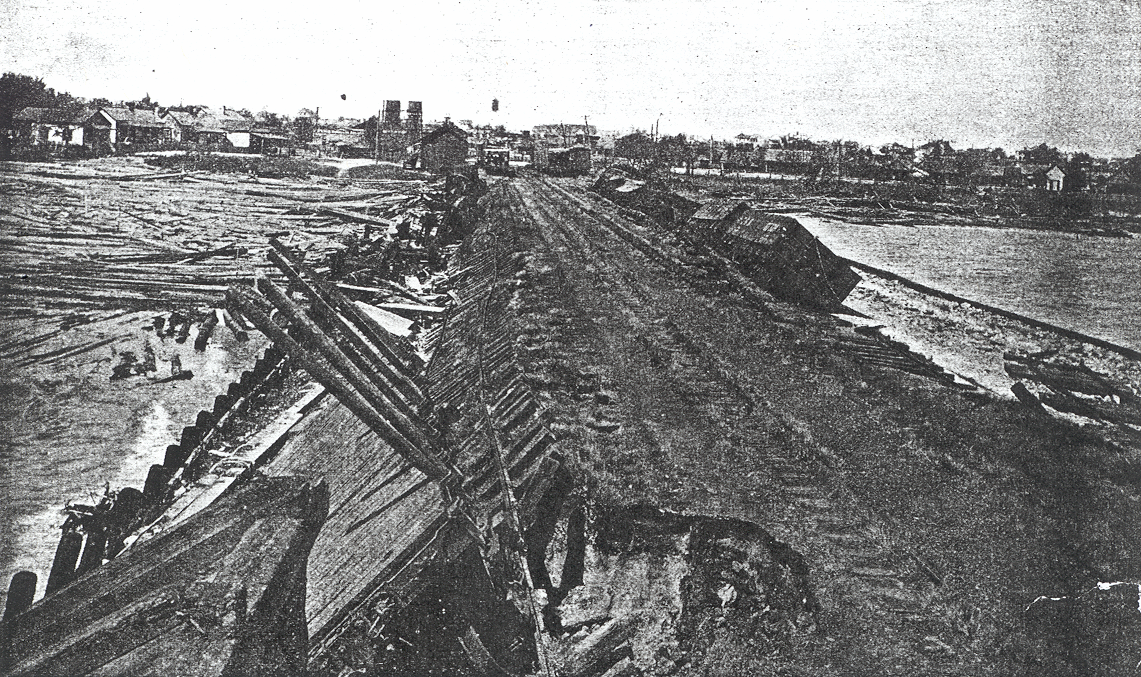
| 20:59, 24 April 2008 | 1906Hurricane-damage.PNG (file) |  |
2.16 MB | "Damage from hurricane in Pensacola in 1906". Taken from [http://www.aoml.noaa.gov/hrd/hurdat/mwr_pdf/1906.pdf http://www.aoml.noaa.gov/hrd/hurdat/mwr_pdf/1906.pdf] via [http://commons.wikimedia.org/wiki/Image:1906_Pensacola_Hurricane_Damage.PNG Wikimedi | 1 |
| 21:07, 21 April 2008 | PNS.jpg (file) |  |
2.16 MB | On the CoP's website [http://www.ci.pensacola.fl.us/live/pages.asp?pageID=3269] Copyright status unknown, assumed PD | 1 |
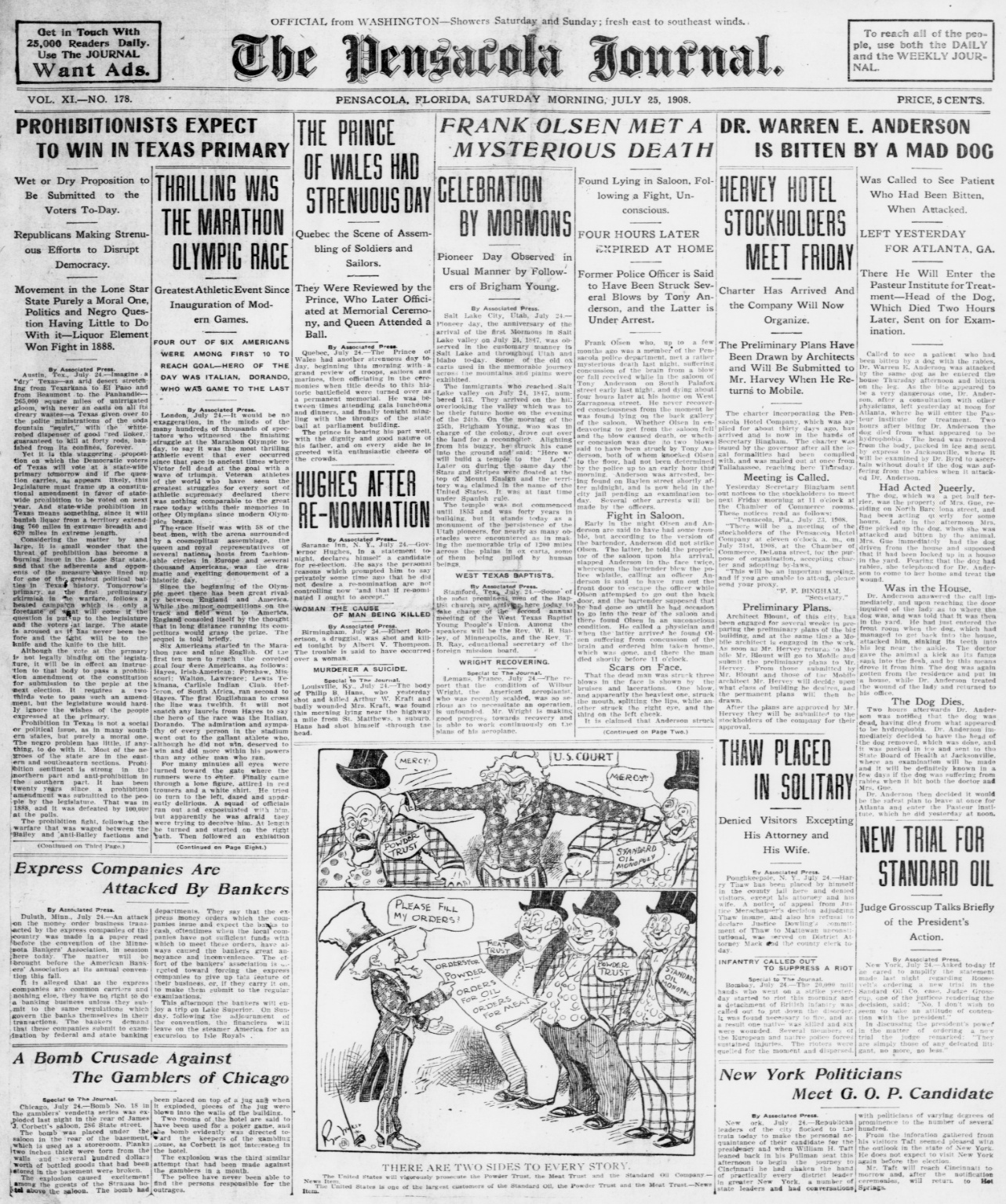
| 16:28, 20 March 2009 | PensacolaJournal.PNG (file) |  |
2.11 MB | 2 | |
| 18:24, 8 February 2009 | LNMarine-HABS-SW3.jpg (file) |  |
2.09 MB | Taken by Jack Boucher in 1974 for the Wikipedia:Historic American Buildings Survey. Held in the Library of Congress, [http://memory.loc.gov/cgi-bin/ampage?collId=pphhphoto&fileName=fl/fl0000/fl0035/photos/browse.db&action=browse&recNum=0&title2=Louis | 1 |
| 18:17, 8 February 2009 | LNMarine-HABS-SE2.jpg (file) |  |
2.04 MB | Taken by Jack Boucher in 1974 for the Wikipedia:Historic American Buildings Survey. Held in the Library of Congress, [http://memory.loc.gov/cgi-bin/ampage?collId=pphhphoto&fileName=fl/fl0000/fl0035/photos/browse.db&action=browse&recNum=0&title2=Louis | 1 |
| 20:47, 20 April 2007 | 300SAlcaniz1974-HR.jpg (file) |  |
2.02 MB | From the LOC Historic American Buildings Survey Photograph by Jack Boucher, March 1974 {{PD-USGov}} | 1 |
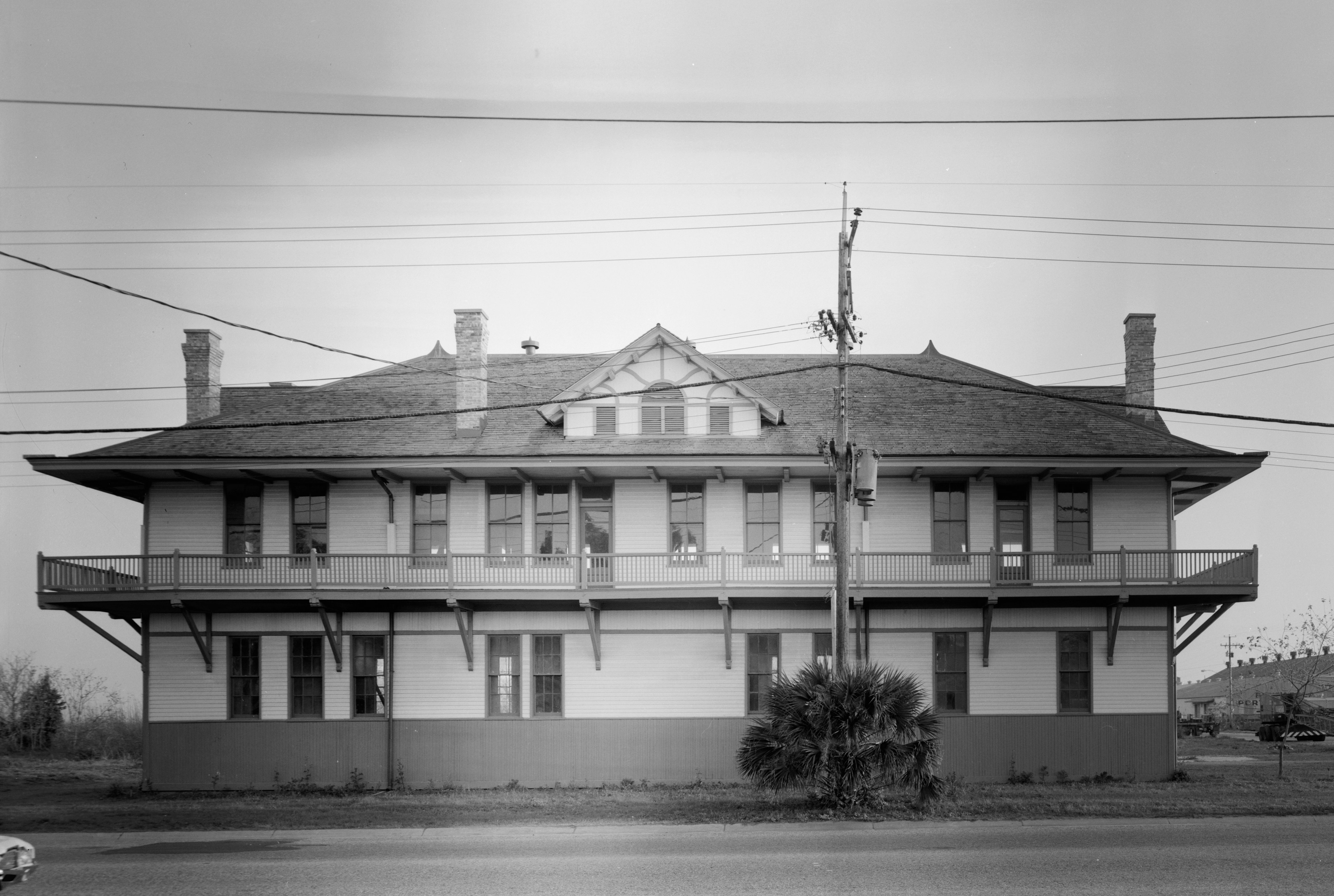
| 18:15, 8 February 2009 | LNMarine-HABS-South.jpg (file) | Error creating thumbnail: File missing |
1.97 MB | Taken by Jack Boucher in 1974 for the Wikipedia:Historic American Buildings Survey. Held in the Library of Congress, [http://memory.loc.gov/cgi-bin/ampage?collId=pphhphoto&fileName=fl/fl0000/fl0035/photos/browse.db&action=browse&recNum=0&title2=Louis | 1 |
| 18:20, 8 February 2009 | LNMarine-HABS-West.jpg (file) |  |
1.91 MB | Taken by Jack Boucher in 1974 for the Wikipedia:Historic American Buildings Survey. Held in the Library of Congress, [http://memory.loc.gov/cgi-bin/ampage?collId=pphhphoto&fileName=fl/fl0000/fl0035/photos/browse.db&action=browse&recNum=0&title2=Louis | 1 |
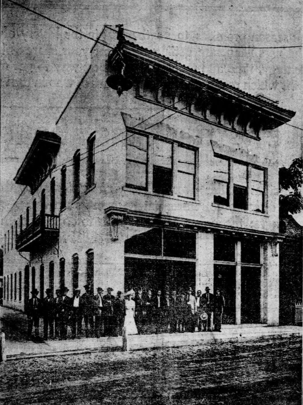
| 16:17, 8 March 2009 | JournalBuilding.PNG (file) |  |
1.82 MB | Appeared in the September 23, 1906 ''Journal''. {{PD-old}} | 1 |
| 18:35, 25 February 2008 | MikeWhitehead.jpg (file) |  |
1.8 MB | Likely PD | 1 |
| 18:32, 8 February 2009 | LNMarine-HABS-SW4.jpg (file) |  |
1.75 MB | Taken by Jack Boucher in 1974 for the Wikipedia:Historic American Buildings Survey. Held in the Library of Congress, [http://memory.loc.gov/cgi-bin/ampage?collId=pphhphoto&fileName=fl/fl0000/fl0035/photos/browse.db&action=browse&recNum=0&title2=Louis | 1 |
| 18:18, 8 February 2009 | LNMarine-HABS-North.jpg (file) |  |
1.71 MB | Taken by Jack Boucher in 1974 for the Wikipedia:Historic American Buildings Survey. Held in the Library of Congress, [http://memory.loc.gov/cgi-bin/ampage?collId=pphhphoto&fileName=fl/fl0000/fl0035/photos/browse.db&action=browse&recNum=0&title2=Louis | 1 |
| 18:17, 25 February 2008 | KevinWhite.jpg (file) |  |
1.7 MB | Likely PD | 1 |
| 21:27, 24 April 2008 | 1906Hurricane-damage2.PNG (file) |  |
1.7 MB | "The effect of the storm at Pensacola, Fla.; View northward from Muscogee wharf, showing the effect of the high seas on the embankment." "Damage from hurricane in Pensacola in 1906". Taken from [http://www.aoml.noaa.gov/hrd/hurdat/mw | 1 |
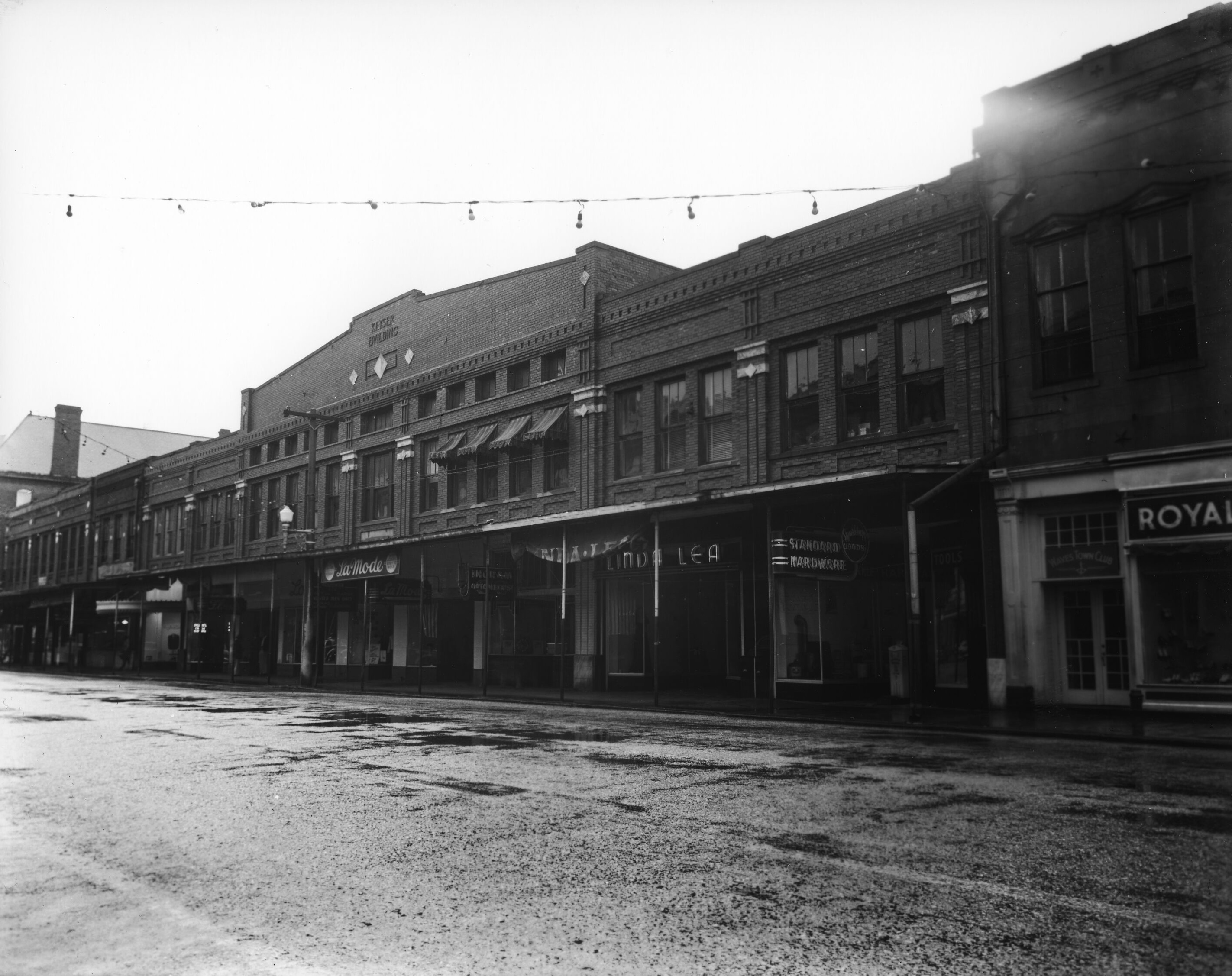
| 23:29, 1 June 2019 | KeyserBuilding1943.jpg (file) |  |
1.55 MB | {{PD-Gov}} | 1 |
| 08:41, 2 June 2019 | LegionField.jpg (file) |  |
1.53 MB | Legion Field circa 1940s. Photograph by Charles Cottrell, from UWF Archives [https://uwf.lyrasistechnology.org/repositories/2/digital_objects/2166] {{PD-Gov}} | 1 |
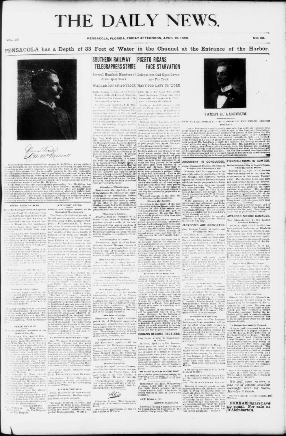
| 15:57, 20 March 2009 | DailyNews.PNG (file) |  |
1.48 MB | April 13, 1900 issue of the ''Daily News'' {{PD-old}} | 1 |
| 06:18, 1 June 2019 | John sunday.jpg (file) |  |
1.47 MB | {{PD-old}} | 1 |
| 06:33, 4 June 2019 | GilbertHotel1939.jpg (file) |  |
1.37 MB | Gilbert Hotel in 1939. From UWF Archives [https://uwf.lyrasistechnology.org/repositories/2/digital_objects/2434] {{PD-Gov}} | 1 |
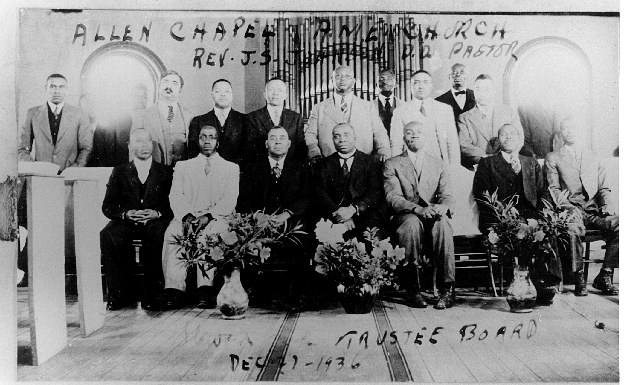
| 07:12, 8 February 2017 | AllenAMETrustees1936.jpg (file) |  |
1.34 MB | Allen Chapel AME Church (Pensacola, Fla.), Board of Trustees, 1936 Photographs from University of West Florida Publications and Marketing Department, donated to University Archives, circa 2009. These may be original unedited images considered for use... | 1 |
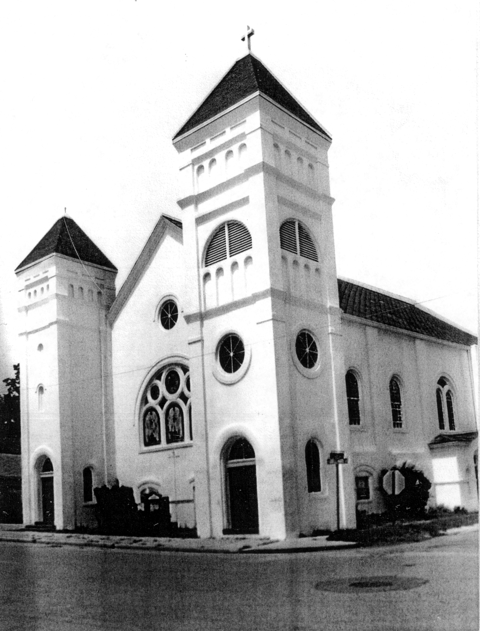
| 07:08, 8 February 2017 | AllenAMElate90s.jpg (file) |  |
1.29 MB | Allen Chapel African Methodist Church (AME), Pensacola, Florida circa late 1990s. Photographs from University of West Florida Publications and Marketing Department, donated to University Archives, circa 2009. These may be original unedited images co... | 1 |
| 22:15, 16 March 2007 | Endoftheline.jpg (file) |  |
1.23 MB | Public domain per author ~~~~ | 1 |
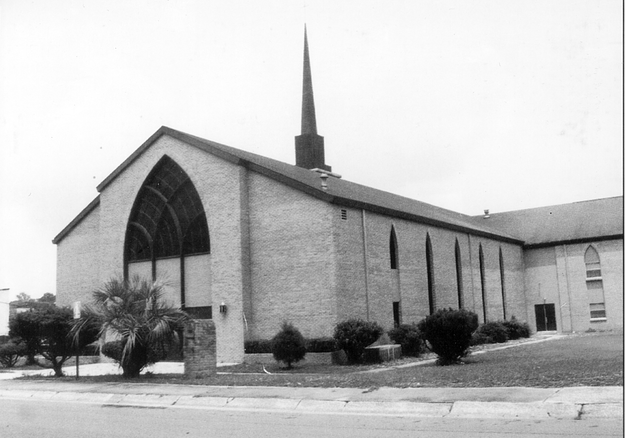
| 05:44, 8 February 2017 | GreaterUnion1990s.jpg (file) |  |
1.1 MB | Greater Union Baptist Church (Pensacola, Fla.), undated (circa 1990s) Photographs from University of West Florida Publications and Marketing Department, donated to University Archives, circa 2009. These may be original unedited images considered fo... | 1 |
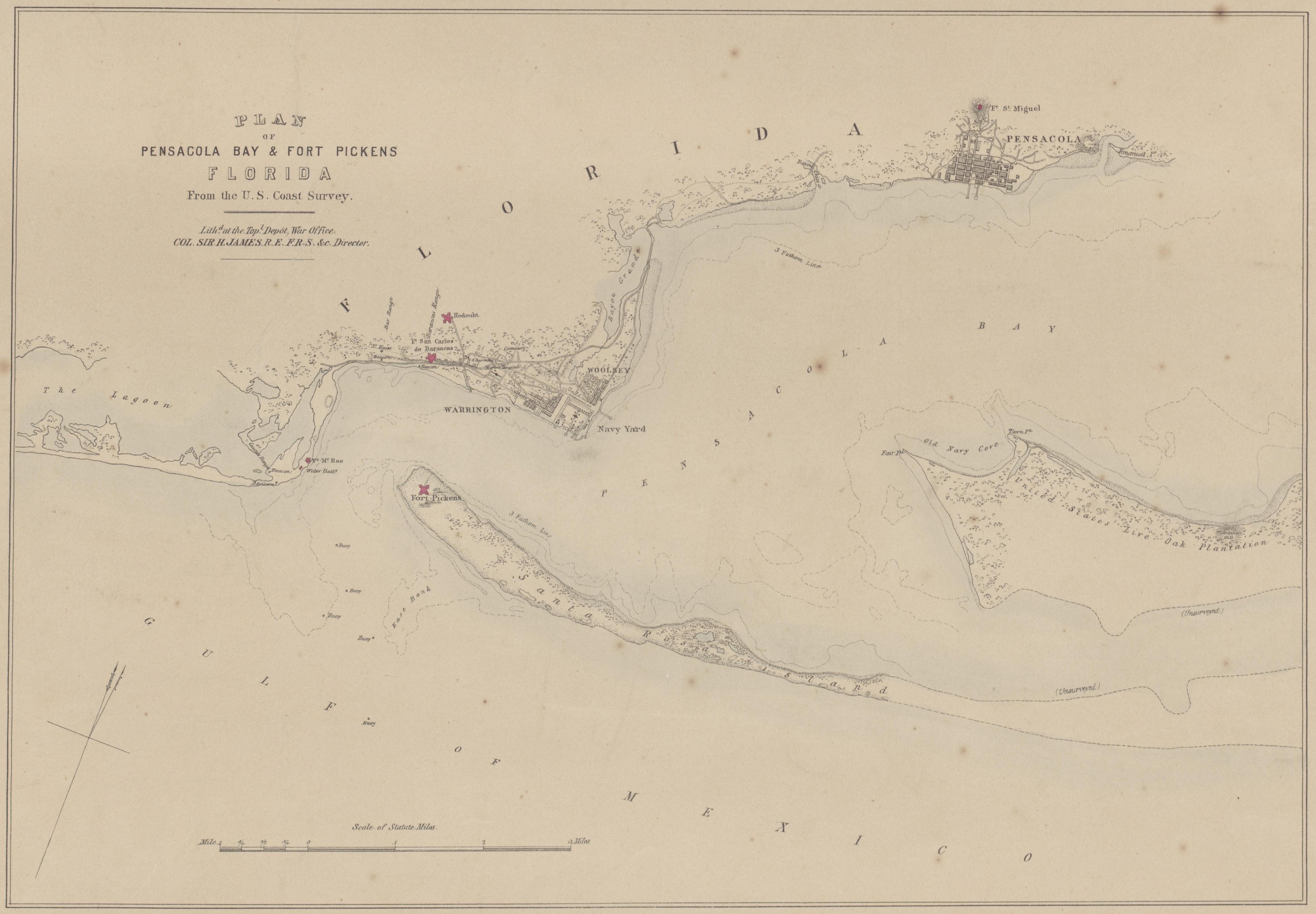
| 18:59, 18 December 2008 | 1861Map.jpg (file) |  |
1.1 MB | Plan of Pensacola Bay & Fort Pickens, Florida, From the U.S. Coast Survey. Lith'd. at the Top'l. Depot, War Office, Col. Sir H. James, R.E. F.R.S. &c. Director. 1861. Obtained from [http://nla.gov.au/nla.map-rm421]. | 1 |
| 22:54, 15 March 2009 | JournalBldgFloorPlan.PNG (file) | Error creating thumbnail: File missing |
1.09 MB | Floor plan of the ''Journal'' Building at the corner of Intendencia and DeLuna Streets, circa 1906. Appeared in the September 23, 1906 ''Journal''. {{PD-old}} | 1 |
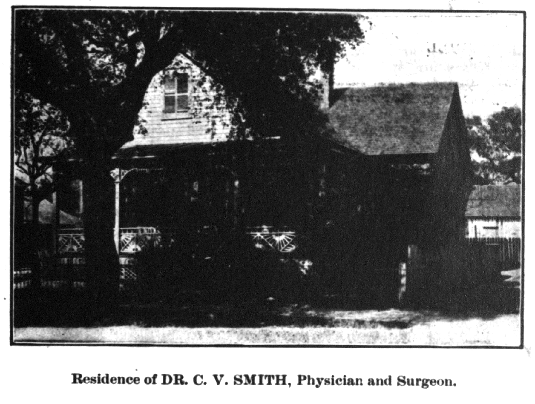
| 00:32, 20 March 2020 | Smithdrcvresidenceflasentinel1904.jpg (file) |  |
1.08 MB | 1 |