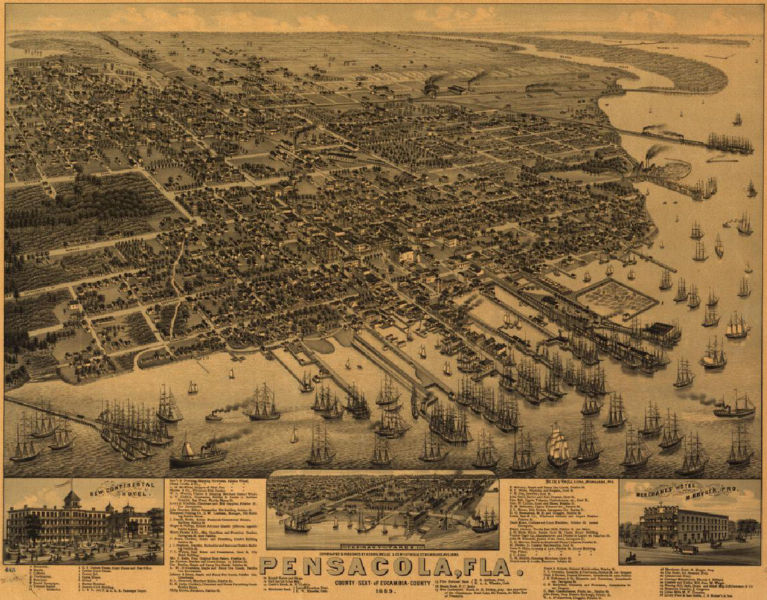
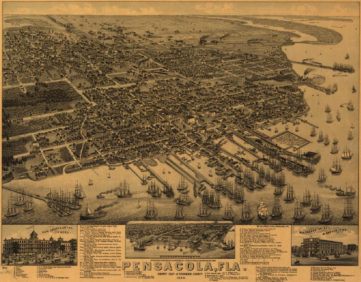
File:WellgeMap.jpg
Jump to navigation
Jump to search


Size of this preview: 767 × 600 pixels. Other resolutions: 307 × 240 pixels | 1,160 × 907 pixels.
Original file (1,160 × 907 pixels, file size: 441 KB, MIME type: image/jpeg)
The Wellge map.
This image is in the public domain in the United States. In most cases, this means that it was first published in the United States prior to January 1, 1923. See Pensapedia:Public domain and Pensapedia:Copyrights for more details.
File history
Click on a date/time to view the file as it appeared at that time.
| Date/Time | Thumbnail | Dimensions | User | Comment | |
|---|---|---|---|---|---|
| current | 20:58, 21 April 2007 | | 1,160 × 907 (441 KB) | Admin (talk | contribs) | The Wellge map. {{PD-US}} Source: [http://memory.loc.gov/cgi-bin/query/D?gmd:22:./temp/~ammem_9Rr9::@@@mdb=mcc,gottscho,detr,nfor,wpa,aap,cwar,bbpix,cowellbib,calbkbib,consrvbib,bdsbib,dag,fsaall,gmd,pan,vv,presp,varstg,suffrg,nawbib,horyd,wtc,toddbib |
- You cannot overwrite this file.
File usage
The following 6 pages uses this file: