File list
Jump to navigation
Jump to search
This special page shows all uploaded files.
| Date | Name | Thumbnail | Size | User | Description | Versions |
|---|---|---|---|---|---|---|
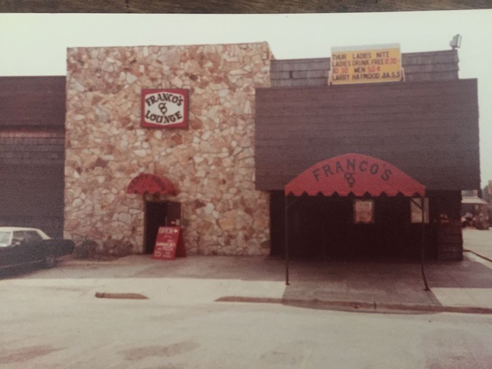
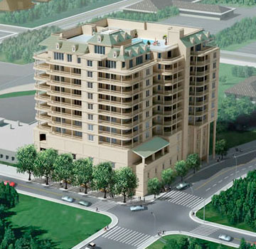
| 05:56, 9 January 2020 | *Francosfrontcmall.jpg (file) |  |
72 KB | Hallgs | 1 | |
| 13:11, 1 January 2015 | 001.jpg (file) |  |
25 KB | Captaink49 | 1 | |
| 12:35, 24 January 2015 | 02.jpg (file) |  |
31 KB | Captaink49 | 1 | |
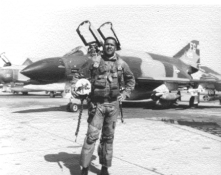
| 17:50, 7 April 2007 | 040130-F-0000G-004.jpg (file) |  |
134 KB | Admin | Source: [http://en.wikipedia.org/wiki/Image:040130-F-0000G-004.jpg Wikipedia] {{PD-USGov}} | 1 |
| 17:07, 13 January 2010 | 09 argo.jpg (file) |  |
14 KB | Jmac9909 | New UWF Mascot 2009-2010 | 1 |
| 21:04, 2 October 2008 | 111SpringRendering.jpg (file) |  |
45 KB | Admin | {{fair use in|111 Spring]] | 1 |
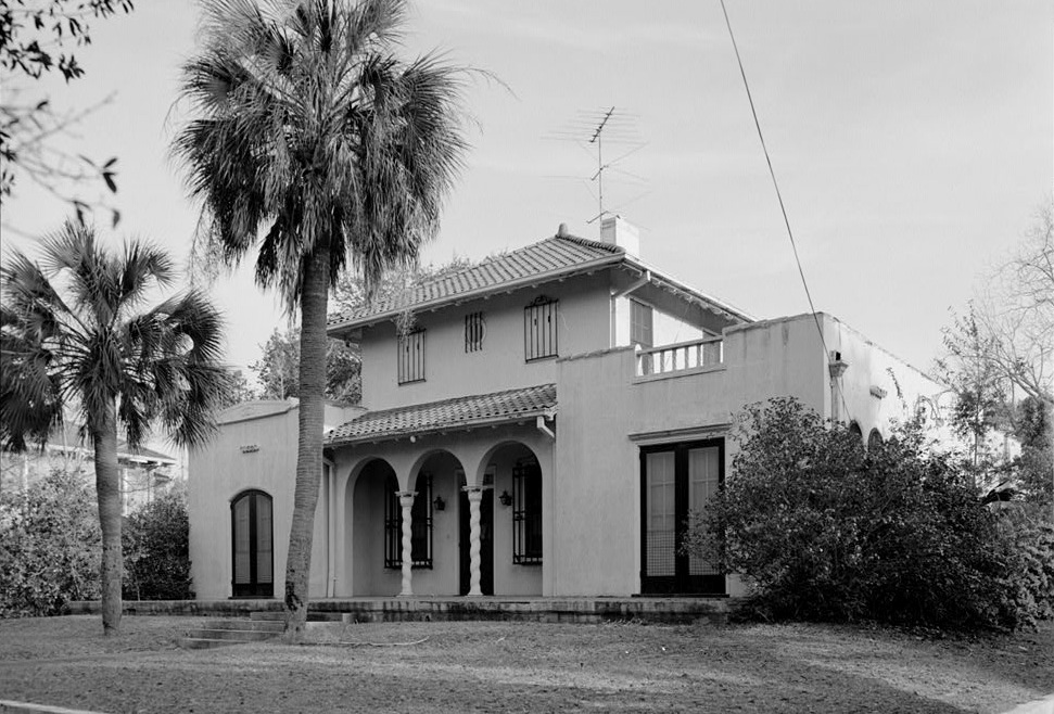
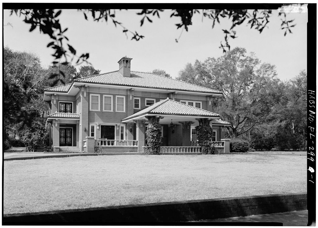
| 22:09, 15 December 2007 | 123WLloyd1974.jpg (file) |  |
219 KB | Admin | {{PD-USGov}} Source: Library of Congress American Memory Credit: Jack Boucher, Historic American Buildings Survey Date: March 1974 | 1 |
| 22:13, 28 May 2009 | 126964.jpg (file) |  |
11 KB | Mom2dx3 | 1 | |
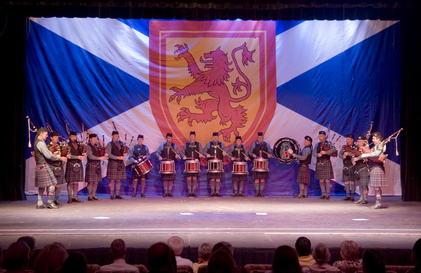
| 15:26, 7 June 2021 | 12 concert.jpg (file) |  |
399 KB | Duncanmccall | 1 | |
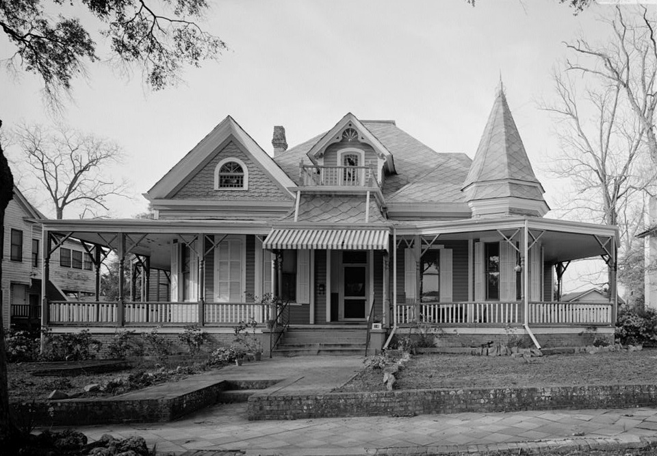
| 21:35, 15 December 2007 | 1300NBaylen1974.jpg (file) |  |
142 KB | Admin | {{PD-USGov}} Source: Library of Congress American Memory Credit: Jack Boucher, Historic American Buildings Survey Date: March 1974 | 1 |
| 22:35, 15 December 2007 | 14EGadsdenSt1974.jpg (file) |  |
223 KB | Admin | {{PD-USGov}} Source: Library of Congress American Memory Credit: Jack Boucher, Historic American Buildings Survey Date: March 1974 | 1 |
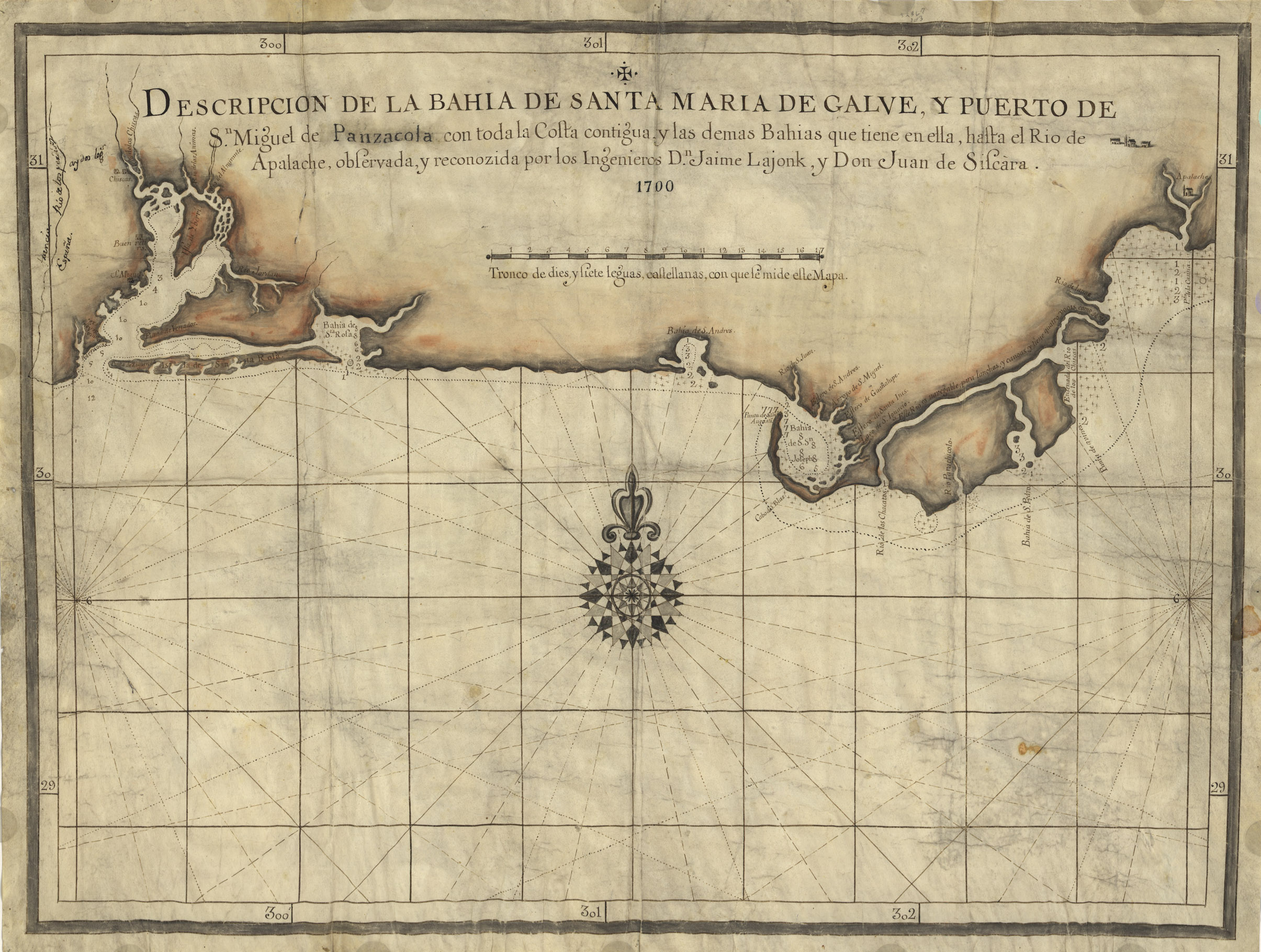
| 16:20, 21 April 2007 | 1700Map.jpg (file) |  |
978 KB | Admin | Descripcion de la Bahia de Santa Maria de Galve, y Puerto de Sn. Miguel de Panzacola con toda la costa contigua y las demas bahias que tiene en ella, hasta el Rio de Apalache / observada, y reconozida por los ingenieros Dn. Jaime Lajonk, y Don Juan de Sis | 1 |
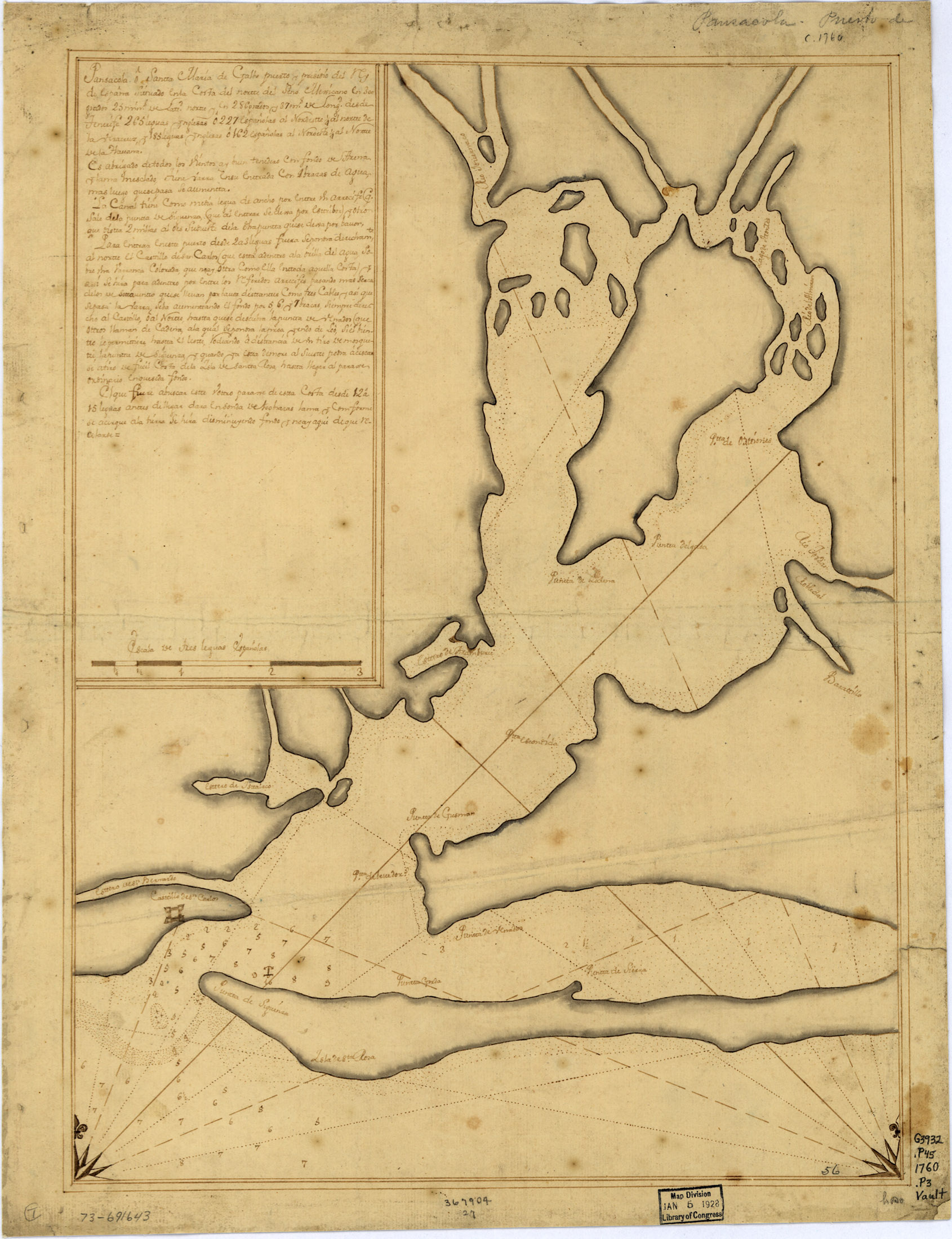
| 04:23, 21 April 2007 | 1760Map.jpg (file) |  |
769 KB | Admin | Pansacola o Santta María de Galbe, puerto y presidio del Ry. de España situado en la costa del nortte del Seno Mexicano, los 30 grados 25 mins. de lattd. nortte y los 286 grados y 37 ms. de longd. desde Tenerife 265 leguas inglesas o 227 españolas al n | 1 |
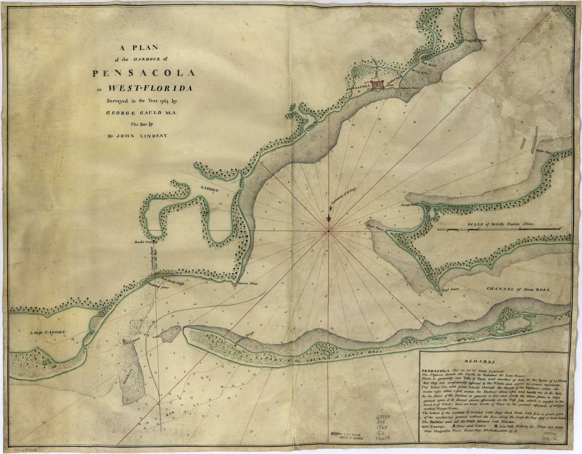
| 04:29, 21 April 2007 | 1764Plan.jpg (file) |  |
733 KB | Admin | A plan of the harbour of Pensacola in West-Florida. Surveyed in the year 1764 by George Gauld, M.A. The bar by Sir John Lindsay. {{PD-USGov}} Source: [http://memory.loc.gov/cgi-bin/query/D?gmd:1:./temp/~ammem_UNdW::@@@mdb=mcc,gottscho,detr,nfor,wpa,aap,cw | 1 |
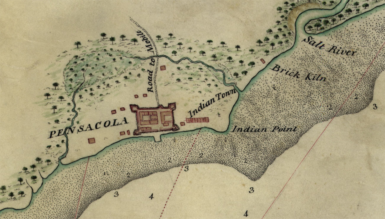
| 04:30, 21 April 2007 | 1764PlanDetail.jpg (file) |  |
279 KB | Admin | A plan of the harbour of Pensacola in West-Florida (detail). Surveyed in the year 1764 by George Gauld, M.A. The bar by Sir John Lindsay. {{PD-USGov}} Source: [http://memory.loc.gov/cgi-bin/query/D?gmd:1:./temp/~ammem_UNdW::@@@mdb=mcc,gottscho,detr,nfor,w | 1 |
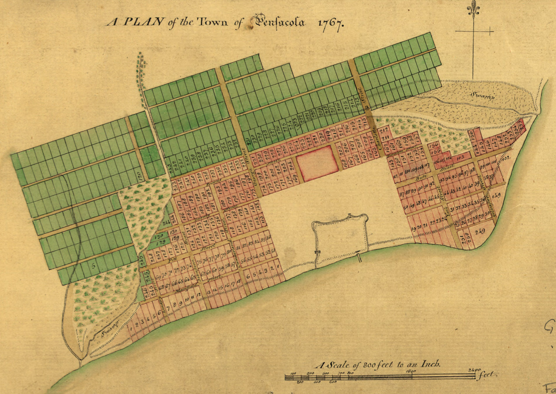
| 17:05, 21 April 2007 | 1767Plan.jpg (file) |  |
617 KB | Admin | A Plan of the town of Pensacola, 1767. {{PD-US}} Source: [http://memory.loc.gov/cgi-bin/query/D?gmd:6:./temp/~ammem_0Es2::@@@mdb=mcc,gottscho,detr,nfor,wpa,aap,cwar,bbpix,cowellbib,calbkbib,consrvbib,bdsbib,dag,fsaall,gmd,pan,vv,presp,varstg,suffrg,nawb | 1 |
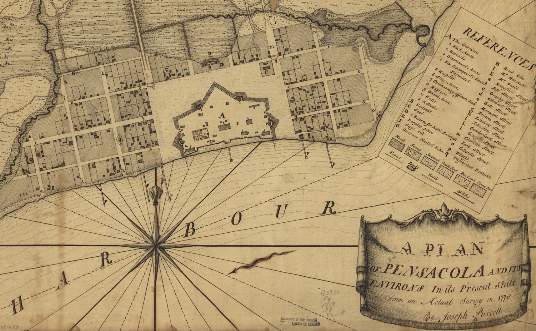
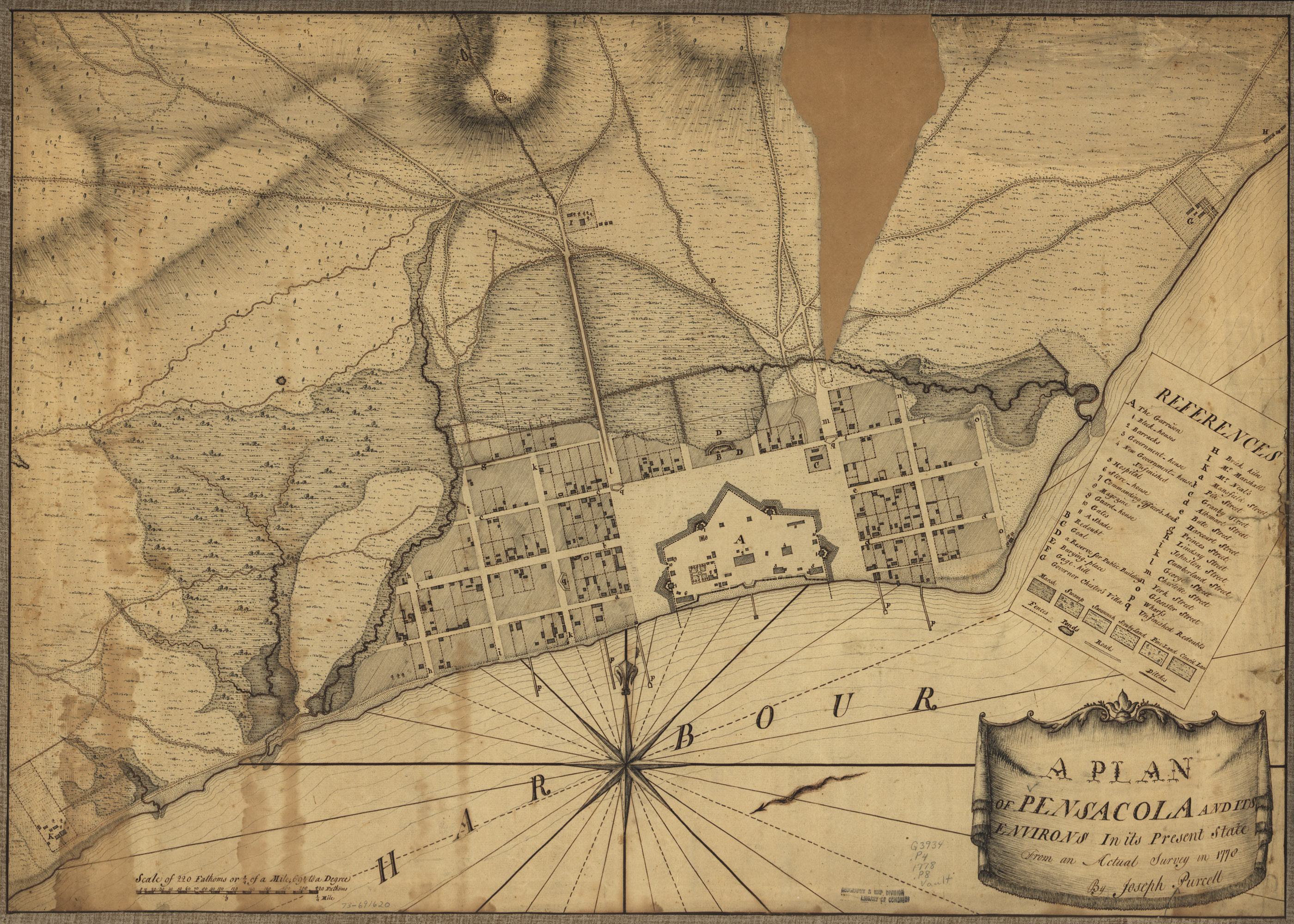
| 15:46, 21 April 2007 | 1778PurcellPlan-Detail.jpg (file) |  |
618 KB | Admin | A plan of Pensacola and its environs in its present state, from an actual survey in 1778, by Joseph Purcell. Detail; see high-res version at Image:1778PurcellPlan.jpg {{PD-US}} Source: [http://memory.loc.gov/cgi-bin/map_item.pl?data=/home/www/data/g | 1 |
| 15:48, 21 April 2007 | 1778PurcellPlan.jpg (file) |  |
1.76 MB | Admin | A plan of Pensacola and its environs in its present state, from an actual survey in 1778, by Joseph Purcell. For most article purposes, the lower-resolution detail is suitable: Image:1778PurcellPlan-Detail.jpg {{PD-US}} Source: [http://memory.loc.g | 1 |
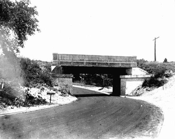
| 19:34, 21 October 2007 | 17thAveBridge-1935.jpg (file) |  |
88 KB | Admin | {{fair use in|17th Avenue railroad trestle}} Source: Florida Photographic Memory | 1 |
| 04:48, 5 April 2007 | 1850Map.jpg (file) |  |
48 KB | Dscosson | Detailed view from a map of Florida that was published in 1850 highlighting Pensacola. From the Special Collections Department, University of South Florida. [http://fcit.usf.edu/Florida/maps/local/escambia/m010301.htm] {{pd-old}} | 1 |
| 19:16, 21 April 2007 | 1861CoastSurvey.jpg (file) |  |
496 KB | Admin | Chart of Pensacola Bay - From the United States Coast Survey. Jim Smith, New York, 1861. {{PD-US}} Source: [http://memory.loc.gov/cgi-bin/query/D?gmd:10:./temp/~ammem_okSE::@@@mdb=mcc,gottscho,detr,nfor,wpa,aap,cwar,bbpix,cowellbib,calbkbib,consrvbib,bd | 1 |
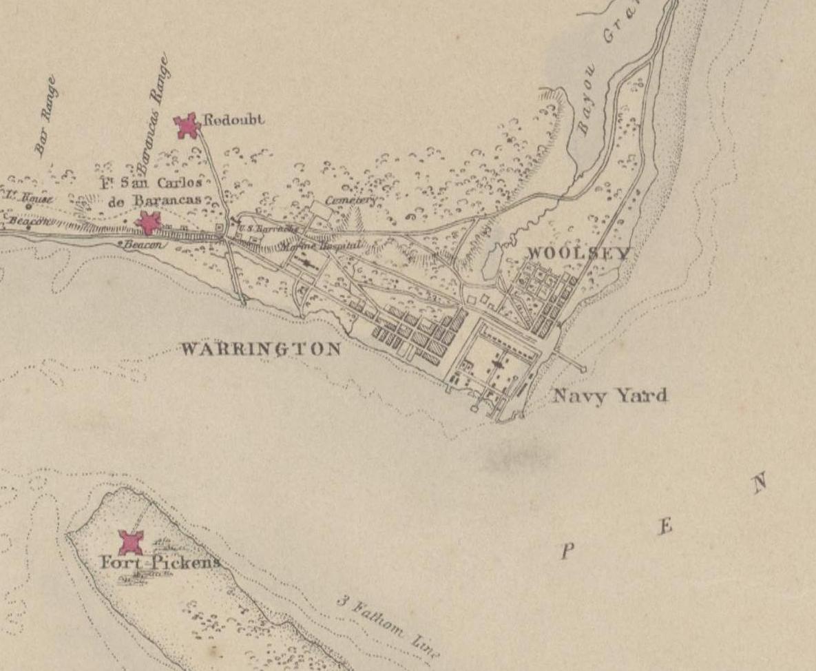
| 19:02, 18 December 2008 | 1861Map-NavyYard.jpg (file) |  |
115 KB | Dscosson | Cropped from Image:1861Map.jpg | 1 |
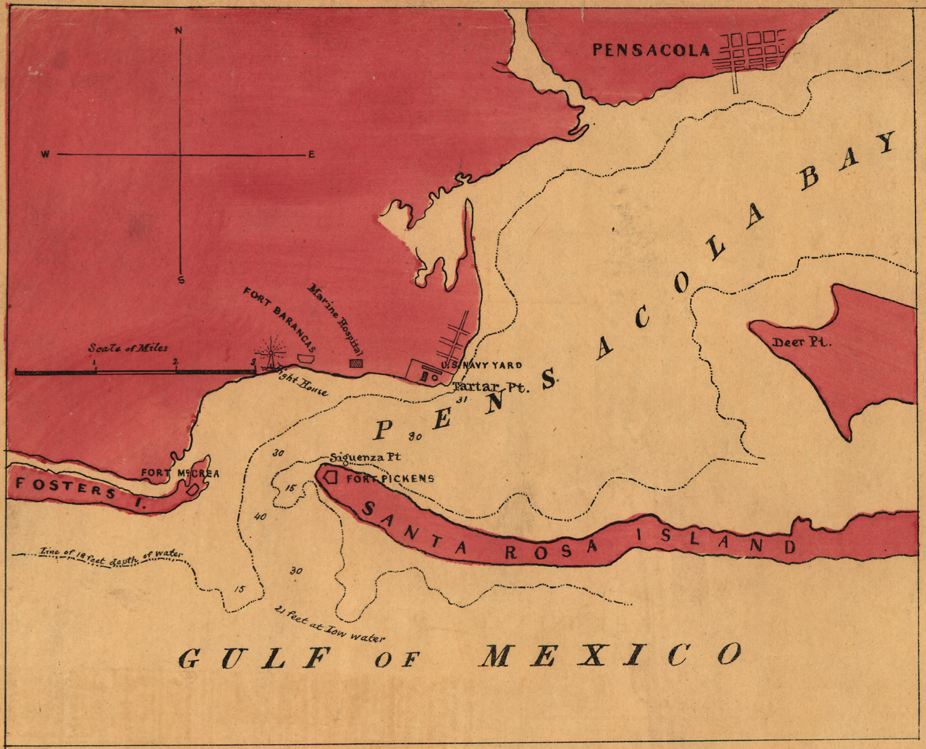
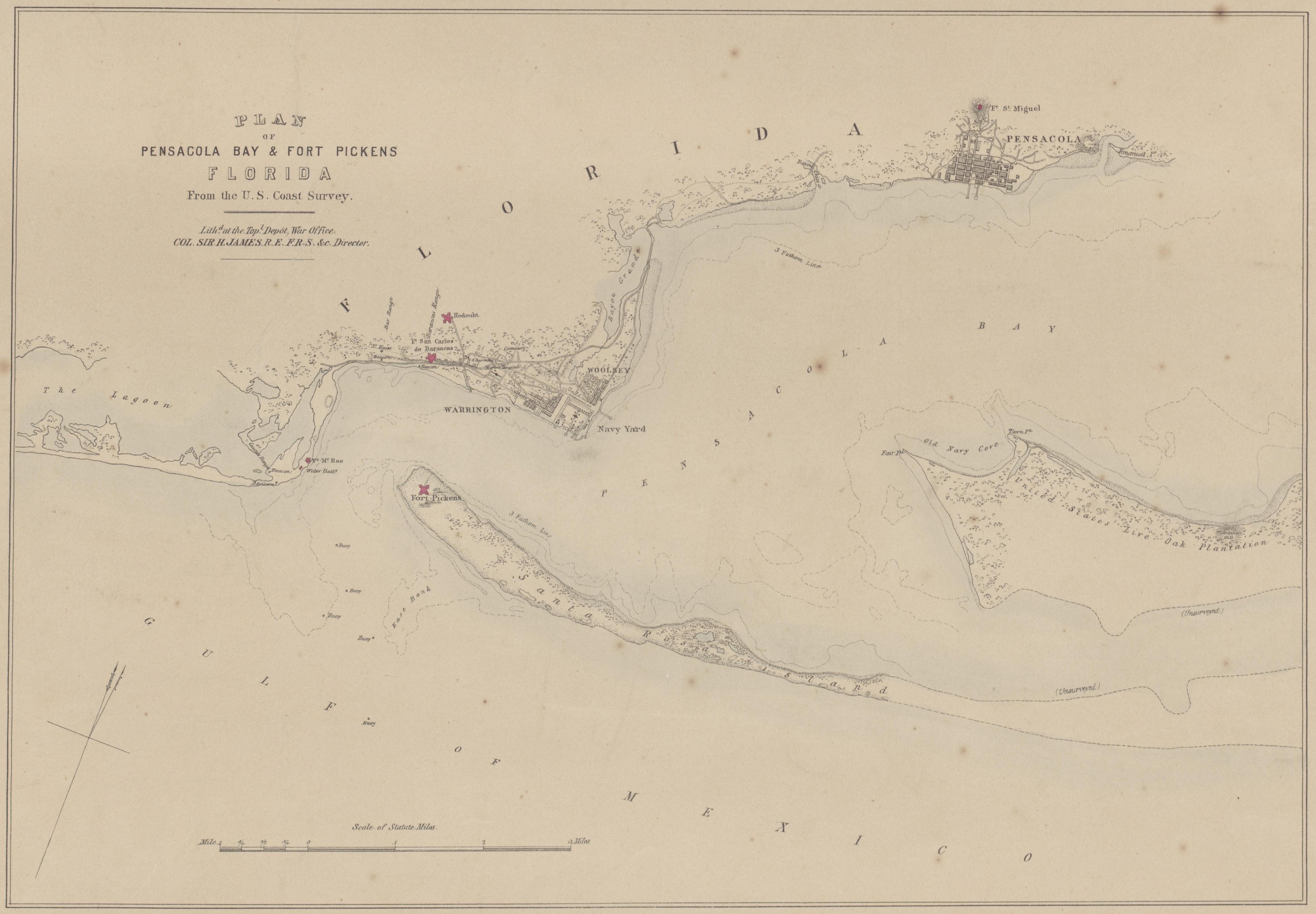
| 18:59, 18 December 2008 | 1861Map.jpg (file) |  |
1.1 MB | Dscosson | Plan of Pensacola Bay & Fort Pickens, Florida, From the U.S. Coast Survey. Lith'd. at the Top'l. Depot, War Office, Col. Sir H. James, R.E. F.R.S. &c. Director. 1861. Obtained from [http://nla.gov.au/nla.map-rm421]. | 1 |
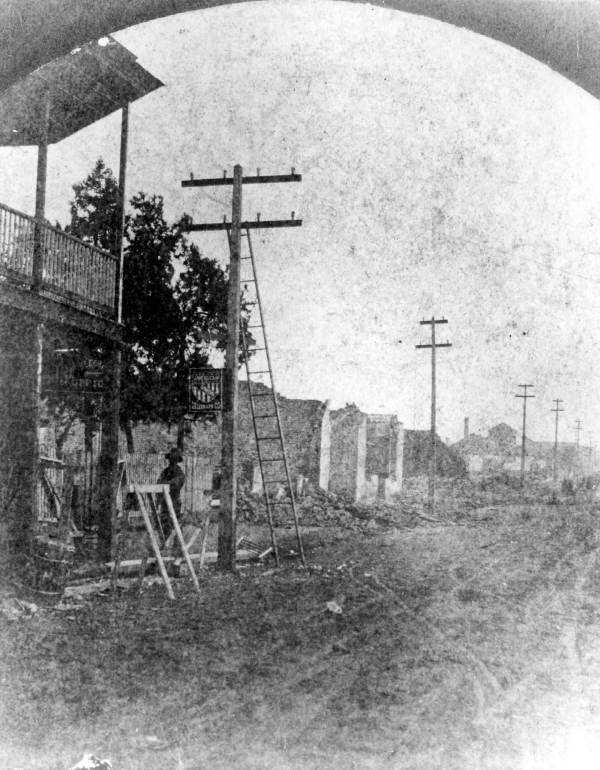
| 23:01, 17 October 2007 | 1880Fire.jpg (file) |  |
76 KB | Admin | {{PD-old}} Source: [http://fpc.dos.state.fl.us/prints/pr08414.jpg Florida Photographic Collection] | 1 |
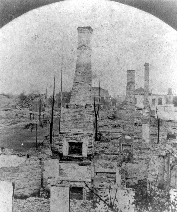
| 23:02, 17 October 2007 | 1880Fire2.jpg (file) |  |
72 KB | Admin | {{PD-old}} Source: [http://fpc.dos.state.fl.us/prints/pr08415.jpg Florida Photographic Collection] | 1 |
| 21:24, 21 April 2008 | 1883Courthouse1.jpg (file) |  |
108 KB | Dscosson | Various government folks. Date of picture unknown. Taken from [http://www.stjohnshistoriccemetery.com/pensacolas_heritages/government.htm]. Copyright status unknown. | 1 |
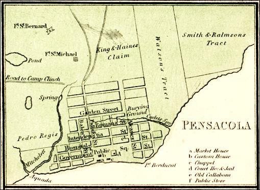
| 17:41, 27 April 2008 | 1890Map.gif (file) |  |
76 KB | Dscosson | "Vicinity of Pensacola". American, 1890, published in Charles Ledyard Norton's ''A Handbook of Florida''. From [http://fcit.usf.edu/florida/maps/pages/2100/f2167/f2167.htm]. {{PD-old}} | 1 |
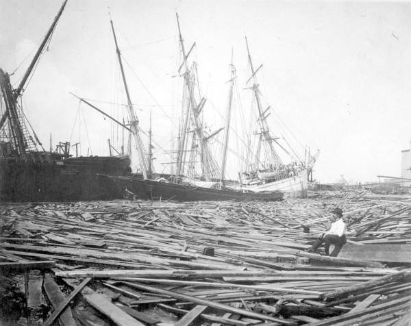
| 20:59, 24 April 2008 | 1906Hurricane-damage.PNG (file) |  |
2.16 MB | Dscosson | "Damage from hurricane in Pensacola in 1906". Taken from [http://www.aoml.noaa.gov/hrd/hurdat/mwr_pdf/1906.pdf http://www.aoml.noaa.gov/hrd/hurdat/mwr_pdf/1906.pdf] via [http://commons.wikimedia.org/wiki/Image:1906_Pensacola_Hurricane_Damage.PNG Wikimedi | 1 |
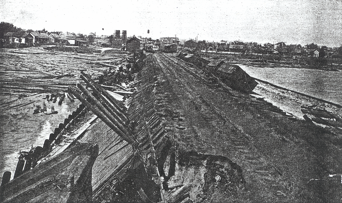
| 21:27, 24 April 2008 | 1906Hurricane-damage2.PNG (file) |  |
1.7 MB | Dscosson | "The effect of the storm at Pensacola, Fla.; View northward from Muscogee wharf, showing the effect of the high seas on the embankment." "Damage from hurricane in Pensacola in 1906". Taken from [http://www.aoml.noaa.gov/hrd/hurdat/mw | 1 |
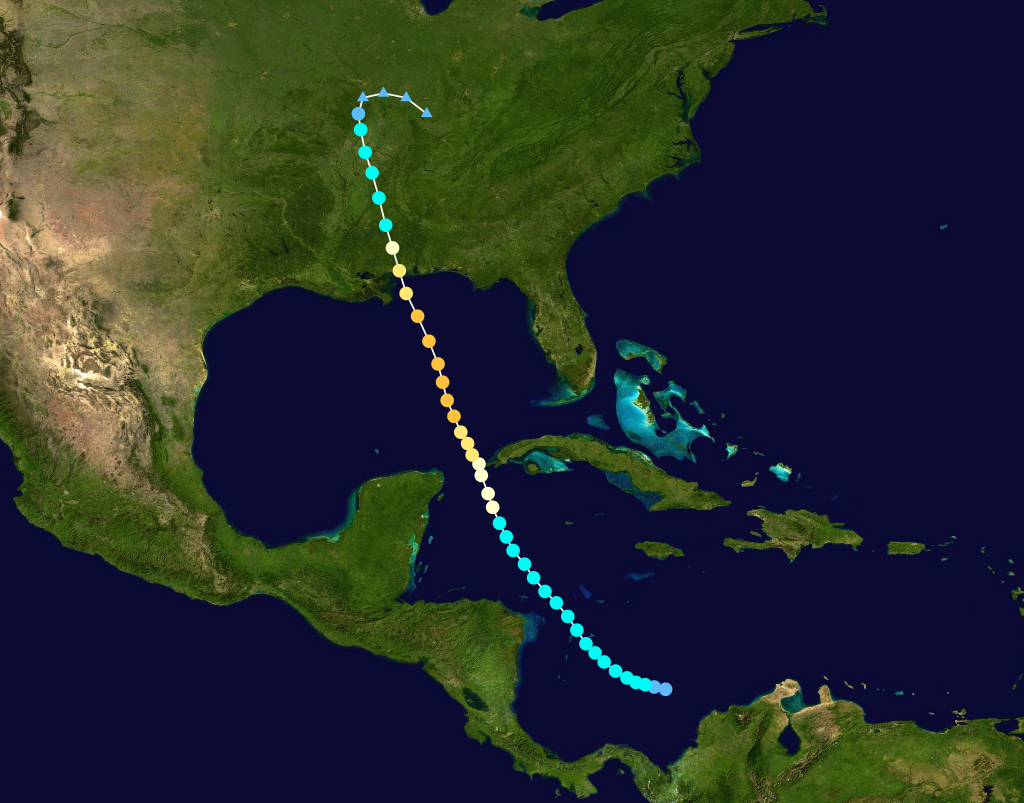
| 15:15, 13 May 2007 | 1906Hurricane.png (file) |  |
815 KB | Admin | {{PD}} Source: [http://en.wikipedia.org/wiki/Image:1906_Atlantic_hurricane_6_track.png Wikipedia] | 1 |
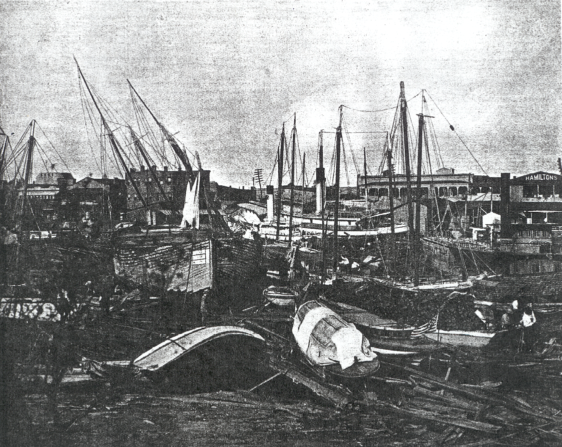
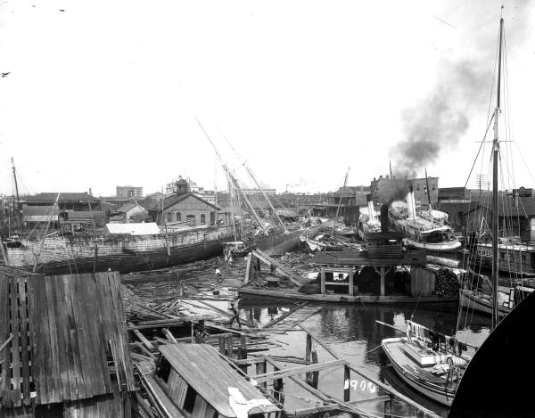
| 18:20, 12 May 2007 | 1906hurricane1.jpg (file) |  |
42 KB | Dscosson | Wrecked ships and debris stemming from Hurricane of 1906. {{PD-old}} | 1 |
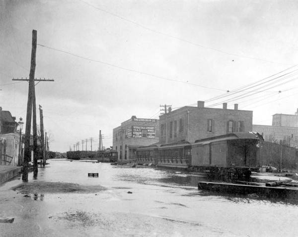
| 18:27, 12 May 2007 | 1906hurricane2.jpg (file) |  |
39 KB | Dscosson | Palafox Street south of Romana looking north after the Hurricane of 1906. {{PD-old}} | 1 |
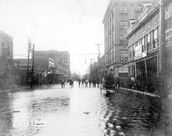
| 19:40, 12 May 2007 | 1906hurricane3.jpg (file) |  |
30 KB | Dscosson | Main Street looking eastward from Palafox after the Hurricane of 1906. {{PD-old}} | 1 |
| 19:42, 12 May 2007 | 1906hurricane4.jpg (file) |  |
41 KB | Dscosson | {{PD-old}} | 1 |
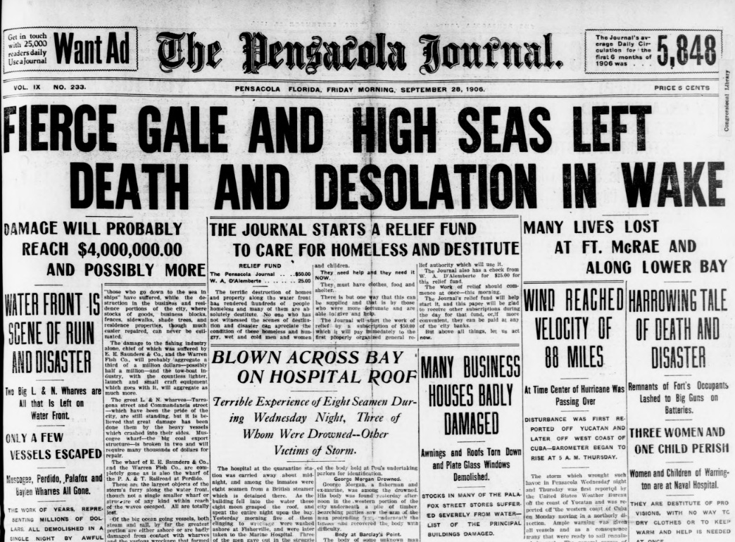
| 21:01, 23 February 2009 | 1906hurricanepaper.PNG (file) |  |
832 KB | Dscosson | Front page of September 29, 1906 ''Pensacola Journal'' {{PD-old}} | 1 |
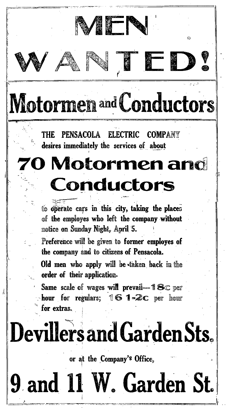
| 01:26, 6 March 2008 | 1908StrikeAd.png (file) |  |
201 KB | Dscosson | From the ''Pensacola Evening News'', April 6 1908 {{PD-old}} | 1 |
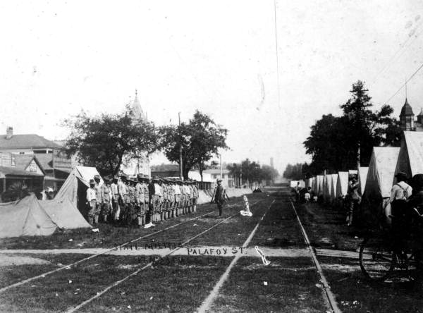
| 15:13, 21 September 2007 | 1908militia.jpg (file) |  |
39 KB | Dscosson | {{PD}} From the [http://www.floridamemory.com/PhotographicCollection/ Florida State Archives Photographic Collection] LCN Rc01669 | 1 |
| 15:16, 21 September 2007 | 1908militia2.jpg (file) |  |
61 KB | Dscosson | {{PD-old}} From the [http://www.floridamemory.com/PhotographicCollection/ Florida State Archives Photographic Collection] LCN Rc01671 | 1 |
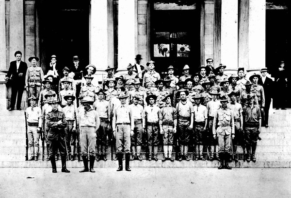
| 15:18, 21 September 2007 | 1908militia3.jpg (file) |  |
40 KB | Dscosson | {{PD-old}} From the [http://www.floridamemory.com/PhotographicCollection/ Florida State Archives Photographic Collection] LCN Rc01672 | 1 |
| 15:20, 21 September 2007 | 1908militia4.jpg (file) |  |
106 KB | Dscosson | {{PD-old}} From the [http://www.floridamemory.com/PhotographicCollection/ Florida State Archives Photographic Collection] LCN N036917 | 1 |
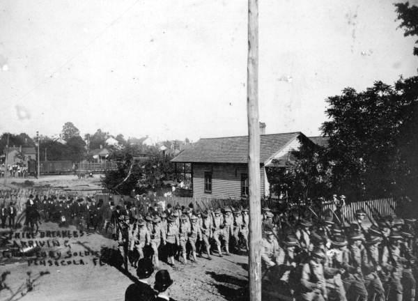
| 15:29, 21 September 2007 | 1908strike.jpg (file) |  |
48 KB | Dscosson | {{PD-old}} From the [http://www.floridamemory.com/PhotographicCollection/ Florida State Archives Photographic Collection] LCN Rc01670 | 1 |
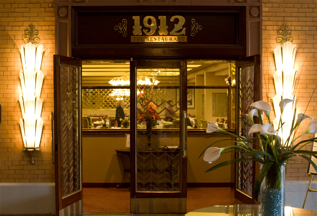
| 19:35, 29 November 2007 | 1912-restaurant.jpg (file) |  |
325 KB | Admin | {{PD-self}} | 1 |
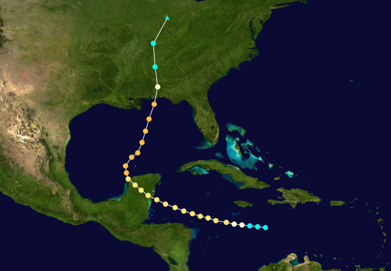
| 02:07, 26 March 2007 | 1916HurricanePath.png (file) |  |
387 KB | Admin | Source (released into public domain by author) | 1 |
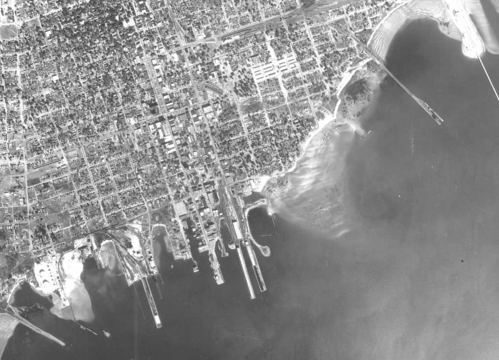
| 22:47, 29 March 2009 | 1940waterfront.PNG (file) |  |
774 KB | Dscosson | From aerial photo at [http://purl.fcla.edu/fcla/aerials/12033_1940_1A_41.sid Florida Aerial Photography] {{PD-UDGov}} | 1 |
| 23:16, 29 March 2009 | 1958woodlandheights.PNG (file) |  |
218 KB | Dscosson | From aerial image at [http://purl.fcla.edu/fcla/aerials/12033_1958_1V_41.sid Florida Aerial Photography] {{PD-USGov}} | 1 |
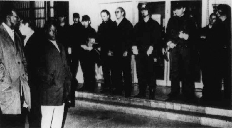
| 16:26, 3 April 2009 | 1975SheriffsDemonstrations.jpg (file) |  |
47 KB | Admin | Credit: John J. Lepinet Source: [http://news.google.com/newspapers?id=Bv8NAAAAIBAJ&sjid=qXkDAAAAIBAJ&pg=6502,801153 "A lingering fever still burns hot in Pensacola."] ''St. Petersburg Times'', March 2, 1975. {{fair use in|Blackwell demonstrations}} | 1 |
| 18:45, 7 March 2007 | 1leftarrow.png (file) |  |
2 KB | Admin | 1 | |
| 16:40, 16 December 2007 | 1stCircuitCourtLogo.jpg (file) |  |
9 KB | Admin | {{logo}} [http://www.firstjudicialcircuit.org/ Source] | 1 |
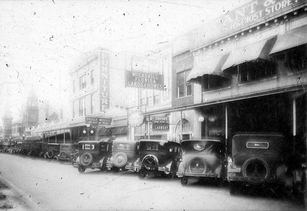
| 15:17, 11 May 2008 | 1stblockNPalafox1920s.jpg (file) |  |
34 KB | Dscosson | First block of North Palafox Street, east side, circa 1920s. Visible are Piggly Wiggly, Rhodes & Collins Furniture, McCaskill Florida Lands & Homes, T. L. Grant & Company, and Empire Laundry Company. Copyright status unknown, from Fl | 1 |
| 21:30, 30 December 2014 | 2001.jpg (file) |  |
132 KB | Captaink49 | 1 |