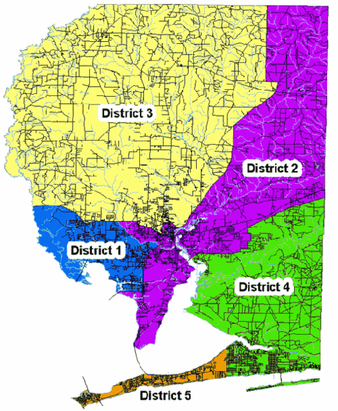
File:SantaRosaDistrictMap.gif
Jump to navigation
Jump to search

Size of this preview: 493 × 599 pixels. Other resolutions: 197 × 240 pixels | 500 × 608 pixels.
Original file (500 × 608 pixels, file size: 67 KB, MIME type: image/gif)
File history
Click on a date/time to view the file as it appeared at that time.
| Date/Time | Thumbnail | Dimensions | User | Comment | |
|---|---|---|---|---|---|
| current | 12:55, 16 August 2009 | | 500 × 608 (67 KB) | Admin (talk | contribs) | Source: http://www.santarosa.fl.gov/bocc/votedistricts.html |
- You cannot overwrite this file.
File usage
The following page uses this file: