File list
Jump to navigation
Jump to search
This special page shows all uploaded files.
| Date | Name | Thumbnail | Size | Description | Versions |
|---|---|---|---|---|---|
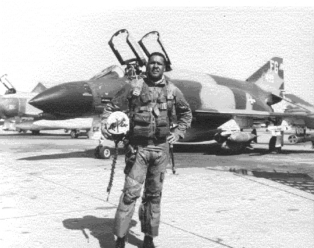
| 17:50, 7 April 2007 | 040130-F-0000G-004.jpg (file) |  |
134 KB | Source: [http://en.wikipedia.org/wiki/Image:040130-F-0000G-004.jpg Wikipedia] {{PD-USGov}} | 1 |
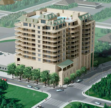
| 21:04, 2 October 2008 | 111SpringRendering.jpg (file) |  |
45 KB | {{fair use in|111 Spring]] | 1 |
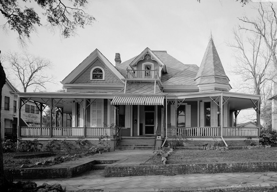
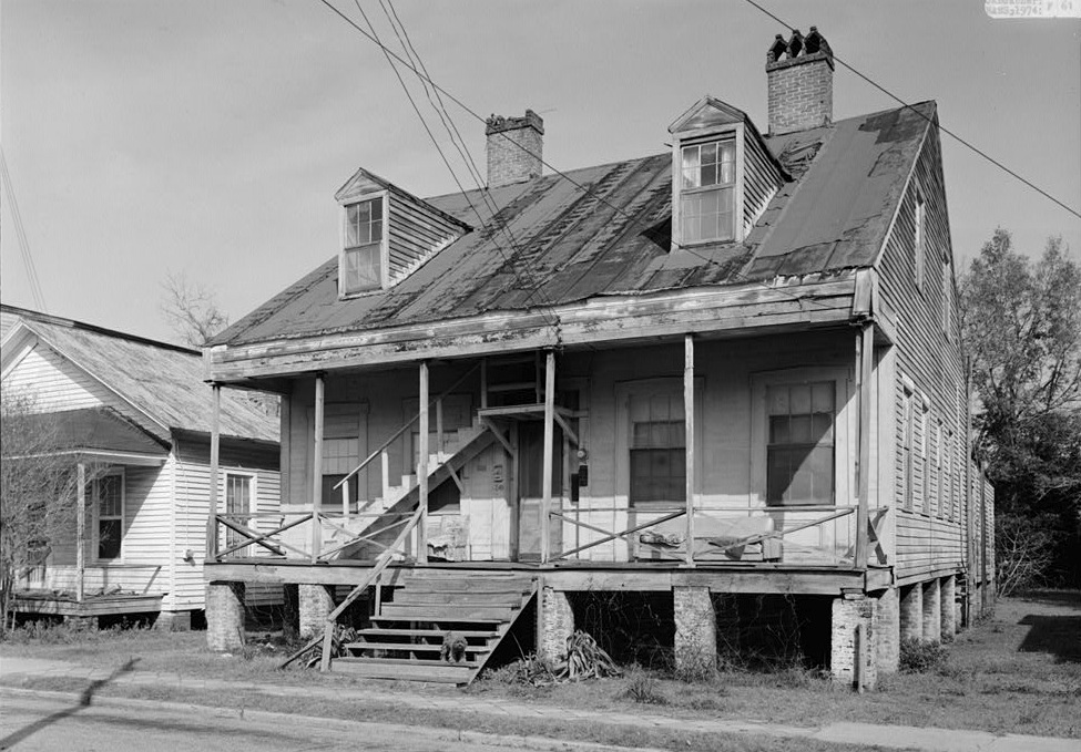
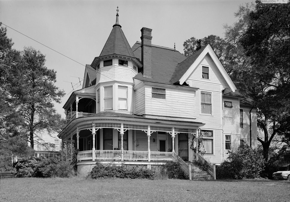
| 22:09, 15 December 2007 | 123WLloyd1974.jpg (file) |  |
219 KB | {{PD-USGov}} Source: Library of Congress American Memory Credit: Jack Boucher, Historic American Buildings Survey Date: March 1974 | 1 |
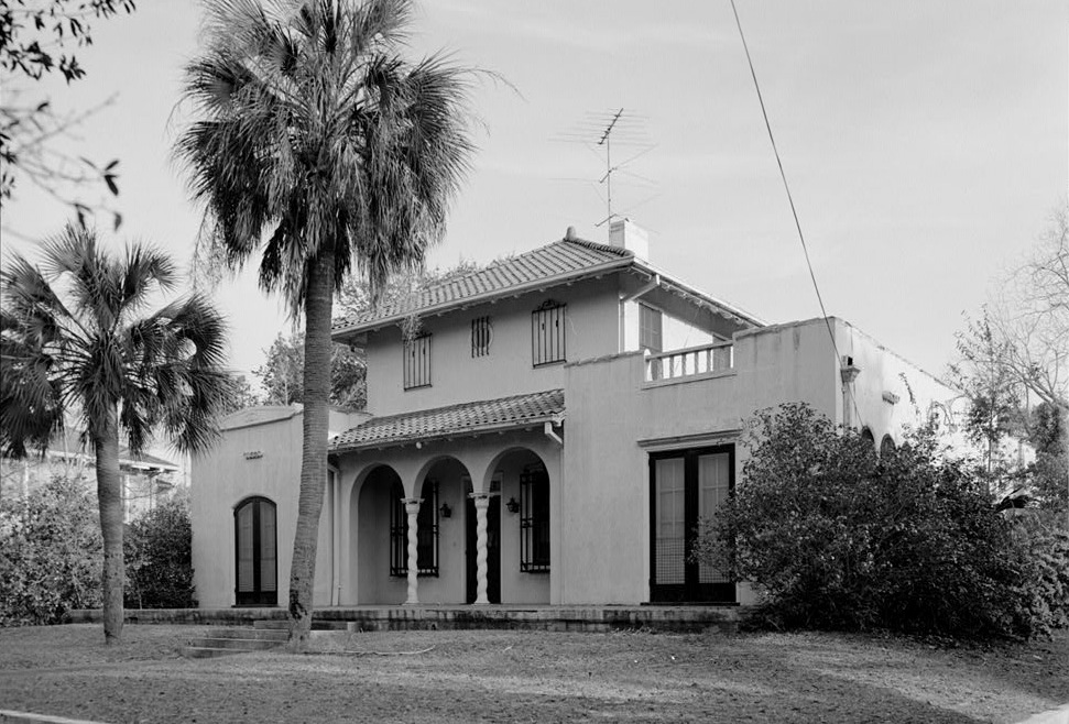
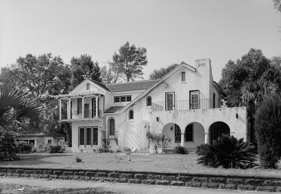
| 21:35, 15 December 2007 | 1300NBaylen1974.jpg (file) |  |
142 KB | {{PD-USGov}} Source: Library of Congress American Memory Credit: Jack Boucher, Historic American Buildings Survey Date: March 1974 | 1 |
| 22:35, 15 December 2007 | 14EGadsdenSt1974.jpg (file) |  |
223 KB | {{PD-USGov}} Source: Library of Congress American Memory Credit: Jack Boucher, Historic American Buildings Survey Date: March 1974 | 1 |
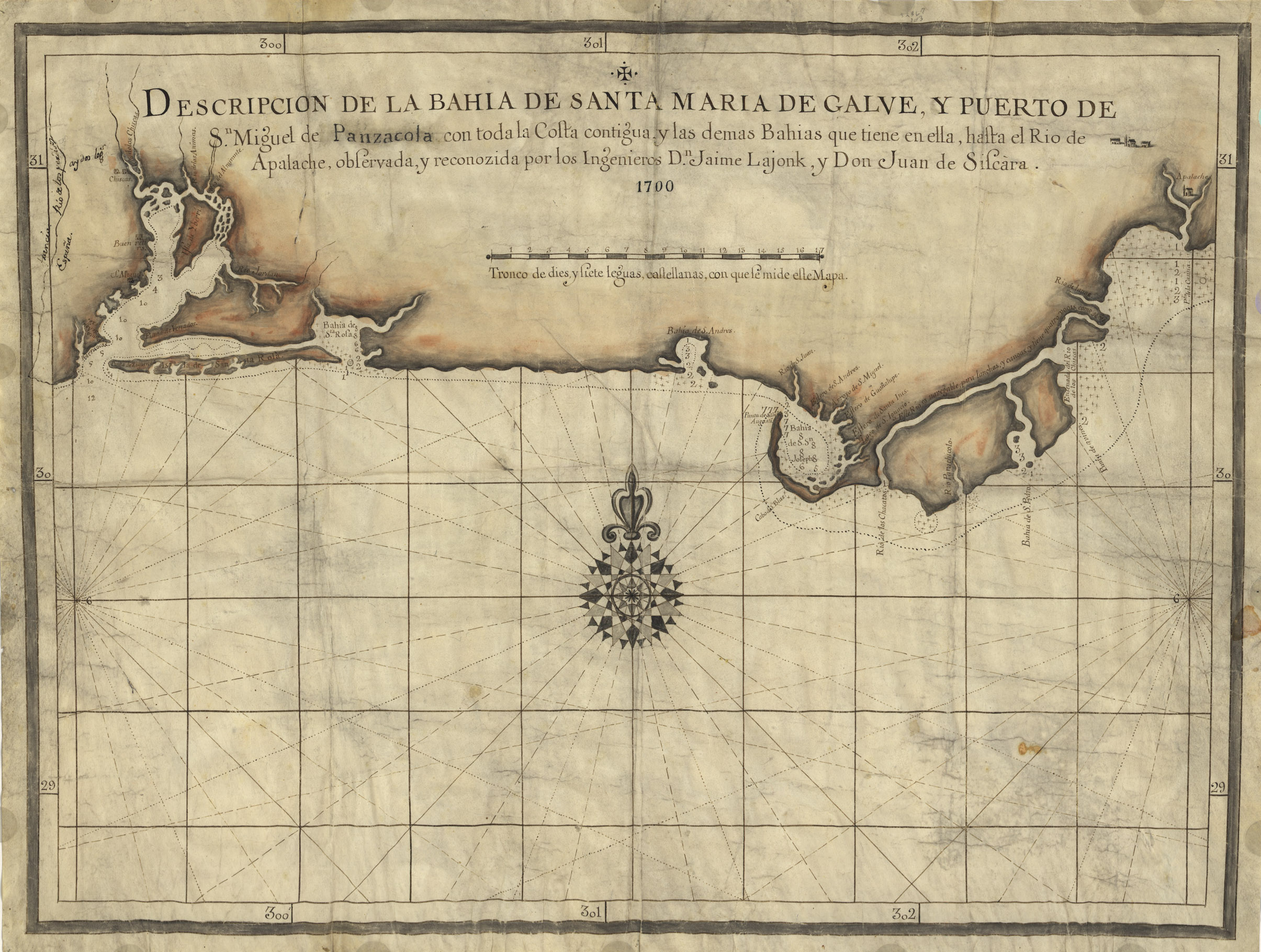
| 16:20, 21 April 2007 | 1700Map.jpg (file) |  |
978 KB | Descripcion de la Bahia de Santa Maria de Galve, y Puerto de Sn. Miguel de Panzacola con toda la costa contigua y las demas bahias que tiene en ella, hasta el Rio de Apalache / observada, y reconozida por los ingenieros Dn. Jaime Lajonk, y Don Juan de Sis | 1 |
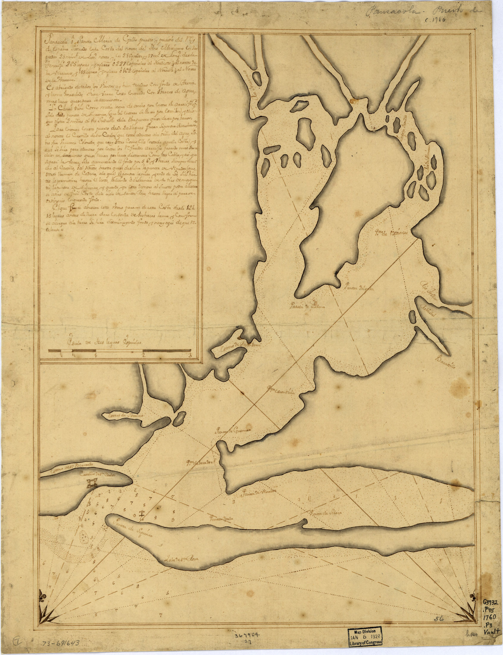
| 04:23, 21 April 2007 | 1760Map.jpg (file) |  |
769 KB | Pansacola o Santta María de Galbe, puerto y presidio del Ry. de España situado en la costa del nortte del Seno Mexicano, los 30 grados 25 mins. de lattd. nortte y los 286 grados y 37 ms. de longd. desde Tenerife 265 leguas inglesas o 227 españolas al n | 1 |
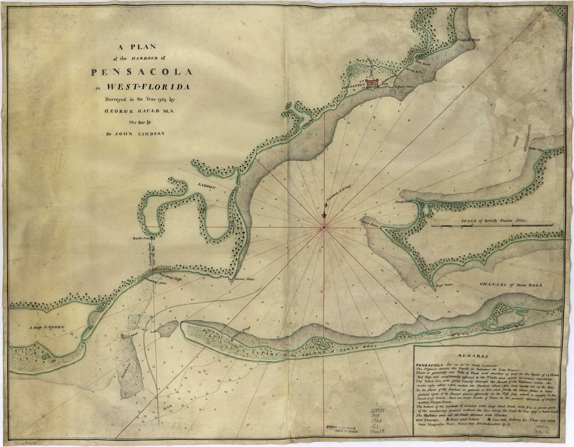
| 04:29, 21 April 2007 | 1764Plan.jpg (file) |  |
733 KB | A plan of the harbour of Pensacola in West-Florida. Surveyed in the year 1764 by George Gauld, M.A. The bar by Sir John Lindsay. {{PD-USGov}} Source: [http://memory.loc.gov/cgi-bin/query/D?gmd:1:./temp/~ammem_UNdW::@@@mdb=mcc,gottscho,detr,nfor,wpa,aap,cw | 1 |
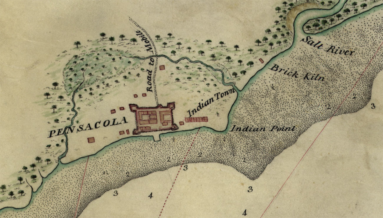
| 04:30, 21 April 2007 | 1764PlanDetail.jpg (file) |  |
279 KB | A plan of the harbour of Pensacola in West-Florida (detail). Surveyed in the year 1764 by George Gauld, M.A. The bar by Sir John Lindsay. {{PD-USGov}} Source: [http://memory.loc.gov/cgi-bin/query/D?gmd:1:./temp/~ammem_UNdW::@@@mdb=mcc,gottscho,detr,nfor,w | 1 |
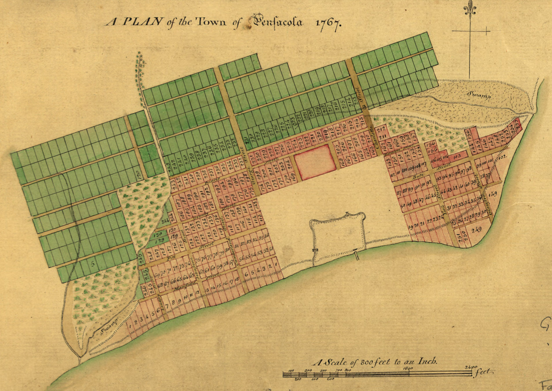
| 17:05, 21 April 2007 | 1767Plan.jpg (file) |  |
617 KB | A Plan of the town of Pensacola, 1767. {{PD-US}} Source: [http://memory.loc.gov/cgi-bin/query/D?gmd:6:./temp/~ammem_0Es2::@@@mdb=mcc,gottscho,detr,nfor,wpa,aap,cwar,bbpix,cowellbib,calbkbib,consrvbib,bdsbib,dag,fsaall,gmd,pan,vv,presp,varstg,suffrg,nawb | 1 |
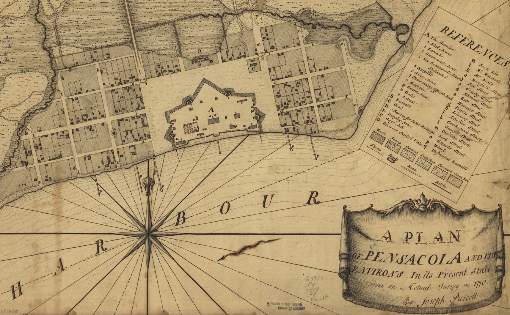
| 15:46, 21 April 2007 | 1778PurcellPlan-Detail.jpg (file) |  |
618 KB | A plan of Pensacola and its environs in its present state, from an actual survey in 1778, by Joseph Purcell. Detail; see high-res version at Image:1778PurcellPlan.jpg {{PD-US}} Source: [http://memory.loc.gov/cgi-bin/map_item.pl?data=/home/www/data/g | 1 |
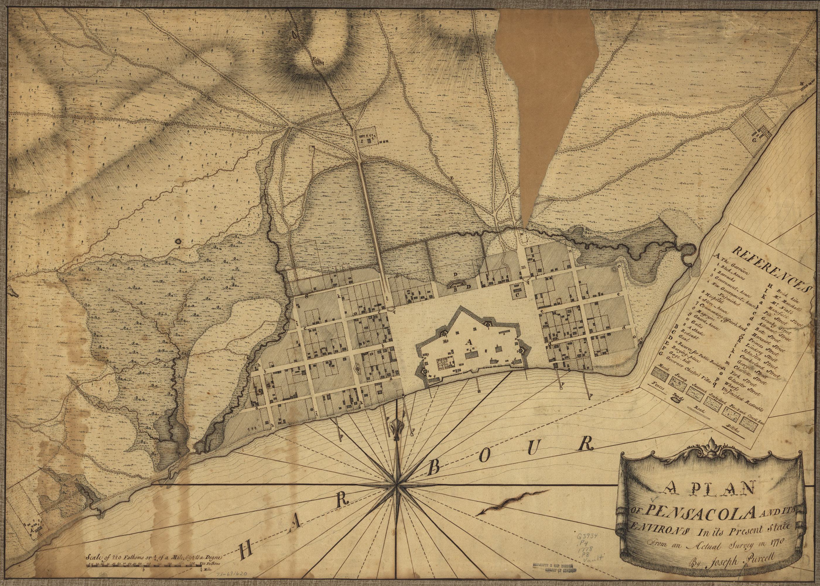
| 15:48, 21 April 2007 | 1778PurcellPlan.jpg (file) |  |
1.76 MB | A plan of Pensacola and its environs in its present state, from an actual survey in 1778, by Joseph Purcell. For most article purposes, the lower-resolution detail is suitable: Image:1778PurcellPlan-Detail.jpg {{PD-US}} Source: [http://memory.loc.g | 1 |
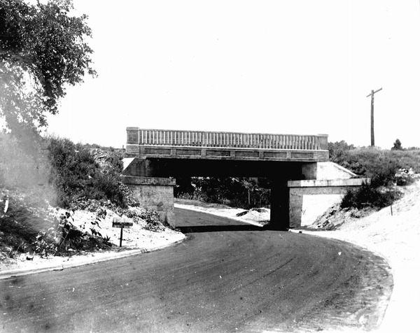
| 19:34, 21 October 2007 | 17thAveBridge-1935.jpg (file) |  |
88 KB | {{fair use in|17th Avenue railroad trestle}} Source: Florida Photographic Memory | 1 |
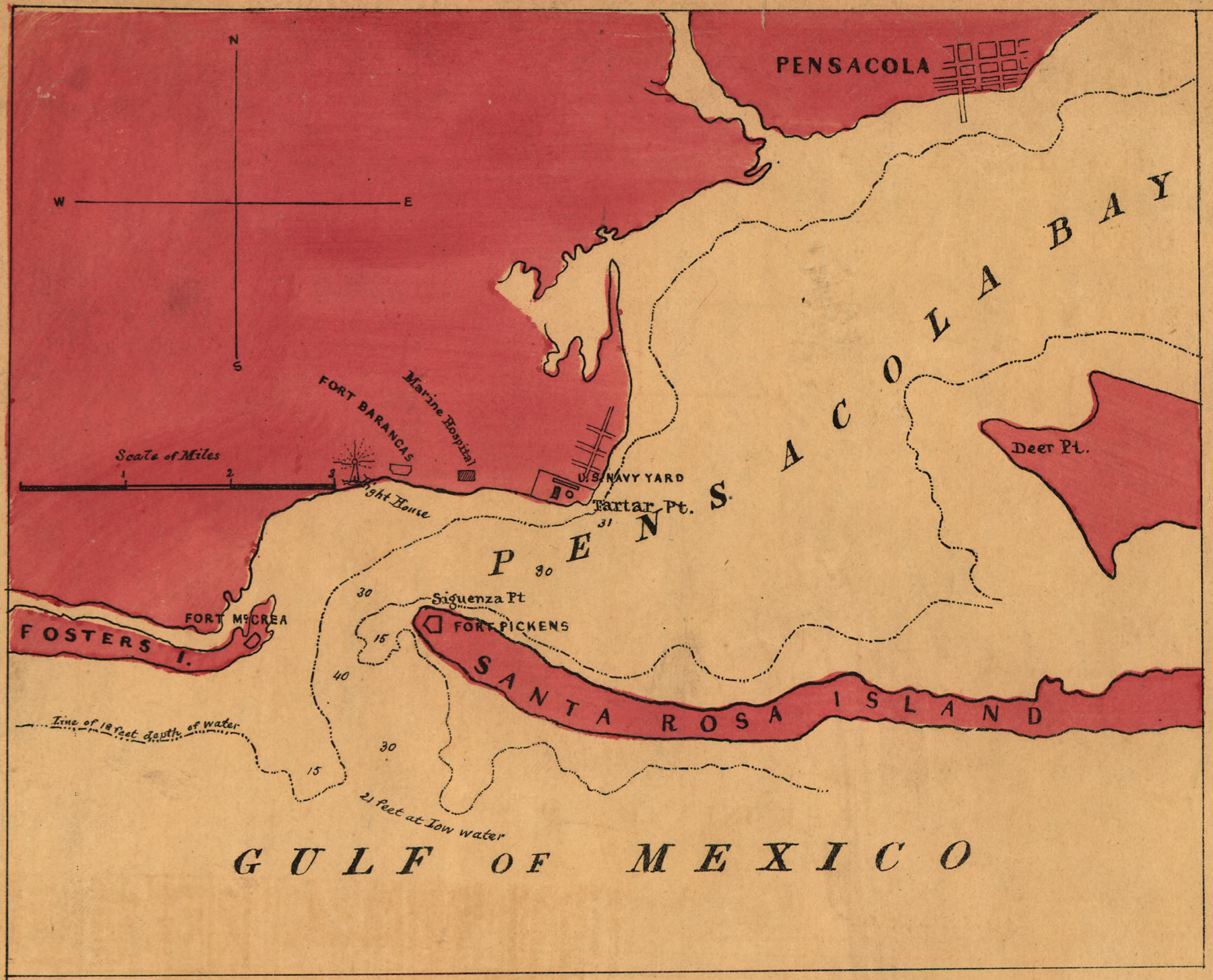
| 19:16, 21 April 2007 | 1861CoastSurvey.jpg (file) |  |
496 KB | Chart of Pensacola Bay - From the United States Coast Survey. Jim Smith, New York, 1861. {{PD-US}} Source: [http://memory.loc.gov/cgi-bin/query/D?gmd:10:./temp/~ammem_okSE::@@@mdb=mcc,gottscho,detr,nfor,wpa,aap,cwar,bbpix,cowellbib,calbkbib,consrvbib,bd | 1 |
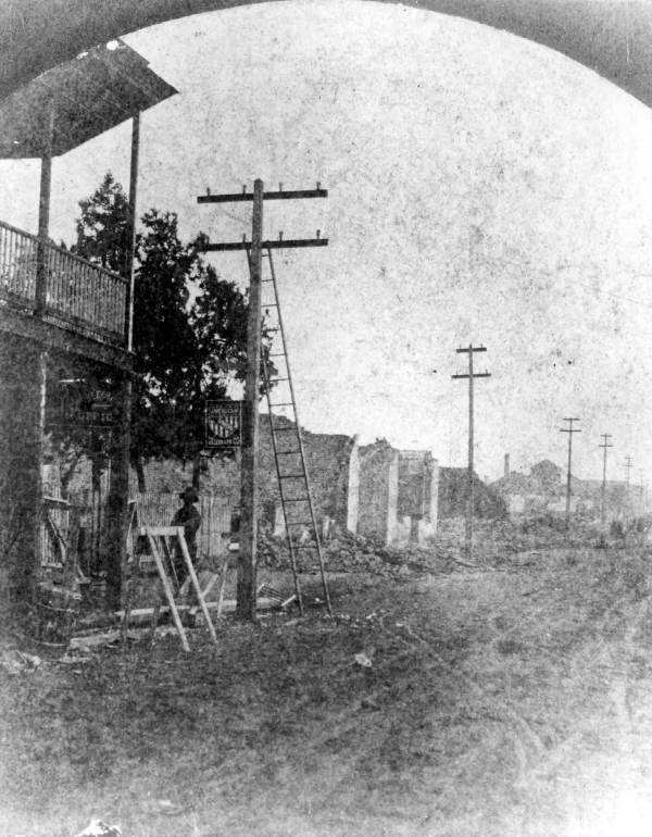
| 23:01, 17 October 2007 | 1880Fire.jpg (file) |  |
76 KB | {{PD-old}} Source: [http://fpc.dos.state.fl.us/prints/pr08414.jpg Florida Photographic Collection] | 1 |
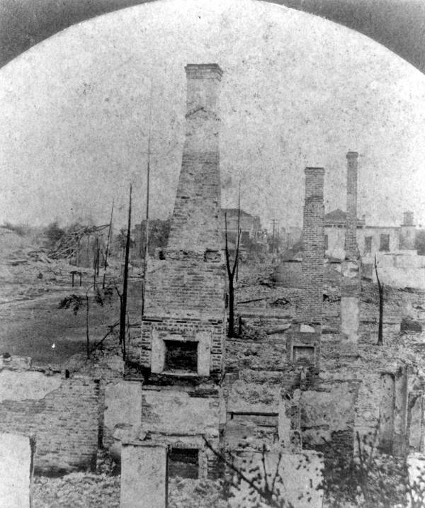
| 23:02, 17 October 2007 | 1880Fire2.jpg (file) |  |
72 KB | {{PD-old}} Source: [http://fpc.dos.state.fl.us/prints/pr08415.jpg Florida Photographic Collection] | 1 |
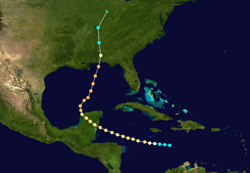
| 15:15, 13 May 2007 | 1906Hurricane.png (file) |  |
815 KB | {{PD}} Source: [http://en.wikipedia.org/wiki/Image:1906_Atlantic_hurricane_6_track.png Wikipedia] | 1 |
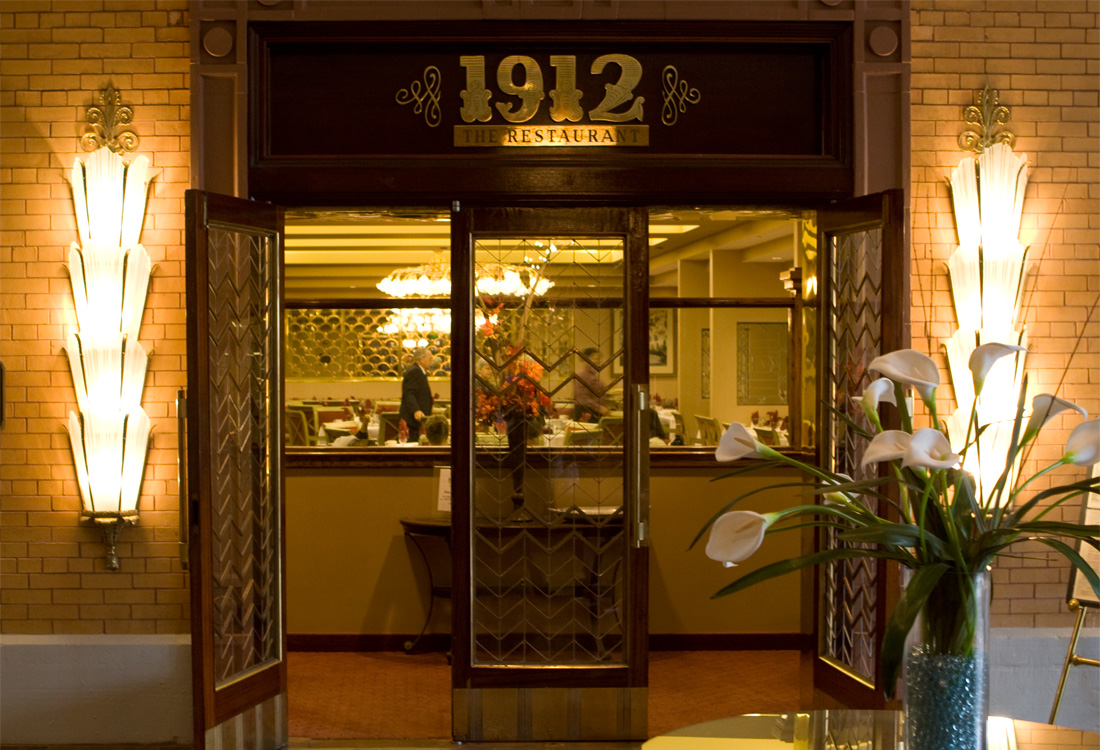
| 19:35, 29 November 2007 | 1912-restaurant.jpg (file) |  |
325 KB | {{PD-self}} | 1 |
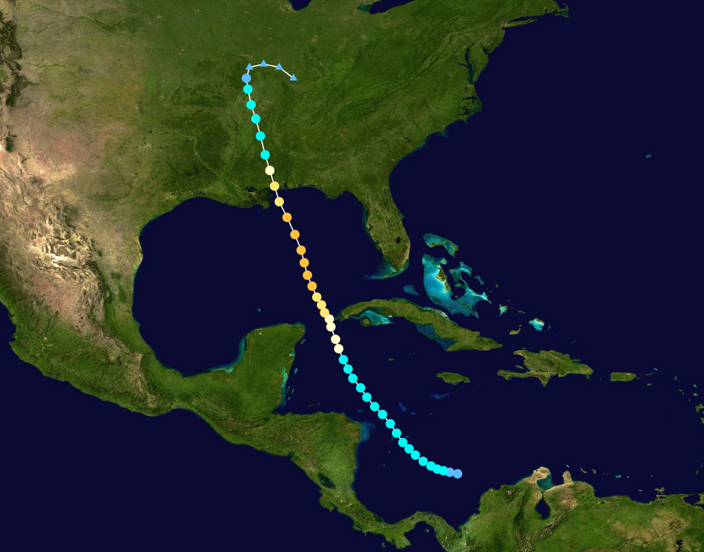
| 02:07, 26 March 2007 | 1916HurricanePath.png (file) |  |
387 KB | Source (released into public domain by author) | 1 |
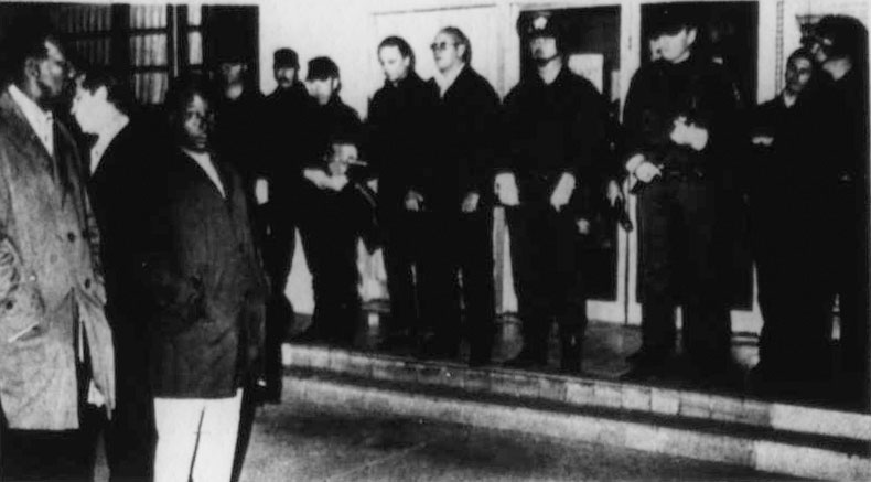
| 16:26, 3 April 2009 | 1975SheriffsDemonstrations.jpg (file) |  |
47 KB | Credit: John J. Lepinet Source: [http://news.google.com/newspapers?id=Bv8NAAAAIBAJ&sjid=qXkDAAAAIBAJ&pg=6502,801153 "A lingering fever still burns hot in Pensacola."] ''St. Petersburg Times'', March 2, 1975. {{fair use in|Blackwell demonstrations}} | 1 |
| 18:45, 7 March 2007 | 1leftarrow.png (file) |  |
2 KB | 1 | |
| 16:40, 16 December 2007 | 1stCircuitCourtLogo.jpg (file) |  |
9 KB | {{logo}} [http://www.firstjudicialcircuit.org/ Source] | 1 |
| 16:35, 2 March 2010 | 204SouthPalafox.jpg (file) |  |
572 KB | Source: "Pensacola Had Historical Photographer." ''Pensacola Journal'', February 28, 1990. | 1 |
| 21:52, 15 December 2007 | 240EIntendencia1974.jpg (file) |  |
225 KB | {{PD-USGov}} Source: Library of Congress American Memory Credit: Jack Boucher, Historic American Buildings Survey Date: March 1974 | 1 |
| 22:37, 15 December 2007 | 284WGonzalez1974.jpg (file) |  |
245 KB | {{PD-USGov}} Source: Library of Congress American Memory Credit: Jack Boucher, Historic American Buildings Survey Date: March 1974 | 1 |
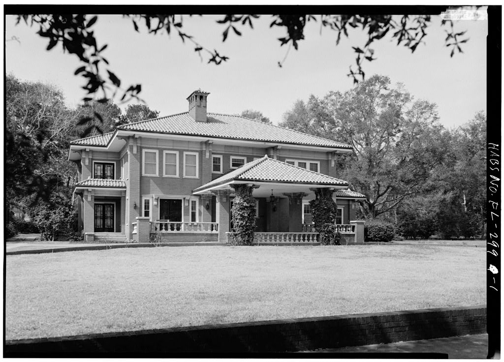
| 22:26, 15 December 2007 | 310EGovernment1974.jpg (file) |  |
190 KB | {{PD-USGov}} Source: Library of Congress American Memory Credit: Jack Boucher, Historic American Buildings Survey Date: March 1974 | 1 |
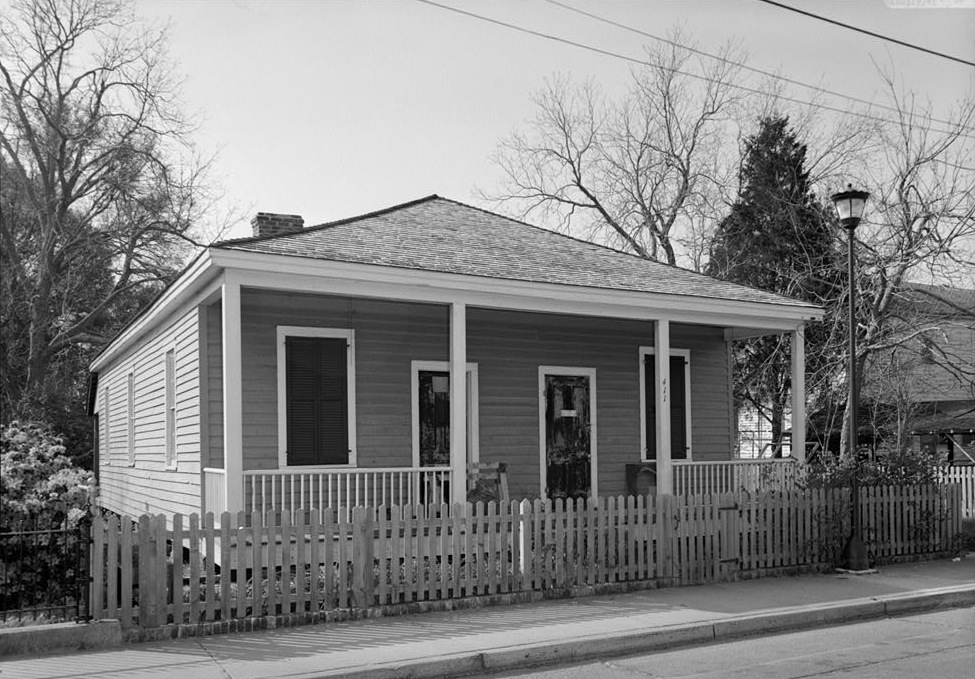
| 03:52, 6 May 2007 | 404WCervantesSt.jpg (file) |  |
55 KB | 1 | |
| 21:54, 15 December 2007 | 411EGovernmentSt1974.jpg (file) |  |
241 KB | {{PD-USGov}} Source: Library of Congress American Memory Credit: Jack Boucher, Historic American Buildings Survey Date: March 1974 | 1 |
| 21:37, 15 December 2007 | 421EZaragoza1974.jpg (file) |  |
250 KB | {{PD-USGov}} Source: Library of Congress American Memory Credit: Jack Boucher, Historic American Buildings Survey Date: March 1974 | 1 |
| 21:40, 15 December 2007 | 433EZaragoza1974.jpg (file) |  |
208 KB | {{PD-USGov}} Source: Library of Congress American Memory Credit: Jack Boucher, Historic American Buildings Survey Date: March 1974 | 1 |
| 22:14, 15 December 2007 | 437EZaragoza1974.jpg (file) |  |
211 KB | {{PD-USGov}} Source: Library of Congress American Memory Credit: Jack Boucher, Historic American Buildings Survey Date: March 1974 | 1 |
| 22:21, 15 December 2007 | 501EGovernment1974.jpg (file) |  |
158 KB | {{PD-USGov}} Source: Library of Congress American Memory Credit: Jack Boucher, Historic American Buildings Survey Date: March 1974 | 1 |
| 21:10, 15 December 2007 | 801NPalafox1974.jpg (file) |  |
81 KB | Source: Library of Congress American Memory Credit: Jack Boucher, March 1974 Copyright: Believed public domain | 1 |
| 16:04, 11 March 2007 | 9-11Memorial.jpg (file) |  |
575 KB | {{cc-by-sa}} | 1 |
| 21:36, 15 December 2007 | 904NBaylen1974.jpg (file) |  |
251 KB | {{PD-USGov}} Source: Library of Congress American Memory Credit: Jack Boucher, Historic American Buildings Survey Date: March 1974 | 1 |
| 21:42, 15 December 2007 | 919NBaylen1974.jpg (file) |  |
214 KB | {{PD-USGov}} Source: Library of Congress American Memory Credit: Jack Boucher, Historic American Buildings Survey Date: March 1974 | 1 |
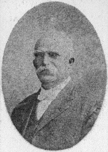
| 13:12, 1 July 2008 | ACBlountPriscus.jpg (file) |  |
45 KB | {{PD-old}} Date: 1900 Source: [http://fpc.dos.state.fl.us/prints/pr08493.jpg FPC] | 1 |
| 03:46, 17 July 2007 | ACLUlogo.png (file) |  |
51 KB | {{logo}} | 1 |
| 20:38, 3 November 2008 | AMAvery-sig.png (file) |  |
8 KB | made background transparent | 1 |
| 18:41, 23 December 2008 | ARCGatewayLogo.png (file) |  |
27 KB | {{logo}} | 1 |
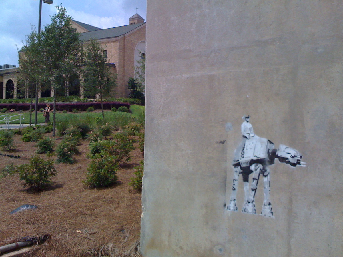
| 01:37, 27 May 2008 | ATATCowboy.jpg (file) |  |
444 KB | {{PD-self}} Seen behind the First Baptist Church ROC Center on Guillemard Street Category:Graffiti | 1 |
| 05:03, 17 March 2010 | AVClubbs2.jpg (file) |  |
70 KB | Source: Historical Society archives | 1 |
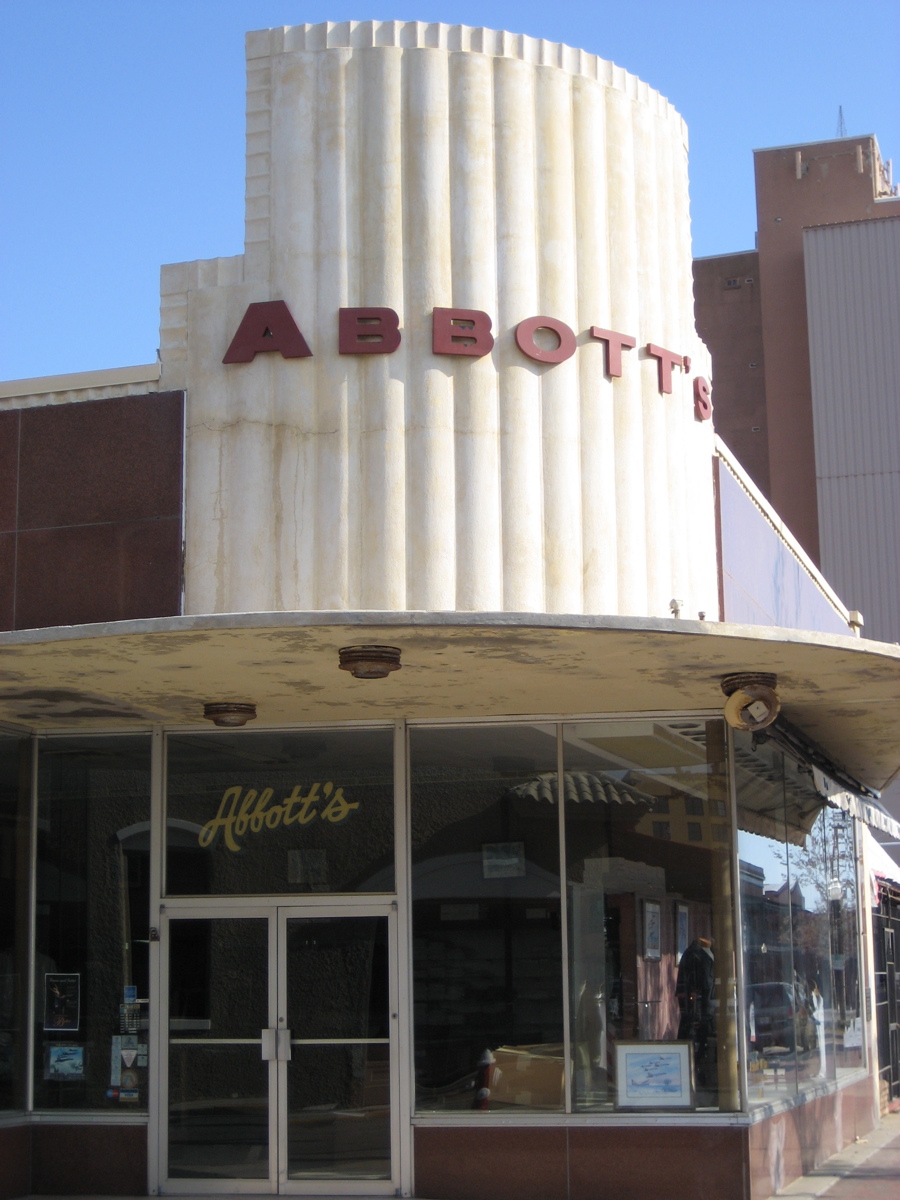
| 16:05, 11 March 2007 | Abbotts.jpg (file) |  |
358 KB | {{cc-by-sa}} | 1 |
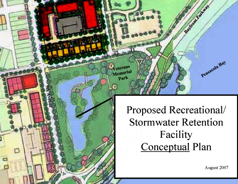
| 22:51, 14 November 2007 | AdmiralMasonPondProposal.jpg (file) |  |
96 KB | {{promotional}} Source: [http://cityofpensacola.com/upload/images/CRA/PDFs/AdmiralMasonStormwaterConcept.pdf City of Pensacola website] | 1 |
| 19:27, 15 December 2008 | AfricanAmerica.png (file) |  |
22 KB | {{cc-by-sa}} Source: http://commons.wikimedia.org/wiki/File:AmericaAfrica.svg | 1 |
| 19:13, 6 September 2009 | Agreenhut-sig.PNG (file) |  |
10 KB | 2 | |
| 08:04, 14 March 2007 | Aiga restaurant.png (file) |  |
4 KB | 1 | |
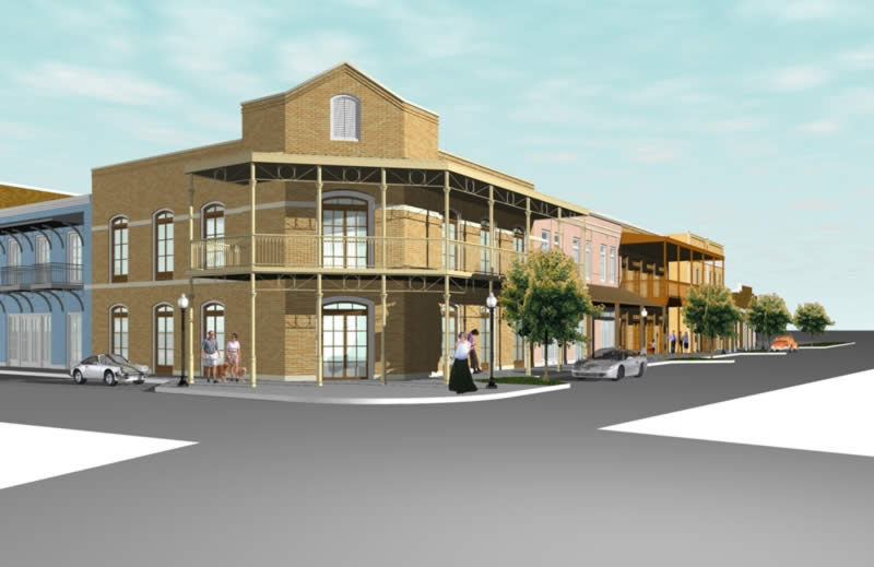
| 18:39, 9 July 2008 | AlcanizCentre-Rendering.jpg (file) |  |
41 KB | {{promotional}} Source: http://www.scogginsrealestate.com/index.cfm?webid=2 | 1 |
| 16:12, 20 February 2010 | AlexanderStoddart.jpg (file) |  |
424 KB | {{PD-US}} Source: BiographicalImages | 1 |
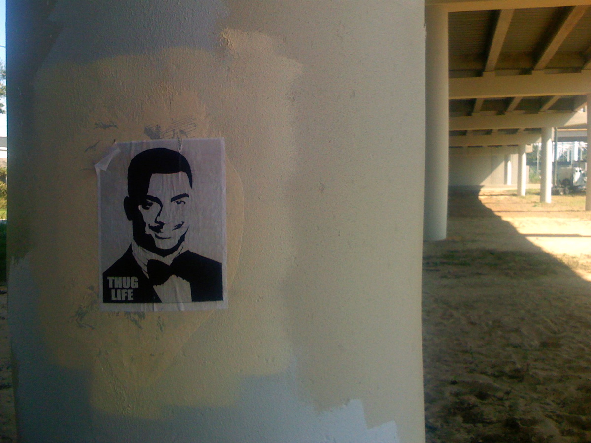
| 01:42, 27 May 2008 | AlfonsoRibeiroThugLife.jpg (file) |  |
371 KB | {{PD-self}} Seen beneath the Cervantes Street overpass. Category:Graffiti | 1 |