File:WilliamsCivilWarMap.jpg
Revision as of 04:47, 21 April 2007 by Admin (talk | contribs) (Sketch of Pensacola Navy Yard and Fort Pickens From U.S. Coast Surveys. By W. A. Williams, Civil Engineer. {{PD-US}} Source: [http://memory.loc.gov/cgi-bin/query/D?gmd:36:./temp/~ammem_9pE7::@@@mdb=mcc,gottscho,detr,nfor,wpa,aap,cwar,bbpix,cowellbib,calb)
Size of this preview: 624 × 600 pixels. Other resolutions: 250 × 240 pixels | 1,550 × 1,490 pixels.
Original file (1,550 × 1,490 pixels, file size: 752 KB, MIME type: image/jpeg)
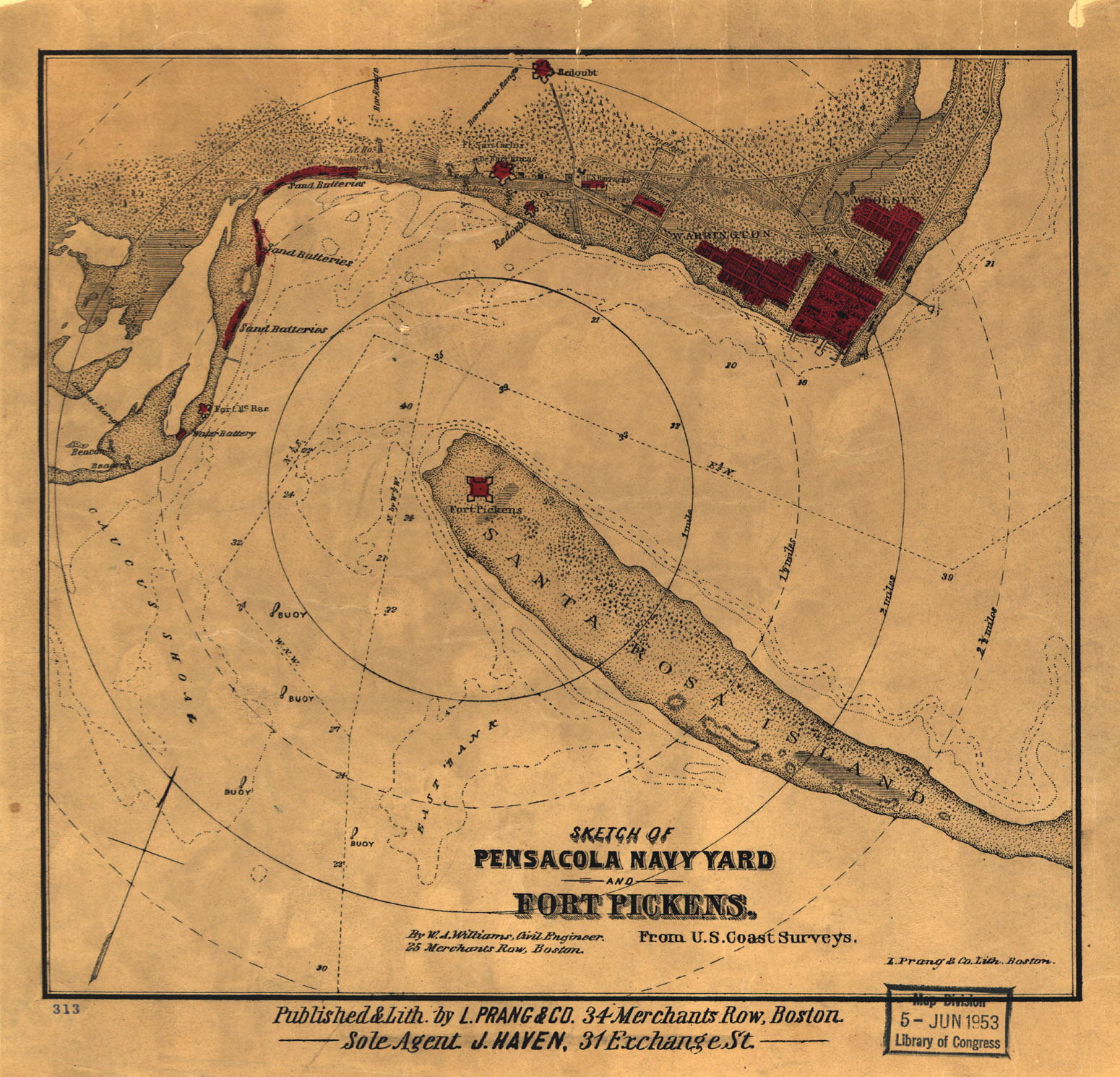
Sketch of Pensacola Navy Yard and Fort Pickens From U.S. Coast Surveys. By W. A. Williams, Civil Engineer.
This image is in the public domain in the United States. In most cases, this means that it was first published in the United States prior to January 1, 1923. See Pensapedia:Public domain and Pensapedia:Copyrights for more details.
File history
Click on a date/time to view the file as it appeared at that time.
| Date/Time | Thumbnail | Dimensions | User | Comment | |
|---|---|---|---|---|---|
| current | 04:47, 21 April 2007 | | 1,550 × 1,490 (752 KB) | Admin (talk | contribs) | Sketch of Pensacola Navy Yard and Fort Pickens From U.S. Coast Surveys. By W. A. Williams, Civil Engineer. {{PD-US}} Source: [http://memory.loc.gov/cgi-bin/query/D?gmd:36:./temp/~ammem_9pE7::@@@mdb=mcc,gottscho,detr,nfor,wpa,aap,cwar,bbpix,cowellbib,calb |
- You cannot overwrite this file.
File usage
The following 2 pages uses this file: