File:VanniMap1763.jpg
Revision as of 20:38, 30 March 2009 by Admin (talk | contribs) (Piano [Plano] del Porto, e degli Stabilimenti Pensacola Creator: Viol. Vanni, 1763 Source: [http://image11.fcla.edu/cgi/i/image/image-idx?xc=1;sid=97690242c1776a59297bf9d54ee5c1bc;c=fhpimage;c=map;c=mca;c=mile;c=rte;c=wolf;q1=pensacola;rgn1=ic_all;size=)
Size of this preview: 800 × 567 pixels. Other resolutions: 320 × 227 pixels | 3,167 × 2,245 pixels.
Original file (3,167 × 2,245 pixels, file size: 2.05 MB, MIME type: image/jpeg)
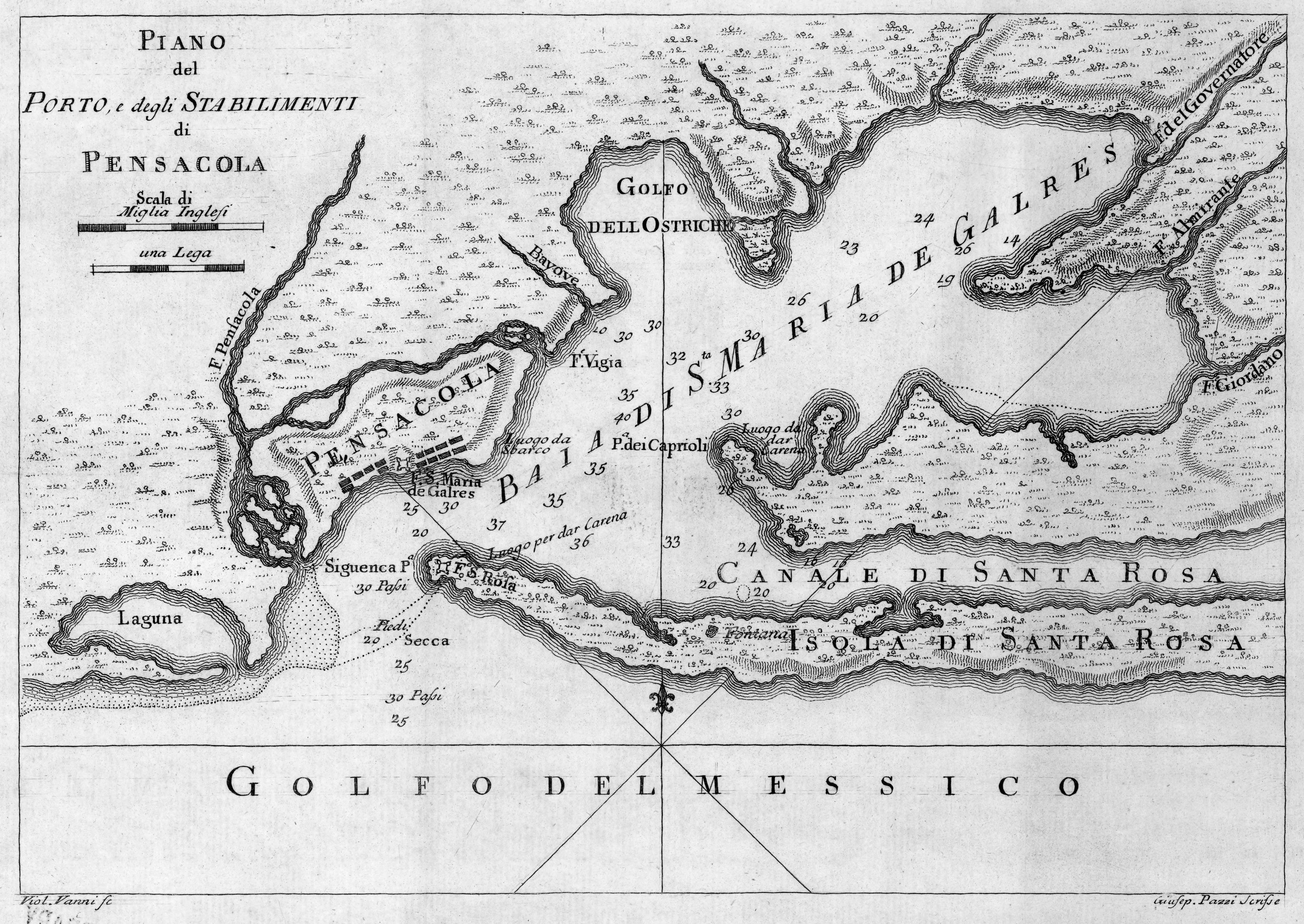
Piano [Plano] del Porto, e degli Stabilimenti Pensacola
Creator: Viol. Vanni, 1763
Source: FCLA World Map Collection
This image is in the public domain in the United States. In most cases, this means that it was first published in the United States prior to January 1, 1923. See Pensapedia:Public domain and Pensapedia:Copyrights for more details.
File history
Click on a date/time to view the file as it appeared at that time.
| Date/Time | Thumbnail | Dimensions | User | Comment | |
|---|---|---|---|---|---|
| current | 20:38, 30 March 2009 | | 3,167 × 2,245 (2.05 MB) | Admin (talk | contribs) | Piano [Plano] del Porto, e degli Stabilimenti Pensacola Creator: Viol. Vanni, 1763 Source: [http://image11.fcla.edu/cgi/i/image/image-idx?xc=1;sid=97690242c1776a59297bf9d54ee5c1bc;c=fhpimage;c=map;c=mca;c=mile;c=rte;c=wolf;q1=pensacola;rgn1=ic_all;size= |
- You cannot overwrite this file.
File usage
The following page uses this file: