File:Map1780.jpg
Jump to navigation
Jump to search

Size of this preview: 800 × 567 pixels. Other resolutions: 320 × 227 pixels | 900 × 638 pixels.
Original file (900 × 638 pixels, file size: 204 KB, MIME type: image/jpeg)
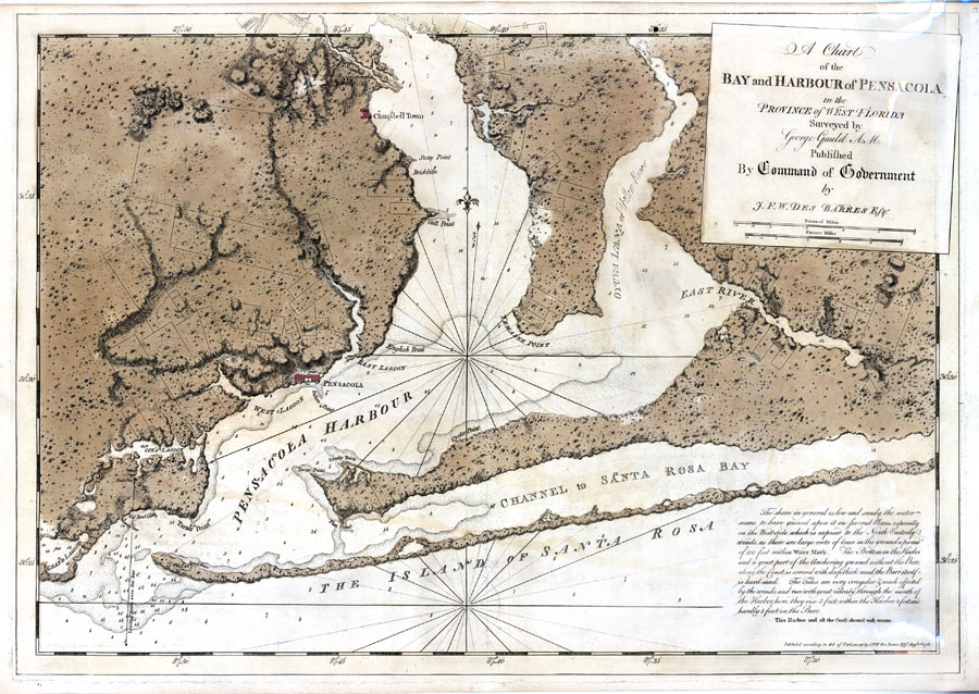
"A Chart of the Bay and Harbour of Pensacola". British, 1780, by Joseph F. W. Des Barres. From [1].
| This image (or other media file) is in the public domain because its copyright has expired. This applies to the United States, Canada, the European Union and those countries with a copyright term of life of the author plus 70 years. |
File history
Click on a date/time to view the file as it appeared at that time.
| Date/Time | Thumbnail | Dimensions | User | Comment | |
|---|---|---|---|---|---|
| current | 17:30, 27 April 2008 | | 900 × 638 (204 KB) | Dscosson (talk | contribs) | "A Chart of the Bay and Harbour of Pensacola". British, 1780, by Joseph F. W. Des Barres. {{PD-old}} |
- You cannot overwrite this file.
File usage
The following 3 pages uses this file: