File:ClaimsMap.jpg
Jump to navigation
Jump to search
Size of this preview: 743 × 600 pixels. Other resolutions: 297 × 240 pixels | 4,225 × 3,410 pixels.
Original file (4,225 × 3,410 pixels, file size: 2.84 MB, MIME type: image/jpeg)
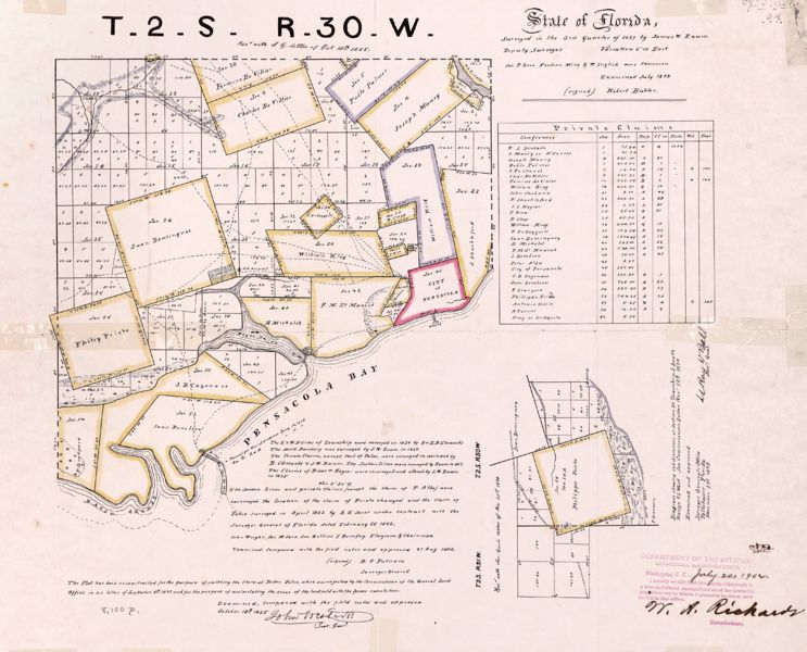
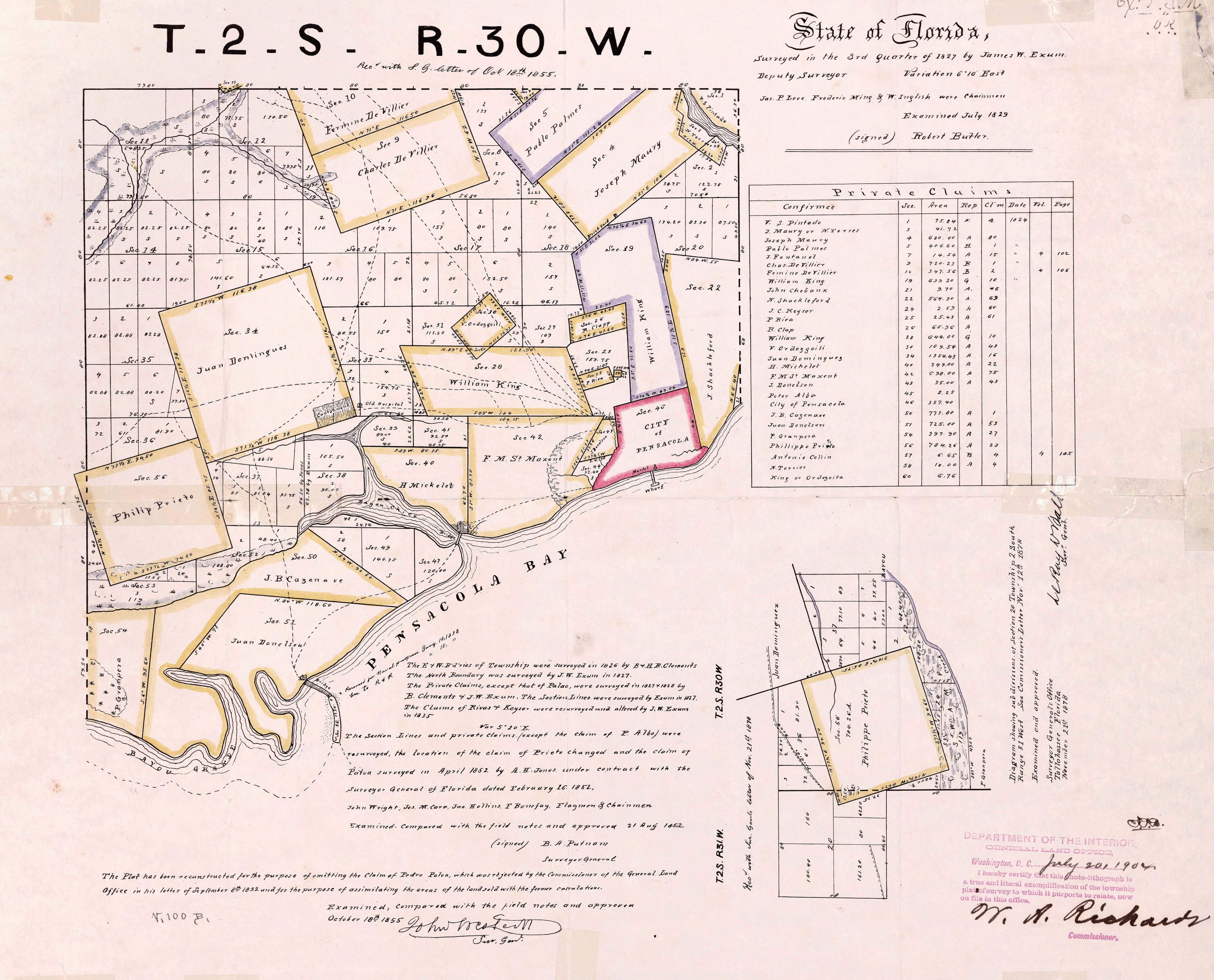
Map of Pensacola-area land claims surveyed and compiled in late 1820s
From George A. Smathers Libraries, University of Florida. ID# UF90000133
| This image (or other media file) is in the public domain because its copyright has expired. This applies to the United States, Canada, the European Union and those countries with a copyright term of life of the author plus 70 years. |
File history
Click on a date/time to view the file as it appeared at that time.
| Date/Time | Thumbnail | Dimensions | User | Comment | |
|---|---|---|---|---|---|
| current | 16:03, 12 June 2009 | | 4,225 × 3,410 (2.84 MB) | Dscosson (talk | contribs) | Map of Pensacola-area land claims surveyed and compiled in late 1820s From George A. Smathers Libraries, University of Florida. ID# UF90000133 {{PD-old}} |
- You cannot overwrite this file.
File usage
The following page uses this file: