Difference between revisions of "File:1850Map.jpg"
Jump to navigation
Jump to search
(Detailed view from a map of Florida that was published in 1850 highlighting Pensacola. From the Special Collections Department, University of South Florida. [http://fcit.usf.edu/Florida/maps/local/escambia/m010301.htm] {{pd-old}}) |
m (cat) |
||
| Line 2: | Line 2: | ||
{{pd-old}} | {{pd-old}} | ||
| + | [[Category:Maps]] | ||
Latest revision as of 19:49, 27 October 2007
Detailed view from a map of Florida that was published in 1850 highlighting Pensacola. From the Special Collections Department, University of South Florida. [1]
File history
Click on a date/time to view the file as it appeared at that time.
| Date/Time | Thumbnail | Dimensions | User | Comment | |
|---|---|---|---|---|---|
| current | 04:48, 5 April 2007 | 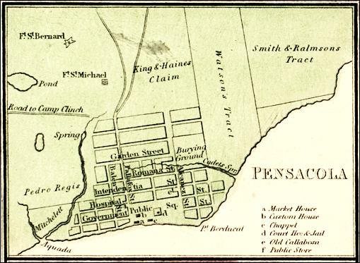 | 509 × 373 (48 KB) | Dscosson (talk | contribs) | Detailed view from a map of Florida that was published in 1850 highlighting Pensacola. From the Special Collections Department, University of South Florida. [http://fcit.usf.edu/Florida/maps/local/escambia/m010301.htm] {{pd-old}} |
- You cannot overwrite this file.
File usage
The following page uses this file: