File:1764Plan.jpg
Jump to navigation
Jump to search


Size of this preview: 769 × 600 pixels. Other resolutions: 308 × 240 pixels | 2,000 × 1,560 pixels.
Original file (2,000 × 1,560 pixels, file size: 733 KB, MIME type: image/jpeg)
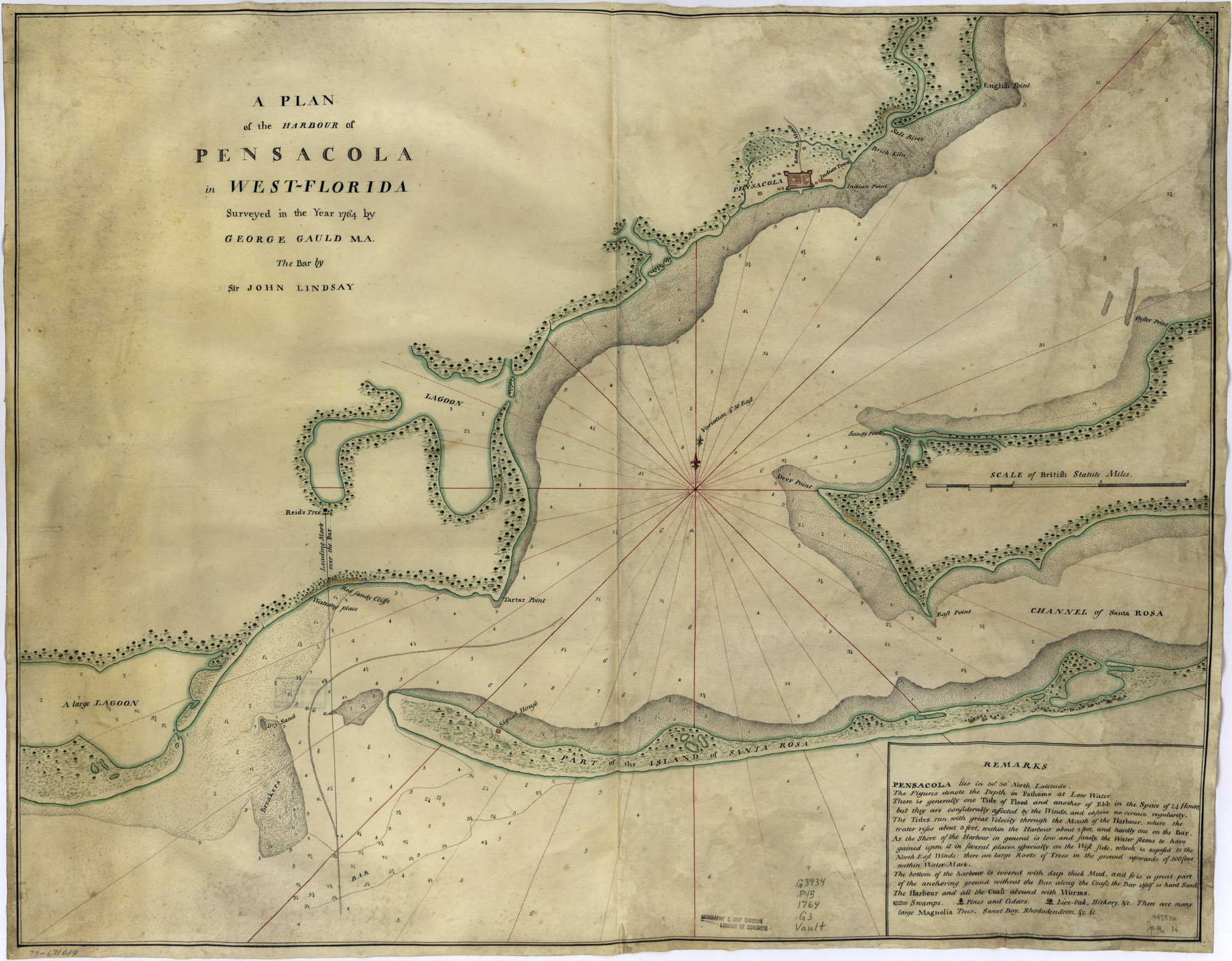
A plan of the harbour of Pensacola in West-Florida. Surveyed in the year 1764 by George Gauld, M.A. The bar by Sir John Lindsay. See also Image:1764PlanDetail.jpg.
This image is in the public domain in the United States. In most cases, this means that it was first published in the United States prior to January 1, 1923. See Pensapedia:Public domain and Pensapedia:Copyrights for more details.
File history
Click on a date/time to view the file as it appeared at that time.
| Date/Time | Thumbnail | Dimensions | User | Comment | |
|---|---|---|---|---|---|
| current | 04:29, 21 April 2007 | | 2,000 × 1,560 (733 KB) | Admin (talk | contribs) | A plan of the harbour of Pensacola in West-Florida. Surveyed in the year 1764 by George Gauld, M.A. The bar by Sir John Lindsay. {{PD-USGov}} Source: [http://memory.loc.gov/cgi-bin/query/D?gmd:1:./temp/~ammem_UNdW::@@@mdb=mcc,gottscho,detr,nfor,wpa,aap,cw |
- You cannot overwrite this file.
File usage
The following 3 pages uses this file: