File:1764Plan.jpg
Revision as of 04:29, 21 April 2007 by Admin (talk | contribs) (A plan of the harbour of Pensacola in West-Florida. Surveyed in the year 1764 by George Gauld, M.A. The bar by Sir John Lindsay. {{PD-USGov}} Source: [http://memory.loc.gov/cgi-bin/query/D?gmd:1:./temp/~ammem_UNdW::@@@mdb=mcc,gottscho,detr,nfor,wpa,aap,cw)
Size of this preview: 769 × 600 pixels. Other resolutions: 308 × 240 pixels | 2,000 × 1,560 pixels.
Original file (2,000 × 1,560 pixels, file size: 733 KB, MIME type: image/jpeg)
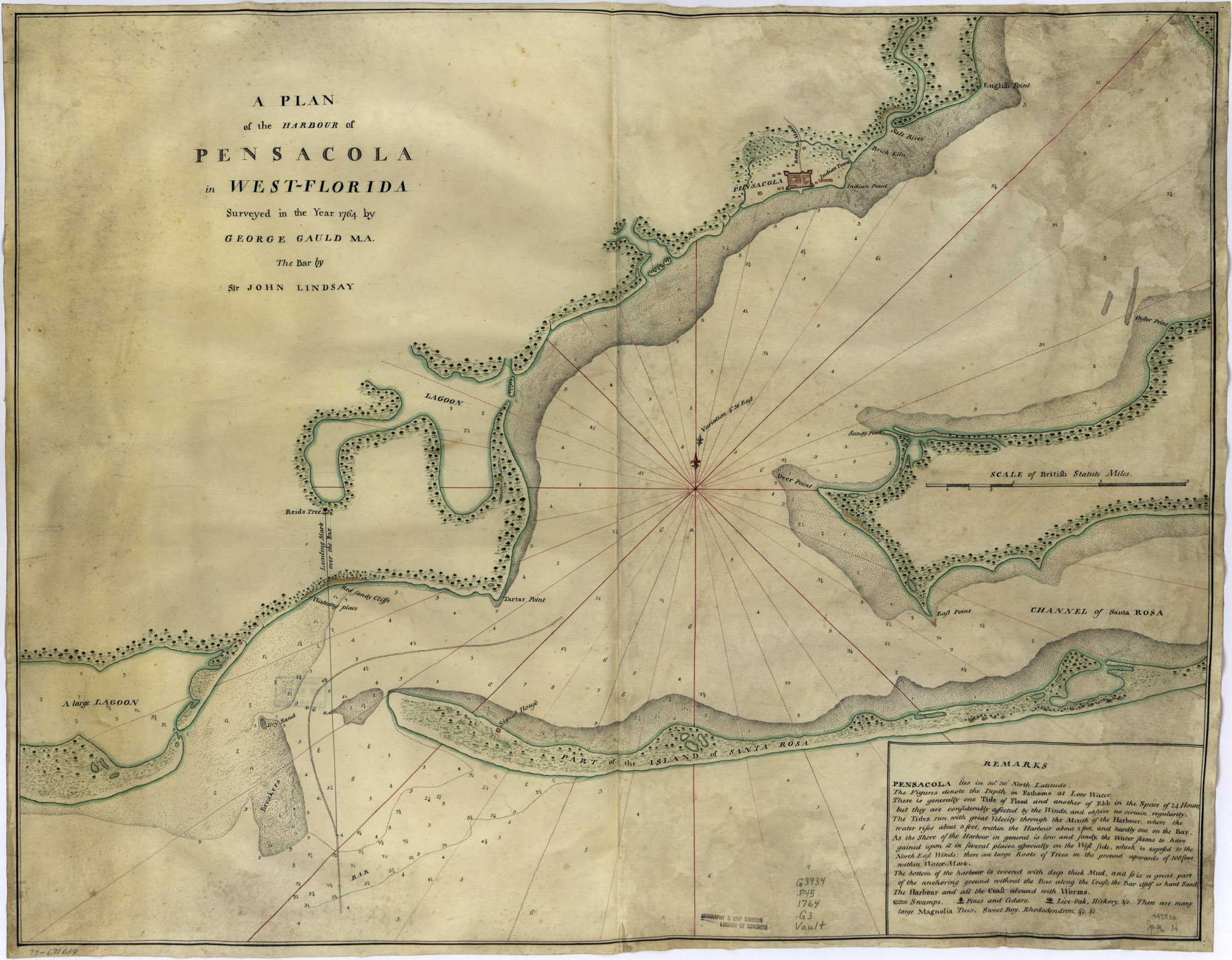
A plan of the harbour of Pensacola in West-Florida. Surveyed in the year 1764 by George Gauld, M.A. The bar by Sir John Lindsay.
| This work is in the public domain in the United States because it is a work of the United States Federal Government under the terms of 17 U.S.C. § 105. See Copyright. |  |
File history
Click on a date/time to view the file as it appeared at that time.
| Date/Time | Thumbnail | Dimensions | User | Comment | |
|---|---|---|---|---|---|
| current | 04:29, 21 April 2007 | | 2,000 × 1,560 (733 KB) | Admin (talk | contribs) | A plan of the harbour of Pensacola in West-Florida. Surveyed in the year 1764 by George Gauld, M.A. The bar by Sir John Lindsay. {{PD-USGov}} Source: [http://memory.loc.gov/cgi-bin/query/D?gmd:1:./temp/~ammem_UNdW::@@@mdb=mcc,gottscho,detr,nfor,wpa,aap,cw |
- You cannot overwrite this file.
File usage
The following 3 pages uses this file: