Difference between revisions of "File:1760Map.jpg"
Jump to navigation
Jump to search
(Pansacola o Santta María de Galbe, puerto y presidio del Ry. de España situado en la costa del nortte del Seno Mexicano, los 30 grados 25 mins. de lattd. nortte y los 286 grados y 37 ms. de longd. desde Tenerife 265 leguas inglesas o 227 españolas al n) |
m (cat) |
||
| Line 3: | Line 3: | ||
{{PD-USGov}} | {{PD-USGov}} | ||
Source: [http://memory.loc.gov/cgi-bin/query/D?gmd:4:./temp/~ammem_UNdW::@@@mdb=mcc,gottscho,detr,nfor,wpa,aap,cwar,bbpix,cowellbib,calbkbib,consrvbib,bdsbib,dag,fsaall,gmd,pan,vv,presp,varstg,suffrg,nawbib,horyd,wtc,toddbib,mgw,ncr,ngp,musdibib,hlaw,papr,lhbumbib,rbpebib,lbcoll,alad,hh,aaodyssey,magbell,bbcards,dcm,raelbib,runyon,dukesm,lomaxbib,mtj,gottlieb,aep,qlt,coolbib,fpnas,aasm,scsm,denn,relpet,amss,aaeo,mffbib,afc911bib,mjm,mnwp,rbcmillerbib,molden,ww2map,mfdipbib,afcnyebib,hawp,omhbib,rbaapcbib,mal,ncpsbib,ncpm,lhbprbib,ftvbib,afcreed,aipn,cwband,flwpabib,wpapos,cmns,psbib,pin,coplandbib,cola,tccc,curt,mharendt,lhbcbbib,eaa,haybib,mesnbib,fine,cwnyhs,svybib,mmorse,afcwwgbib,mymhiwebib,uncall,afcwip,mtaft,manz,llstbib,fawbib,berl,fmuever,cdn,upboverbib,mussm,cic,afcpearl,awh,awhbib,sgp,wright,lhbtnbib,afcesnbib,hurstonbib,mreynoldsbib,spaldingbib,sgproto Library of Congress - American Memory] | Source: [http://memory.loc.gov/cgi-bin/query/D?gmd:4:./temp/~ammem_UNdW::@@@mdb=mcc,gottscho,detr,nfor,wpa,aap,cwar,bbpix,cowellbib,calbkbib,consrvbib,bdsbib,dag,fsaall,gmd,pan,vv,presp,varstg,suffrg,nawbib,horyd,wtc,toddbib,mgw,ncr,ngp,musdibib,hlaw,papr,lhbumbib,rbpebib,lbcoll,alad,hh,aaodyssey,magbell,bbcards,dcm,raelbib,runyon,dukesm,lomaxbib,mtj,gottlieb,aep,qlt,coolbib,fpnas,aasm,scsm,denn,relpet,amss,aaeo,mffbib,afc911bib,mjm,mnwp,rbcmillerbib,molden,ww2map,mfdipbib,afcnyebib,hawp,omhbib,rbaapcbib,mal,ncpsbib,ncpm,lhbprbib,ftvbib,afcreed,aipn,cwband,flwpabib,wpapos,cmns,psbib,pin,coplandbib,cola,tccc,curt,mharendt,lhbcbbib,eaa,haybib,mesnbib,fine,cwnyhs,svybib,mmorse,afcwwgbib,mymhiwebib,uncall,afcwip,mtaft,manz,llstbib,fawbib,berl,fmuever,cdn,upboverbib,mussm,cic,afcpearl,awh,awhbib,sgp,wright,lhbtnbib,afcesnbib,hurstonbib,mreynoldsbib,spaldingbib,sgproto Library of Congress - American Memory] | ||
| + | [[Category:Maps]] | ||
Latest revision as of 19:48, 27 October 2007
Pansacola o Santta María de Galbe, puerto y presidio del Ry. de España situado en la costa del nortte del Seno Mexicano, los 30 grados 25 mins. de lattd. nortte y los 286 grados y 37 ms. de longd. desde Tenerife 265 leguas inglesas o 227 españolas al nordestte 1/4 al nortte de la Veracruz i 185 leguas inglesas o 162 españolas al nordeste 1/4 al nortte de la Havana.
| This work is in the public domain in the United States because it is a work of the United States Federal Government under the terms of 17 U.S.C. § 105. See Copyright. |  |
File history
Click on a date/time to view the file as it appeared at that time.
| Date/Time | Thumbnail | Dimensions | User | Comment | |
|---|---|---|---|---|---|
| current | 04:23, 21 April 2007 | 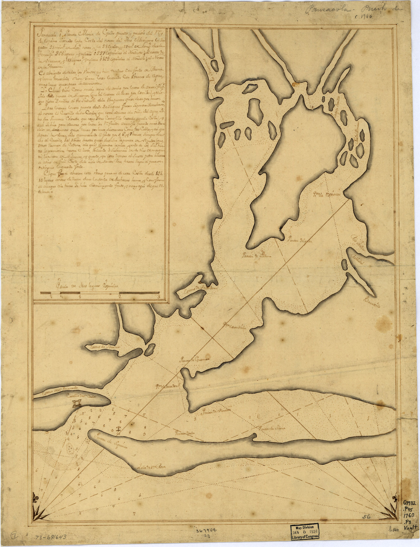 | 1,690 × 2,200 (769 KB) | Admin (talk | contribs) | Pansacola o Santta María de Galbe, puerto y presidio del Ry. de España situado en la costa del nortte del Seno Mexicano, los 30 grados 25 mins. de lattd. nortte y los 286 grados y 37 ms. de longd. desde Tenerife 265 leguas inglesas o 227 españolas al n |
- You cannot overwrite this file.
File usage
The following 2 pages uses this file: